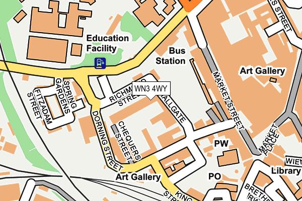
WN3 4WY is located in the Wigan Central electoral ward, within the metropolitan district of Wigan and the English Parliamentary constituency of Wigan. The Sub Integrated Care Board (ICB) Location is NHS Greater Manchester ICB - 02H and the police force is Greater Manchester. This postcode has been in use since September 2004.


GetTheData
Source: OS OpenMap – Local (Ordnance Survey)
Source: OS VectorMap District (Ordnance Survey)
Licence: Open Government Licence (requires attribution)
| Easting | 358016 |
| Northing | 405780 |
| Latitude | 53.546967 |
| Longitude | -2.635089 |
GetTheData
Source: Open Postcode Geo
Licence: Open Government Licence
| Country | England |
| Postcode District | WN3 |
➜ See where WN3 is on a map ➜ Where is Wigan? | |
GetTheData
Source: Land Registry Price Paid Data
Licence: Open Government Licence
Elevation or altitude of WN3 4WY as distance above sea level:
| Metres | Feet | |
|---|---|---|
| Elevation | 40m | 131ft |
Elevation is measured from the approximate centre of the postcode, to the nearest point on an OS contour line from OS Terrain 50, which has contour spacing of ten vertical metres.
➜ How high above sea level am I? Find the elevation of your current position using your device's GPS.
GetTheData
Source: Open Postcode Elevation
Licence: Open Government Licence
| Ward | Wigan Central |
| Constituency | Wigan |
GetTheData
Source: ONS Postcode Database
Licence: Open Government Licence
| Stand Number 2 - Temporary Stop (Hallgate) | Wigan | 39m |
| Stand Number 1 - Temporary Stop (Hallgate) | Wigan | 73m |
| Frog Ln/Deanery Hs (Frog Ln) | Wigan | 137m |
| Frog Ln/Deanery Hs (Frog Ln) | Wigan | 180m |
| King St West/Wallgate (King St West) | Wigan | 256m |
| Wigan Wallgate Station | 0.3km |
| Wigan North Western Station | 0.4km |
| Ince (Manchester) Station | 1.8km |
GetTheData
Source: NaPTAN
Licence: Open Government Licence
GetTheData
Source: ONS Postcode Database
Licence: Open Government Licence


➜ Get more ratings from the Food Standards Agency
GetTheData
Source: Food Standards Agency
Licence: FSA terms & conditions
| Last Collection | |||
|---|---|---|---|
| Location | Mon-Fri | Sat | Distance |
| Wigan Delivery Office | 19:15 | 12:40 | 19m |
| Wigan Branch Office | 19:05 | 12:30 | 253m |
| Swinley Road | 17:55 | 12:00 | 440m |
GetTheData
Source: Dracos
Licence: Creative Commons Attribution-ShareAlike
The below table lists the International Territorial Level (ITL) codes (formerly Nomenclature of Territorial Units for Statistics (NUTS) codes) and Local Administrative Units (LAU) codes for WN3 4WY:
| ITL 1 Code | Name |
|---|---|
| TLD | North West (England) |
| ITL 2 Code | Name |
| TLD3 | Greater Manchester |
| ITL 3 Code | Name |
| TLD36 | Greater Manchester North West |
| LAU 1 Code | Name |
| E08000010 | Wigan |
GetTheData
Source: ONS Postcode Directory
Licence: Open Government Licence
The below table lists the Census Output Area (OA), Lower Layer Super Output Area (LSOA), and Middle Layer Super Output Area (MSOA) for WN3 4WY:
| Code | Name | |
|---|---|---|
| OA | E00032310 | |
| LSOA | E01006369 | Wigan 008C |
| MSOA | E02001294 | Wigan 008 |
GetTheData
Source: ONS Postcode Directory
Licence: Open Government Licence
| WN1 1HP | Hallgate | 40m |
| WN1 1HW | Dorning Street | 110m |
| WN1 1LR | Hallgate | 120m |
| WN1 1HX | Market Street | 131m |
| WN1 1HB | Myrtle Street | 142m |
| WN1 1HZ | Deanery Court | 147m |
| WN1 1NL | Bishopgate | 149m |
| WN1 1SE | New Market Street | 151m |
| WN1 1HA | Spring Gardens | 180m |
| WN1 1HG | Frog Lane | 197m |
GetTheData
Source: Open Postcode Geo; Land Registry Price Paid Data
Licence: Open Government Licence