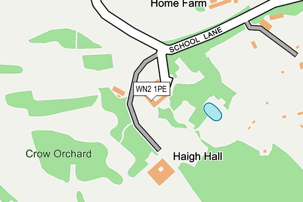
WN2 1PE is located in the Aspull, New Springs & Whelley electoral ward, within the metropolitan district of Wigan and the English Parliamentary constituency of Wigan. The Sub Integrated Care Board (ICB) Location is NHS Greater Manchester ICB - 02H and the police force is Greater Manchester. This postcode has been in use since January 1980.


GetTheData
Source: OS OpenMap – Local (Ordnance Survey)
Source: OS VectorMap District (Ordnance Survey)
Licence: Open Government Licence (requires attribution)
| Easting | 359723 |
| Northing | 408660 |
| Latitude | 53.572986 |
| Longitude | -2.609701 |
GetTheData
Source: Open Postcode Geo
Licence: Open Government Licence
| Country | England |
| Postcode District | WN2 |
➜ See where WN2 is on a map | |
GetTheData
Source: Land Registry Price Paid Data
Licence: Open Government Licence
Elevation or altitude of WN2 1PE as distance above sea level:
| Metres | Feet | |
|---|---|---|
| Elevation | 140m | 459ft |
Elevation is measured from the approximate centre of the postcode, to the nearest point on an OS contour line from OS Terrain 50, which has contour spacing of ten vertical metres.
➜ How high above sea level am I? Find the elevation of your current position using your device's GPS.
GetTheData
Source: Open Postcode Elevation
Licence: Open Government Licence
| Ward | Aspull, New Springs & Whelley |
| Constituency | Wigan |
GetTheData
Source: ONS Postcode Database
Licence: Open Government Licence
| St David's Cres | Aspull | 989m |
| St David's Cres | Aspull | 995m |
| Haigh Road (Sebnd) (Haigh Road) | Haigh | 1,016m |
| Haigh Rd/Haigh Church (Haigh Rd) | Haigh | 1,037m |
| Red Rock Ln/Red Rock Cottage (Red Rock Ln) | Red Rock | 1,059m |
| Blackrod Station | 3.4km |
| Wigan Wallgate Station | 3.5km |
| Wigan North Western Station | 3.6km |
GetTheData
Source: NaPTAN
Licence: Open Government Licence
GetTheData
Source: ONS Postcode Database
Licence: Open Government Licence


➜ Get more ratings from the Food Standards Agency
GetTheData
Source: Food Standards Agency
Licence: FSA terms & conditions
| Last Collection | |||
|---|---|---|---|
| Location | Mon-Fri | Sat | Distance |
| St Clements Road | 18:20 | 11:10 | 1,789m |
| Elmfield Road | 18:20 | 11:10 | 1,896m |
| Chauner Place | 18:20 | 11:05 | 2,063m |
GetTheData
Source: Dracos
Licence: Creative Commons Attribution-ShareAlike
The below table lists the International Territorial Level (ITL) codes (formerly Nomenclature of Territorial Units for Statistics (NUTS) codes) and Local Administrative Units (LAU) codes for WN2 1PE:
| ITL 1 Code | Name |
|---|---|
| TLD | North West (England) |
| ITL 2 Code | Name |
| TLD3 | Greater Manchester |
| ITL 3 Code | Name |
| TLD36 | Greater Manchester North West |
| LAU 1 Code | Name |
| E08000010 | Wigan |
GetTheData
Source: ONS Postcode Directory
Licence: Open Government Licence
The below table lists the Census Output Area (OA), Lower Layer Super Output Area (LSOA), and Middle Layer Super Output Area (MSOA) for WN2 1PE:
| Code | Name | |
|---|---|---|
| OA | E00031619 | |
| LSOA | E01006231 | Wigan 004A |
| MSOA | E02001290 | Wigan 004 |
GetTheData
Source: ONS Postcode Directory
Licence: Open Government Licence
| WN2 1PD | School Lane | 301m |
| WN2 1PB | Copperas Lane | 531m |
| WN2 1LS | Sennicar Lane | 668m |
| WN2 1LR | School Lane | 671m |
| WN2 1PF | New Road | 744m |
| WN2 1PA | Copperas Lane | 794m |
| WN2 1LA | Prospect Cottages | 797m |
| WN2 1LU | Pendlebury Lane | 855m |
| WN2 1LL | Meadow Pit Lane | 936m |
| WN2 1SZ | St Davids Crescent | 1014m |
GetTheData
Source: Open Postcode Geo; Land Registry Price Paid Data
Licence: Open Government Licence