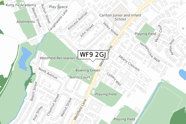
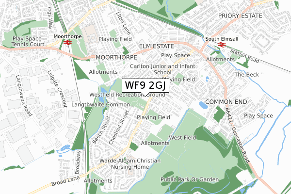
WF9 2GJ is located in the South Elmsall and South Kirkby electoral ward, within the metropolitan district of Wakefield and the English Parliamentary constituency of Hemsworth. The Sub Integrated Care Board (ICB) Location is NHS West Yorkshire ICB - 03R and the police force is West Yorkshire. This postcode has been in use since February 2020.


GetTheData
Source: OS Open Zoomstack (Ordnance Survey)
Licence: Open Government Licence (requires attribution)
Attribution: Contains OS data © Crown copyright and database right 2025
Source: Open Postcode Geo
Licence: Open Government Licence (requires attribution)
Attribution: Contains OS data © Crown copyright and database right 2025; Contains Royal Mail data © Royal Mail copyright and database right 2025; Source: Office for National Statistics licensed under the Open Government Licence v.3.0
| Easting | 446773 |
| Northing | 410696 |
| Latitude | 53.590783 |
| Longitude | -1.294851 |
GetTheData
Source: Open Postcode Geo
Licence: Open Government Licence
| Country | England |
| Postcode District | WF9 |
➜ See where WF9 is on a map ➜ Where is South Elmsall? | |
GetTheData
Source: Land Registry Price Paid Data
Licence: Open Government Licence
| Ward | South Elmsall And South Kirkby |
| Constituency | Hemsworth |
GetTheData
Source: ONS Postcode Database
Licence: Open Government Licence
| Westfield Lane Victor St (Westfield Lane) | South Elmsall | 42m |
| Westfield Lane Oxford St (Westfield Lane) | South Elmsall | 49m |
| North Avenue Chestnut St (North Avenue) | South Elmsall | 190m |
| Westfield Lane Central Ave (Westfield Lane) | South Elmsall | 195m |
| Westfield Lane Central Ave (Westfield Lane) | South Elmsall | 236m |
| South Elmsall Station | 0.8km |
| Moorthorpe Station | 0.8km |
GetTheData
Source: NaPTAN
Licence: Open Government Licence
GetTheData
Source: ONS Postcode Database
Licence: Open Government Licence


➜ Get more ratings from the Food Standards Agency
GetTheData
Source: Food Standards Agency
Licence: FSA terms & conditions
| Last Collection | |||
|---|---|---|---|
| Location | Mon-Fri | Sat | Distance |
| Westfield Lane/Field Cres | 16:15 | 11:45 | 104m |
| Moorthorpe | 17:15 | 11:30 | 399m |
| Frickley Colliery | 16:15 | 11:45 | 448m |
GetTheData
Source: Dracos
Licence: Creative Commons Attribution-ShareAlike
The below table lists the International Territorial Level (ITL) codes (formerly Nomenclature of Territorial Units for Statistics (NUTS) codes) and Local Administrative Units (LAU) codes for WF9 2GJ:
| ITL 1 Code | Name |
|---|---|
| TLE | Yorkshire and The Humber |
| ITL 2 Code | Name |
| TLE4 | West Yorkshire |
| ITL 3 Code | Name |
| TLE45 | Wakefield |
| LAU 1 Code | Name |
| E08000036 | Wakefield |
GetTheData
Source: ONS Postcode Directory
Licence: Open Government Licence
The below table lists the Census Output Area (OA), Lower Layer Super Output Area (LSOA), and Middle Layer Super Output Area (MSOA) for WF9 2GJ:
| Code | Name | |
|---|---|---|
| OA | E00059809 | |
| LSOA | E01011863 | Wakefield 044D |
| MSOA | E02002481 | Wakefield 044 |
GetTheData
Source: ONS Postcode Directory
Licence: Open Government Licence
| WF9 2EQ | Westfield Lane | 62m |
| WF9 2EF | Westfield Lane | 84m |
| WF9 2QU | Princess Avenue | 90m |
| WF9 2EG | Field Crescent | 96m |
| WF9 2EN | Albany Place | 132m |
| WF9 2EX | Walnut Street | 147m |
| WF9 2EH | Albany Street | 149m |
| WF9 2EJ | Wood Lea | 159m |
| WF9 2QT | Valley Street | 183m |
| WF9 2QY | John Street | 189m |
GetTheData
Source: Open Postcode Geo; Land Registry Price Paid Data
Licence: Open Government Licence