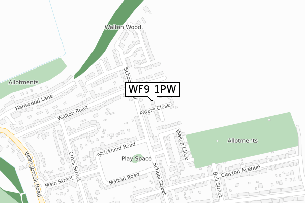
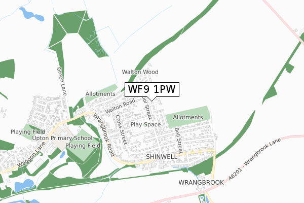
WF9 1PW is located in the Ackworth, North Elmsall and Upton electoral ward, within the metropolitan district of Wakefield and the English Parliamentary constituency of Hemsworth. The Sub Integrated Care Board (ICB) Location is NHS West Yorkshire ICB - 03R and the police force is West Yorkshire. This postcode has been in use since April 2018.


GetTheData
Source: OS Open Zoomstack (Ordnance Survey)
Licence: Open Government Licence (requires attribution)
Attribution: Contains OS data © Crown copyright and database right 2025
Source: Open Postcode Geo
Licence: Open Government Licence (requires attribution)
Attribution: Contains OS data © Crown copyright and database right 2025; Contains Royal Mail data © Royal Mail copyright and database right 2025; Source: Office for National Statistics licensed under the Open Government Licence v.3.0
| Easting | 448970 |
| Northing | 413938 |
| Latitude | 53.619720 |
| Longitude | -1.261155 |
GetTheData
Source: Open Postcode Geo
Licence: Open Government Licence
| Country | England |
| Postcode District | WF9 |
➜ See where WF9 is on a map ➜ Where is Upton? | |
GetTheData
Source: Land Registry Price Paid Data
Licence: Open Government Licence
| Ward | Ackworth, North Elmsall And Upton |
| Constituency | Hemsworth |
GetTheData
Source: ONS Postcode Database
Licence: Open Government Licence
| Wrangbrook Road Main St (Wrangbrook Road) | Upton | 471m |
| Tom Wood Ash Lane Bell St (Tom Wood Ash Lane) | Upton | 478m |
| Wrangbrook Rd Walton Road (Wrangbrook Road) | Upton | 484m |
| Wrangbrook Road Main St (Wrangbrook Road) | Upton | 496m |
| Tom Wood Ash Lane Bell St (Tom Wood Ash Lane) | Upton | 504m |
| South Elmsall Station | 3.2km |
| Moorthorpe Station | 4km |
GetTheData
Source: NaPTAN
Licence: Open Government Licence
| Percentage of properties with Next Generation Access | 100.0% |
| Percentage of properties with Superfast Broadband | 100.0% |
| Percentage of properties with Ultrafast Broadband | 0.0% |
| Percentage of properties with Full Fibre Broadband | 0.0% |
Superfast Broadband is between 30Mbps and 300Mbps
Ultrafast Broadband is > 300Mbps
| Median download speed | 40.0Mbps |
| Average download speed | 43.8Mbps |
| Maximum download speed | 53.44Mbps |
| Median upload speed | 9.8Mbps |
| Average upload speed | 10.8Mbps |
| Maximum upload speed | 14.36Mbps |
| Percentage of properties unable to receive 2Mbps | 0.0% |
| Percentage of properties unable to receive 5Mbps | 0.0% |
| Percentage of properties unable to receive 10Mbps | 0.0% |
| Percentage of properties unable to receive 30Mbps | 0.0% |
GetTheData
Source: Ofcom
Licence: Ofcom Terms of Use (requires attribution)
GetTheData
Source: ONS Postcode Database
Licence: Open Government Licence


➜ Get more ratings from the Food Standards Agency
GetTheData
Source: Food Standards Agency
Licence: FSA terms & conditions
| Last Collection | |||
|---|---|---|---|
| Location | Mon-Fri | Sat | Distance |
| Smeaton Road / School St | 17:00 | 12:00 | 382m |
| Harewood Estate P.o. | 17:15 | 12:15 | 455m |
| Upton P.o. | 17:15 | 12:15 | 1,635m |
GetTheData
Source: Dracos
Licence: Creative Commons Attribution-ShareAlike
The below table lists the International Territorial Level (ITL) codes (formerly Nomenclature of Territorial Units for Statistics (NUTS) codes) and Local Administrative Units (LAU) codes for WF9 1PW:
| ITL 1 Code | Name |
|---|---|
| TLE | Yorkshire and The Humber |
| ITL 2 Code | Name |
| TLE4 | West Yorkshire |
| ITL 3 Code | Name |
| TLE45 | Wakefield |
| LAU 1 Code | Name |
| E08000036 | Wakefield |
GetTheData
Source: ONS Postcode Directory
Licence: Open Government Licence
The below table lists the Census Output Area (OA), Lower Layer Super Output Area (LSOA), and Middle Layer Super Output Area (MSOA) for WF9 1PW:
| Code | Name | |
|---|---|---|
| OA | E00059788 | |
| LSOA | E01011854 | Wakefield 041A |
| MSOA | E02002478 | Wakefield 041 |
GetTheData
Source: ONS Postcode Directory
Licence: Open Government Licence
| WF9 1GH | Peters Close | 35m |
| WF9 1EP | School Street | 75m |
| WF9 1PG | Marguerite Gardens | 159m |
| WF9 1JF | Walton Road | 184m |
| WF9 1EW | Strickland Road | 198m |
| WF9 1JD | Walton Road | 240m |
| WF9 1EL | Graham Avenue | 242m |
| WF9 1ER | School Street | 244m |
| WF9 1ET | Malton Road | 283m |
| WF9 1ES | Dorman Avenue | 298m |
GetTheData
Source: Open Postcode Geo; Land Registry Price Paid Data
Licence: Open Government Licence