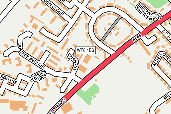
WF8 4ES is located in the Pontefract North electoral ward, within the metropolitan district of Wakefield and the English Parliamentary constituency of Normanton, Pontefract and Castleford. The Sub Integrated Care Board (ICB) Location is NHS West Yorkshire ICB - 03R and the police force is West Yorkshire. This postcode has been in use since January 1980.


GetTheData
Source: OS OpenMap – Local (Ordnance Survey)
Source: OS VectorMap District (Ordnance Survey)
Licence: Open Government Licence (requires attribution)
| Easting | 444608 |
| Northing | 421241 |
| Latitude | 53.685727 |
| Longitude | -1.326046 |
GetTheData
Source: Open Postcode Geo
Licence: Open Government Licence
| Country | England |
| Postcode District | WF8 |
➜ See where WF8 is on a map ➜ Where is Pontefract? | |
GetTheData
Source: Land Registry Price Paid Data
Licence: Open Government Licence
Elevation or altitude of WF8 4ES as distance above sea level:
| Metres | Feet | |
|---|---|---|
| Elevation | 80m | 262ft |
Elevation is measured from the approximate centre of the postcode, to the nearest point on an OS contour line from OS Terrain 50, which has contour spacing of ten vertical metres.
➜ How high above sea level am I? Find the elevation of your current position using your device's GPS.
GetTheData
Source: Open Postcode Elevation
Licence: Open Government Licence
| Ward | Pontefract North |
| Constituency | Normanton, Pontefract And Castleford |
GetTheData
Source: ONS Postcode Database
Licence: Open Government Licence
| Wakefield Rd Queens Avenue (Wakefield Road) | Pontefract | 62m |
| Wakefield Rd Queens Avenue (Wakefield Road) | Pontefract | 68m |
| Wakefield Rd Drivers Row (Wakefield Road) | Pontefract | 199m |
| Minden Close Halfpenny Lane (Minden Close) | Pontefract | 217m |
| Minden Close Halfpenny Lane (Minden Close) | Pontefract | 221m |
| Pontefract Tanshelf Station | 1km |
| Pontefract Baghill Station | 1.6km |
| Pontefract Monkhill Station | 2.1km |
GetTheData
Source: NaPTAN
Licence: Open Government Licence
GetTheData
Source: ONS Postcode Database
Licence: Open Government Licence


➜ Get more ratings from the Food Standards Agency
GetTheData
Source: Food Standards Agency
Licence: FSA terms & conditions
| Last Collection | |||
|---|---|---|---|
| Location | Mon-Fri | Sat | Distance |
| The Barracks | 17:30 | 12:30 | 62m |
| Kingsmead/East Avenue | 17:30 | 12:30 | 136m |
| Alden Cres / Mill Hill Lane | 17:30 | 11:30 | 357m |
GetTheData
Source: Dracos
Licence: Creative Commons Attribution-ShareAlike
The below table lists the International Territorial Level (ITL) codes (formerly Nomenclature of Territorial Units for Statistics (NUTS) codes) and Local Administrative Units (LAU) codes for WF8 4ES:
| ITL 1 Code | Name |
|---|---|
| TLE | Yorkshire and The Humber |
| ITL 2 Code | Name |
| TLE4 | West Yorkshire |
| ITL 3 Code | Name |
| TLE45 | Wakefield |
| LAU 1 Code | Name |
| E08000036 | Wakefield |
GetTheData
Source: ONS Postcode Directory
Licence: Open Government Licence
The below table lists the Census Output Area (OA), Lower Layer Super Output Area (LSOA), and Middle Layer Super Output Area (MSOA) for WF8 4ES:
| Code | Name | |
|---|---|---|
| OA | E00059706 | |
| LSOA | E01011842 | Wakefield 015E |
| MSOA | E02002452 | Wakefield 015 |
GetTheData
Source: ONS Postcode Directory
Licence: Open Government Licence
| WF8 4HH | Wakefield Road | 44m |
| WF8 4ER | Kings Mead | 91m |
| WF8 4SD | Queens Avenue | 117m |
| WF8 4EQ | Love Lane | 148m |
| WF8 4HE | Wakefield Road | 150m |
| WF8 4HD | Wakefield Road | 151m |
| WF8 4SB | Queens Road | 165m |
| WF8 4EP | Kings Mead | 181m |
| WF8 4HF | Drivers Row | 208m |
| WF8 4BB | Love Lane | 224m |
GetTheData
Source: Open Postcode Geo; Land Registry Price Paid Data
Licence: Open Government Licence