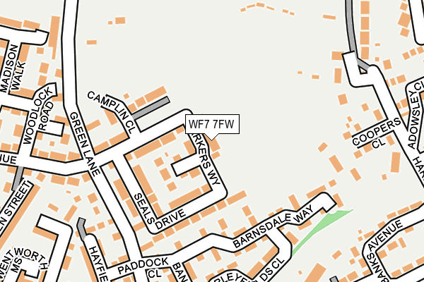
WF7 7FW is located in the Ackworth, North Elmsall and Upton electoral ward, within the metropolitan district of Wakefield and the English Parliamentary constituency of Hemsworth. The Sub Integrated Care Board (ICB) Location is NHS West Yorkshire ICB - 03R and the police force is West Yorkshire. This postcode has been in use since February 2017.


GetTheData
Source: OS OpenMap – Local (Ordnance Survey)
Source: OS VectorMap District (Ordnance Survey)
Licence: Open Government Licence (requires attribution)
| Easting | 443065 |
| Northing | 416563 |
| Latitude | 53.643830 |
| Longitude | -1.350056 |
GetTheData
Source: Open Postcode Geo
Licence: Open Government Licence
| Country | England |
| Postcode District | WF7 |
➜ See where WF7 is on a map ➜ Where is Ackworth Moor Top? | |
GetTheData
Source: Land Registry Price Paid Data
Licence: Open Government Licence
| Ward | Ackworth, North Elmsall And Upton |
| Constituency | Hemsworth |
GetTheData
Source: ONS Postcode Database
Licence: Open Government Licence
| Wakefield Rd Heaton Street (Wakefield Road) | Ackworth Moor Top | 308m |
| Wakefield Rd Heaton Street (Wakefield Road) | Ackworth Moor Top | 320m |
| Wakefield Road Dicky Sykes Ln (Wakefield Road) | Ackworth Moor Top | 323m |
| Wakefield Road Dicky Sykes Ln (Wakefield Road) | Ackworth Moor Top | 339m |
| Wakefield Rd Garden Street (Wakefield Road) | Ackworth Moor Top | 449m |
| Fitzwilliam Station | 2km |
| Featherstone Station | 4km |
| Streethouse Station | 4.9km |
GetTheData
Source: NaPTAN
Licence: Open Government Licence
| Percentage of properties with Next Generation Access | 100.0% |
| Percentage of properties with Superfast Broadband | 100.0% |
| Percentage of properties with Ultrafast Broadband | 0.0% |
| Percentage of properties with Full Fibre Broadband | 0.0% |
Superfast Broadband is between 30Mbps and 300Mbps
Ultrafast Broadband is > 300Mbps
| Median download speed | 49.4Mbps |
| Average download speed | 48.8Mbps |
| Maximum download speed | 66.30Mbps |
| Median upload speed | 14.3Mbps |
| Average upload speed | 13.6Mbps |
| Maximum upload speed | 19.46Mbps |
| Percentage of properties unable to receive 2Mbps | 0.0% |
| Percentage of properties unable to receive 5Mbps | 0.0% |
| Percentage of properties unable to receive 10Mbps | 0.0% |
| Percentage of properties unable to receive 30Mbps | 0.0% |
GetTheData
Source: Ofcom
Licence: Ofcom Terms of Use (requires attribution)
GetTheData
Source: ONS Postcode Database
Licence: Open Government Licence


➜ Get more ratings from the Food Standards Agency
GetTheData
Source: Food Standards Agency
Licence: FSA terms & conditions
| Last Collection | |||
|---|---|---|---|
| Location | Mon-Fri | Sat | Distance |
| Brackenhill Edge | 16:00 | 11:15 | 290m |
| Brackenhill P.o. | 16:30 | 11:15 | 379m |
| Ackworth Moor Top | 16:00 | 11:00 | 700m |
GetTheData
Source: Dracos
Licence: Creative Commons Attribution-ShareAlike
The below table lists the International Territorial Level (ITL) codes (formerly Nomenclature of Territorial Units for Statistics (NUTS) codes) and Local Administrative Units (LAU) codes for WF7 7FW:
| ITL 1 Code | Name |
|---|---|
| TLE | Yorkshire and The Humber |
| ITL 2 Code | Name |
| TLE4 | West Yorkshire |
| ITL 3 Code | Name |
| TLE45 | Wakefield |
| LAU 1 Code | Name |
| E08000036 | Wakefield |
GetTheData
Source: ONS Postcode Directory
Licence: Open Government Licence
The below table lists the Census Output Area (OA), Lower Layer Super Output Area (LSOA), and Middle Layer Super Output Area (MSOA) for WF7 7FW:
| Code | Name | |
|---|---|---|
| OA | E00059326 | |
| LSOA | E01011769 | Wakefield 034C |
| MSOA | E02002471 | Wakefield 034 |
GetTheData
Source: ONS Postcode Directory
Licence: Open Government Licence
| WF7 7RU | Barnsdale Way | 125m |
| WF7 7RY | Barleyfields Close | 182m |
| WF7 7BH | Green Lane | 184m |
| WF7 7FB | Turnberry Avenue | 185m |
| WF7 7RL | Paddock Close | 195m |
| WF7 7RW | Barncroft Close | 199m |
| WF7 7RA | Coopers Close | 206m |
| WF7 7FE | Turnberry Avenue | 210m |
| WF7 7RH | Hayfield Way | 216m |
| WF7 7JX | The Bungalows | 224m |
GetTheData
Source: Open Postcode Geo; Land Registry Price Paid Data
Licence: Open Government Licence