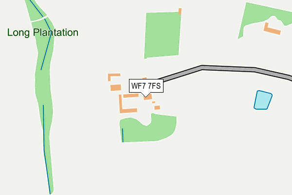
WF7 7FS is located in the Ackworth, North Elmsall and Upton electoral ward, within the metropolitan district of Wakefield and the English Parliamentary constituency of Hemsworth. The Sub Integrated Care Board (ICB) Location is NHS West Yorkshire ICB - 03R and the police force is West Yorkshire. This postcode has been in use since March 2016.


GetTheData
Source: OS OpenMap – Local (Ordnance Survey)
Source: OS VectorMap District (Ordnance Survey)
Licence: Open Government Licence (requires attribution)
| Easting | 444072 |
| Northing | 418720 |
| Latitude | 53.663133 |
| Longitude | -1.334521 |
GetTheData
Source: Open Postcode Geo
Licence: Open Government Licence
| Country | England |
| Postcode District | WF7 |
➜ See where WF7 is on a map ➜ Where is High Ackworth? | |
GetTheData
Source: Land Registry Price Paid Data
Licence: Open Government Licence
Elevation or altitude of WF7 7FS as distance above sea level:
| Metres | Feet | |
|---|---|---|
| Elevation | 60m | 197ft |
Elevation is measured from the approximate centre of the postcode, to the nearest point on an OS contour line from OS Terrain 50, which has contour spacing of ten vertical metres.
➜ How high above sea level am I? Find the elevation of your current position using your device's GPS.
GetTheData
Source: Open Postcode Elevation
Licence: Open Government Licence
| Ward | Ackworth, North Elmsall And Upton |
| Constituency | Hemsworth |
GetTheData
Source: ONS Postcode Database
Licence: Open Government Licence
| Pontefract Road Park Croft (Pontefract Road) | High Ackworth | 481m |
| Ackworth Rd Purston Lane (Ackworth Road) | High Ackworth | 578m |
| Ackworth Rd Purston Lane (Ackworth Road) | High Ackworth | 604m |
| Pontefract Rd Meadow Way (Pontefract Road) | High Ackworth | 629m |
| Pontefract Rd Meadow Way (Pontefract Road) | High Ackworth | 636m |
| Featherstone Station | 2.4km |
| Pontefract Tanshelf Station | 3.6km |
| Pontefract Baghill Station | 3.8km |
GetTheData
Source: NaPTAN
Licence: Open Government Licence
GetTheData
Source: ONS Postcode Database
Licence: Open Government Licence


➜ Get more ratings from the Food Standards Agency
GetTheData
Source: Food Standards Agency
Licence: FSA terms & conditions
| Last Collection | |||
|---|---|---|---|
| Location | Mon-Fri | Sat | Distance |
| Ackworth P.o. | 17:00 | 11:15 | 730m |
| High Ackworth | 16:00 | 11:00 | 744m |
| Leatham Ave / Little Lane | 17:15 | 12:15 | 1,403m |
GetTheData
Source: Dracos
Licence: Creative Commons Attribution-ShareAlike
The below table lists the International Territorial Level (ITL) codes (formerly Nomenclature of Territorial Units for Statistics (NUTS) codes) and Local Administrative Units (LAU) codes for WF7 7FS:
| ITL 1 Code | Name |
|---|---|
| TLE | Yorkshire and The Humber |
| ITL 2 Code | Name |
| TLE4 | West Yorkshire |
| ITL 3 Code | Name |
| TLE45 | Wakefield |
| LAU 1 Code | Name |
| E08000036 | Wakefield |
GetTheData
Source: ONS Postcode Directory
Licence: Open Government Licence
The below table lists the Census Output Area (OA), Lower Layer Super Output Area (LSOA), and Middle Layer Super Output Area (MSOA) for WF7 7FS:
| Code | Name | |
|---|---|---|
| OA | E00059342 | |
| LSOA | E01011767 | Wakefield 034A |
| MSOA | E02002471 | Wakefield 034 |
GetTheData
Source: ONS Postcode Directory
Licence: Open Government Licence
| WF7 7ET | Pontefract Road | 290m |
| WF7 7EU | Pontefract Road | 427m |
| WF7 7ES | Beech Drive | 497m |
| WF7 7EH | Purston Lane | 547m |
| WF7 7EA | Long Meadow | 550m |
| WF7 7RP | Westwinds | 626m |
| WF7 7EP | Woodland Grove | 642m |
| WF7 7EL | Pontefract Road | 685m |
| WF7 7EJ | Cross Hill | 688m |
| WF7 7HW | Meadow Bank | 693m |
GetTheData
Source: Open Postcode Geo; Land Registry Price Paid Data
Licence: Open Government Licence