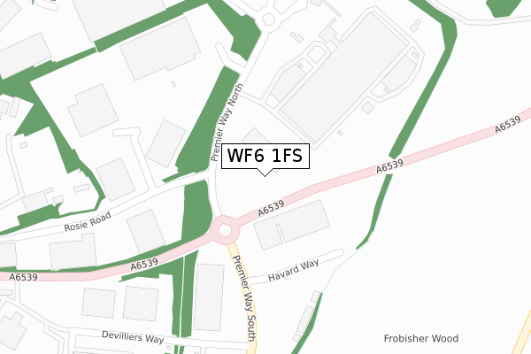
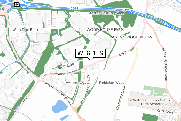
WF6 1FS is located in the Featherstone electoral ward, within the metropolitan district of Wakefield and the English Parliamentary constituency of Hemsworth. The Sub Integrated Care Board (ICB) Location is NHS West Yorkshire ICB - 03R and the police force is West Yorkshire. This postcode has been in use since November 2019.


GetTheData
Source: OS Open Zoomstack (Ordnance Survey)
Licence: Open Government Licence (requires attribution)
Attribution: Contains OS data © Crown copyright and database right 2025
Source: Open Postcode Geo
Licence: Open Government Licence (requires attribution)
Attribution: Contains OS data © Crown copyright and database right 2025; Contains Royal Mail data © Royal Mail copyright and database right 2025; Source: Office for National Statistics licensed under the Open Government Licence v.3.0
| Easting | 440997 |
| Northing | 422941 |
| Latitude | 53.701319 |
| Longitude | -1.380497 |
GetTheData
Source: Open Postcode Geo
Licence: Open Government Licence
| Country | England |
| Postcode District | WF6 |
➜ See where WF6 is on a map ➜ Where is Normanton? | |
GetTheData
Source: Land Registry Price Paid Data
Licence: Open Government Licence
| Ward | Featherstone |
| Constituency | Hemsworth |
GetTheData
Source: ONS Postcode Database
Licence: Open Government Licence
| Loscoe Lane | Ackton | 593m |
| Loscoe Lane | Ackton | 598m |
| Loscoe Lane | Ackton | 605m |
| Pontefract Road | Whitwood | 1,021m |
| Ackton Close (Ackton Lane) | Ackton | 1,033m |
| Glasshoughton Station | 2.7km |
| Normanton Station | 2.8km |
| Featherstone Station | 2.9km |
GetTheData
Source: NaPTAN
Licence: Open Government Licence
GetTheData
Source: ONS Postcode Database
Licence: Open Government Licence


➜ Get more ratings from the Food Standards Agency
GetTheData
Source: Food Standards Agency
Licence: FSA terms & conditions
| Last Collection | |||
|---|---|---|---|
| Location | Mon-Fri | Sat | Distance |
| Aketon Lane/West End Ave | 16:15 | 11:45 | 1,100m |
| Normanton Industrial Estate | 1,230m | ||
| Ripley Drive | 18:30 | 11:00 | 1,351m |
GetTheData
Source: Dracos
Licence: Creative Commons Attribution-ShareAlike
The below table lists the International Territorial Level (ITL) codes (formerly Nomenclature of Territorial Units for Statistics (NUTS) codes) and Local Administrative Units (LAU) codes for WF6 1FS:
| ITL 1 Code | Name |
|---|---|
| TLE | Yorkshire and The Humber |
| ITL 2 Code | Name |
| TLE4 | West Yorkshire |
| ITL 3 Code | Name |
| TLE45 | Wakefield |
| LAU 1 Code | Name |
| E08000036 | Wakefield |
GetTheData
Source: ONS Postcode Directory
Licence: Open Government Licence
The below table lists the Census Output Area (OA), Lower Layer Super Output Area (LSOA), and Middle Layer Super Output Area (MSOA) for WF6 1FS:
| Code | Name | |
|---|---|---|
| OA | E00168737 | |
| LSOA | E01011775 | Wakefield 024A |
| MSOA | E02002461 | Wakefield 024 |
GetTheData
Source: ONS Postcode Directory
Licence: Open Government Licence
| WF6 1GX | Devilliers Way | 269m |
| WF7 6HU | Ackton Wood Villas | 721m |
| WF6 1TN | Foxbridge Way | 734m |
| WF6 1RL | Tyler Close | 799m |
| WF6 1TA | Mildred Sylvester Way | 879m |
| WF10 5PL | Wood Lane | 950m |
| WF10 5PJ | Wood Lane | 951m |
| WF7 6HT | Stretton Close | 976m |
| WF7 6HS | 983m | |
| WF7 6HR | Loscoe Lane | 992m |
GetTheData
Source: Open Postcode Geo; Land Registry Price Paid Data
Licence: Open Government Licence