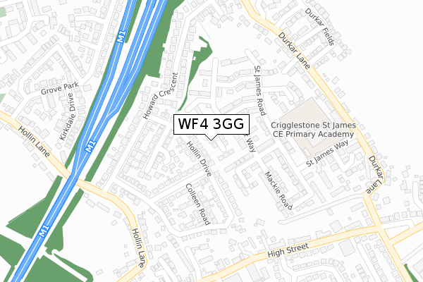
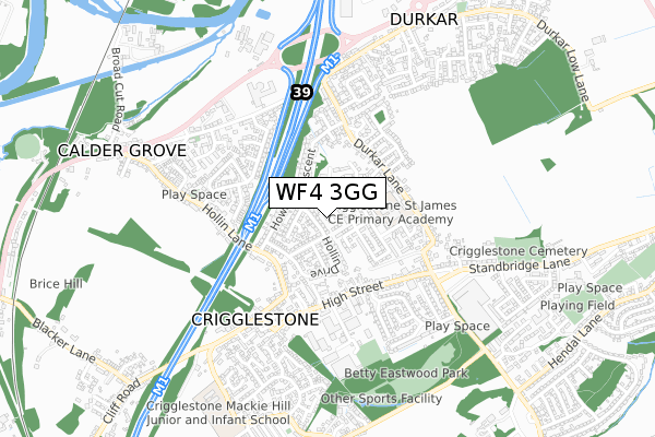
WF4 3GG is located in the Wakefield Rural electoral ward, within the metropolitan district of Wakefield and the English Parliamentary constituency of Wakefield. The Sub Integrated Care Board (ICB) Location is NHS West Yorkshire ICB - 03R and the police force is West Yorkshire. This postcode has been in use since May 2018.


GetTheData
Source: OS Open Zoomstack (Ordnance Survey)
Licence: Open Government Licence (requires attribution)
Attribution: Contains OS data © Crown copyright and database right 2024
Source: Open Postcode Geo
Licence: Open Government Licence (requires attribution)
Attribution: Contains OS data © Crown copyright and database right 2024; Contains Royal Mail data © Royal Mail copyright and database right 2024; Source: Office for National Statistics licensed under the Open Government Licence v.3.0
| Easting | 431307 |
| Northing | 416578 |
| Latitude | 53.644797 |
| Longitude | -1.527904 |
GetTheData
Source: Open Postcode Geo
Licence: Open Government Licence
| Country | England |
| Postcode District | WF4 |
➜ See where WF4 is on a map ➜ Where is Crigglestone? | |
GetTheData
Source: Land Registry Price Paid Data
Licence: Open Government Licence
| Ward | Wakefield Rural |
| Constituency | Wakefield |
GetTheData
Source: ONS Postcode Database
Licence: Open Government Licence
2023 6 OCT £300,000 |
1, SANDPIPER DRIVE, CRIGGLESTONE, WAKEFIELD, WF4 3GG 2018 1 JUN £269,995 |
2018 25 MAY £256,995 |
GetTheData
Source: HM Land Registry Price Paid Data
Licence: Contains HM Land Registry data © Crown copyright and database right 2024. This data is licensed under the Open Government Licence v3.0.
| Hollin Lane Howard Crescent (Hollin Lane) | Crigglestone | 256m |
| Durkar Fields (Durkar Lane) | Durkar | 290m |
| Durkar Fields (Durkar Lane) | Durkar | 302m |
| Hollin Lane Howard Crescent (Hollin Lane) | Crigglestone | 306m |
| Gardeners Arms (High Street) | Crigglestone | 315m |
| Sandal & Agbrigg Station | 3.7km |
| Wakefield Westgate Station | 4.5km |
| Wakefield Kirkgate Station | 4.6km |
GetTheData
Source: NaPTAN
Licence: Open Government Licence
| Percentage of properties with Next Generation Access | 79.3% |
| Percentage of properties with Superfast Broadband | 79.3% |
| Percentage of properties with Ultrafast Broadband | 79.3% |
| Percentage of properties with Full Fibre Broadband | 0.0% |
Superfast Broadband is between 30Mbps and 300Mbps
Ultrafast Broadband is > 300Mbps
| Median download speed | 28.1Mbps |
| Average download speed | 77.4Mbps |
| Maximum download speed | 350.00Mbps |
| Median upload speed | 0.8Mbps |
| Average upload speed | 0.7Mbps |
| Maximum upload speed | 0.78Mbps |
| Percentage of properties unable to receive 2Mbps | 0.0% |
| Percentage of properties unable to receive 5Mbps | 0.0% |
| Percentage of properties unable to receive 10Mbps | 20.7% |
| Percentage of properties unable to receive 30Mbps | 20.7% |
GetTheData
Source: Ofcom
Licence: Ofcom Terms of Use (requires attribution)
GetTheData
Source: ONS Postcode Database
Licence: Open Government Licence


➜ Get more ratings from the Food Standards Agency
GetTheData
Source: Food Standards Agency
Licence: FSA terms & conditions
| Last Collection | |||
|---|---|---|---|
| Location | Mon-Fri | Sat | Distance |
| Howard Crescent/ Holling Lane | 16:00 | 11:00 | 265m |
| Crigglestone P.o. | 16:30 | 11:45 | 339m |
| Calder Grove P.o. | 17:30 | 11:15 | 757m |
GetTheData
Source: Dracos
Licence: Creative Commons Attribution-ShareAlike
The below table lists the International Territorial Level (ITL) codes (formerly Nomenclature of Territorial Units for Statistics (NUTS) codes) and Local Administrative Units (LAU) codes for WF4 3GG:
| ITL 1 Code | Name |
|---|---|
| TLE | Yorkshire and The Humber |
| ITL 2 Code | Name |
| TLE4 | West Yorkshire |
| ITL 3 Code | Name |
| TLE45 | Wakefield |
| LAU 1 Code | Name |
| E08000036 | Wakefield |
GetTheData
Source: ONS Postcode Directory
Licence: Open Government Licence
The below table lists the Census Output Area (OA), Lower Layer Super Output Area (LSOA), and Middle Layer Super Output Area (MSOA) for WF4 3GG:
| Code | Name | |
|---|---|---|
| OA | E00060155 | |
| LSOA | E01011929 | Wakefield 036A |
| MSOA | E02002473 | Wakefield 036 |
GetTheData
Source: ONS Postcode Directory
Licence: Open Government Licence
| WF4 3FW | Calder Way | 90m |
| WF4 3PR | Hollin Drive | 109m |
| WF4 3FT | Pugneys Avenue | 118m |
| WF4 3FX | Micklewait Avenue | 119m |
| WF4 3PL | Julie Avenue | 121m |
| WF4 3PP | Gillion Crescent | 131m |
| WF4 3FQ | St James Road | 133m |
| WF4 3PX | Colleen Road | 175m |
| WF4 3FR | St James Road | 179m |
| WF4 3AN | Howard Crescent | 184m |
GetTheData
Source: Open Postcode Geo; Land Registry Price Paid Data
Licence: Open Government Licence