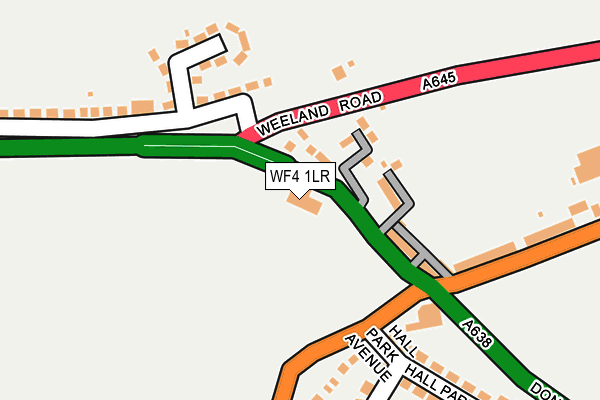
WF4 1LR lies on Doncaster Road in Crofton, Wakefield. WF4 1LR is located in the Crofton, Ryhill and Walton electoral ward, within the metropolitan district of Wakefield and the English Parliamentary constituency of Hemsworth. The Sub Integrated Care Board (ICB) Location is NHS West Yorkshire ICB - 03R and the police force is West Yorkshire. This postcode has been in use since January 1980.


GetTheData
Source: OS OpenMap – Local (Ordnance Survey)
Source: OS VectorMap District (Ordnance Survey)
Licence: Open Government Licence (requires attribution)
| Easting | 437538 |
| Northing | 418812 |
| Latitude | 53.664450 |
| Longitude | -1.433383 |
GetTheData
Source: Open Postcode Geo
Licence: Open Government Licence
| Street | Doncaster Road |
| Locality | Crofton |
| Town/City | Wakefield |
| Country | England |
| Postcode District | WF4 |
➜ See where WF4 is on a map ➜ Where is Crofton? | |
GetTheData
Source: Land Registry Price Paid Data
Licence: Open Government Licence
Elevation or altitude of WF4 1LR as distance above sea level:
| Metres | Feet | |
|---|---|---|
| Elevation | 50m | 164ft |
Elevation is measured from the approximate centre of the postcode, to the nearest point on an OS contour line from OS Terrain 50, which has contour spacing of ten vertical metres.
➜ How high above sea level am I? Find the elevation of your current position using your device's GPS.
GetTheData
Source: Open Postcode Elevation
Licence: Open Government Licence
| Ward | Crofton, Ryhill And Walton |
| Constituency | Hemsworth |
GetTheData
Source: ONS Postcode Database
Licence: Open Government Licence
532, DONCASTER ROAD, CROFTON, WAKEFIELD, WF4 1LR 2002 31 JAN £144,000 |
GetTheData
Source: HM Land Registry Price Paid Data
Licence: Contains HM Land Registry data © Crown copyright and database right 2025. This data is licensed under the Open Government Licence v3.0.
| Doncaster Rd Cock Lane (Doncaster Road) | Crofton | 48m |
| Doncaster Rd Cock Lane (Doncaster Road) | Crofton | 111m |
| Doncaster Road Weeland Rd (Doncaster Road) | Crofton | 211m |
| Doncaster Road Weeland Rd (Doncaster Road) | Crofton | 234m |
| Pontefract Rd Doncaster Road (Pontefract Road) | Crofton | 236m |
| Streethouse Station | 2.6km |
| Sandal & Agbrigg Station | 3.2km |
| Wakefield Kirkgate Station | 4km |
GetTheData
Source: NaPTAN
Licence: Open Government Licence
GetTheData
Source: ONS Postcode Database
Licence: Open Government Licence


➜ Get more ratings from the Food Standards Agency
GetTheData
Source: Food Standards Agency
Licence: FSA terms & conditions
| Last Collection | |||
|---|---|---|---|
| Location | Mon-Fri | Sat | Distance |
| Crown View | 17:30 | 11:15 | 228m |
| Ashdene Drive/Ashdene Approach | 17:30 | 11:15 | 443m |
| Shay Lane Estate | 17:00 | 11:15 | 565m |
GetTheData
Source: Dracos
Licence: Creative Commons Attribution-ShareAlike
The below table lists the International Territorial Level (ITL) codes (formerly Nomenclature of Territorial Units for Statistics (NUTS) codes) and Local Administrative Units (LAU) codes for WF4 1LR:
| ITL 1 Code | Name |
|---|---|
| TLE | Yorkshire and The Humber |
| ITL 2 Code | Name |
| TLE4 | West Yorkshire |
| ITL 3 Code | Name |
| TLE45 | Wakefield |
| LAU 1 Code | Name |
| E08000036 | Wakefield |
GetTheData
Source: ONS Postcode Directory
Licence: Open Government Licence
The below table lists the Census Output Area (OA), Lower Layer Super Output Area (LSOA), and Middle Layer Super Output Area (MSOA) for WF4 1LR:
| Code | Name | |
|---|---|---|
| OA | E00059354 | |
| LSOA | E01011774 | Wakefield 032D |
| MSOA | E02002469 | Wakefield 032 |
GetTheData
Source: ONS Postcode Directory
Licence: Open Government Licence
| WF4 1LP | Doncaster Road | 96m |
| WF4 1LS | Weeland Road | 127m |
| WF4 1RL | Kingsley Close | 161m |
| WF4 1RN | Kingsley Avenue | 187m |
| WF4 1LU | Cock Lane | 209m |
| WF4 1LL | Pontefract Road | 229m |
| WF4 1LT | Hall Park Avenue | 241m |
| WF4 1SX | Parkway | 263m |
| WF4 1RP | Doncaster Road | 329m |
| WF4 1LX | Ashdene Avenue | 361m |
GetTheData
Source: Open Postcode Geo; Land Registry Price Paid Data
Licence: Open Government Licence