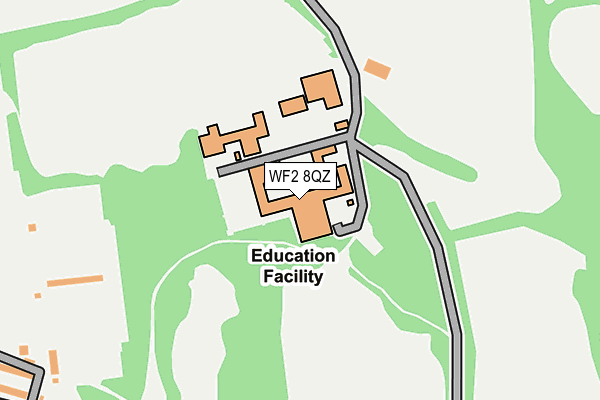
WF2 8QZ is located in the Wakefield West electoral ward, within the metropolitan district of Wakefield and the English Parliamentary constituency of Wakefield. The Sub Integrated Care Board (ICB) Location is NHS West Yorkshire ICB - 03R and the police force is West Yorkshire. This postcode has been in use since July 1995.


GetTheData
Source: OS OpenMap – Local (Ordnance Survey)
Source: OS VectorMap District (Ordnance Survey)
Licence: Open Government Licence (requires attribution)
| Easting | 432354 |
| Northing | 419710 |
| Latitude | 53.672866 |
| Longitude | -1.511740 |
GetTheData
Source: Open Postcode Geo
Licence: Open Government Licence
| Country | England |
| Postcode District | WF2 |
➜ See where WF2 is on a map ➜ Where is Wakefield? | |
GetTheData
Source: Land Registry Price Paid Data
Licence: Open Government Licence
Elevation or altitude of WF2 8QZ as distance above sea level:
| Metres | Feet | |
|---|---|---|
| Elevation | 40m | 131ft |
Elevation is measured from the approximate centre of the postcode, to the nearest point on an OS contour line from OS Terrain 50, which has contour spacing of ten vertical metres.
➜ How high above sea level am I? Find the elevation of your current position using your device's GPS.
GetTheData
Source: Open Postcode Elevation
Licence: Open Government Licence
| Ward | Wakefield West |
| Constituency | Wakefield |
GetTheData
Source: ONS Postcode Database
Licence: Open Government Licence
| Thornes Road | Thornes | 320m |
| Thornes Road | Thornes | 322m |
| Lawefield Ln Park Grove Rd (Lawefield Lane) | Thornes | 376m |
| Park Gates (Thornes Road) | Thornes | 380m |
| Lawefield Lane School (Lawefield Lane) | Thornes | 383m |
| Wakefield Westgate Station | 1.2km |
| Wakefield Kirkgate Station | 1.7km |
| Sandal & Agbrigg Station | 2.3km |
GetTheData
Source: NaPTAN
Licence: Open Government Licence
GetTheData
Source: ONS Postcode Database
Licence: Open Government Licence


➜ Get more ratings from the Food Standards Agency
GetTheData
Source: Food Standards Agency
Licence: FSA terms & conditions
| Last Collection | |||
|---|---|---|---|
| Location | Mon-Fri | Sat | Distance |
| Thornes Road | 18:00 | 12:30 | 385m |
| 123 Lawefield Lane | 17:45 | 11:45 | 424m |
| 17 Thornes Road | 18:00 | 11:45 | 500m |
GetTheData
Source: Dracos
Licence: Creative Commons Attribution-ShareAlike
The below table lists the International Territorial Level (ITL) codes (formerly Nomenclature of Territorial Units for Statistics (NUTS) codes) and Local Administrative Units (LAU) codes for WF2 8QZ:
| ITL 1 Code | Name |
|---|---|
| TLE | Yorkshire and The Humber |
| ITL 2 Code | Name |
| TLE4 | West Yorkshire |
| ITL 3 Code | Name |
| TLE45 | Wakefield |
| LAU 1 Code | Name |
| E08000036 | Wakefield |
GetTheData
Source: ONS Postcode Directory
Licence: Open Government Licence
The below table lists the Census Output Area (OA), Lower Layer Super Output Area (LSOA), and Middle Layer Super Output Area (MSOA) for WF2 8QZ:
| Code | Name | |
|---|---|---|
| OA | E00060019 | |
| LSOA | E01011907 | Wakefield 028D |
| MSOA | E02002465 | Wakefield 028 |
GetTheData
Source: ONS Postcode Directory
Licence: Open Government Licence
| WF2 8QE | Thornes Road | 294m |
| WF2 8QD | Thornes Road | 351m |
| WF2 8QF | Thornes Road | 384m |
| WF2 8SX | Lawefield Lane | 386m |
| WF2 8BT | Gill Sike Road | 414m |
| WF2 8BP | Gill Sike Bungalows | 417m |
| WF2 8QA | Thornes Moor Close | 418m |
| WF2 8PP | Thornes Road | 433m |
| WF2 8QB | Thornes Moor Drive | 435m |
| WF2 8PS | Thornes Moor Road | 439m |
GetTheData
Source: Open Postcode Geo; Land Registry Price Paid Data
Licence: Open Government Licence