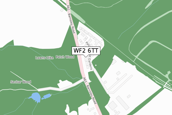
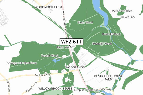
WF2 6TT is located in the Wakefield Rural electoral ward, within the metropolitan district of Wakefield and the English Parliamentary constituency of Wakefield. The Sub Integrated Care Board (ICB) Location is NHS West Yorkshire ICB - 03R and the police force is West Yorkshire. This postcode has been in use since November 2017.


GetTheData
Source: OS Open Zoomstack (Ordnance Survey)
Licence: Open Government Licence (requires attribution)
Attribution: Contains OS data © Crown copyright and database right 2025
Source: Open Postcode Geo
Licence: Open Government Licence (requires attribution)
Attribution: Contains OS data © Crown copyright and database right 2025; Contains Royal Mail data © Royal Mail copyright and database right 2025; Source: Office for National Statistics licensed under the Open Government Licence v.3.0
| Easting | 433123 |
| Northing | 414439 |
| Latitude | 53.625461 |
| Longitude | -1.500662 |
GetTheData
Source: Open Postcode Geo
Licence: Open Government Licence
| Country | England |
| Postcode District | WF2 |
➜ See where WF2 is on a map | |
GetTheData
Source: Land Registry Price Paid Data
Licence: Open Government Licence
| Ward | Wakefield Rural |
| Constituency | Wakefield |
GetTheData
Source: ONS Postcode Database
Licence: Open Government Licence
| Patch Wood Industrial Estate (Barnsley Road) | Newmillerdam | 30m |
| Patch Wood Industrial Estate (Barnsley Road) | Newmillerdam | 58m |
| Barnsley Road Seckar Ln (Barnsley Road) | Woolley Village | 387m |
| Barnsley Road Seckar Ln (Barnsley Road) | Woolley Village | 417m |
| Kings Wood (Barnsley Road) | Newmillerdam | 445m |
| Sandal & Agbrigg Station | 4.4km |
| Darton Station | 4.6km |
GetTheData
Source: NaPTAN
Licence: Open Government Licence
| Percentage of properties with Next Generation Access | 100.0% |
| Percentage of properties with Superfast Broadband | 0.0% |
| Percentage of properties with Ultrafast Broadband | 0.0% |
| Percentage of properties with Full Fibre Broadband | 0.0% |
Superfast Broadband is between 30Mbps and 300Mbps
Ultrafast Broadband is > 300Mbps
| Median download speed | 8.6Mbps |
| Average download speed | 9.3Mbps |
| Maximum download speed | 16.38Mbps |
| Median upload speed | 1.2Mbps |
| Average upload speed | 1.5Mbps |
| Maximum upload speed | 3.00Mbps |
| Percentage of properties unable to receive 2Mbps | 0.0% |
| Percentage of properties unable to receive 5Mbps | 0.0% |
| Percentage of properties unable to receive 10Mbps | 0.0% |
| Percentage of properties unable to receive 30Mbps | 100.0% |
GetTheData
Source: Ofcom
Licence: Ofcom Terms of Use (requires attribution)
GetTheData
Source: ONS Postcode Database
Licence: Open Government Licence


➜ Get more ratings from the Food Standards Agency
GetTheData
Source: Food Standards Agency
Licence: FSA terms & conditions
| Last Collection | |||
|---|---|---|---|
| Location | Mon-Fri | Sat | Distance |
| Seckar Lane/Barnsley Road | 17:00 | 11:00 | 394m |
| Woodmoor | 16:45 | 12:15 | 1,190m |
| Newmillerdam | 17:00 | 12:15 | 1,448m |
GetTheData
Source: Dracos
Licence: Creative Commons Attribution-ShareAlike
The below table lists the International Territorial Level (ITL) codes (formerly Nomenclature of Territorial Units for Statistics (NUTS) codes) and Local Administrative Units (LAU) codes for WF2 6TT:
| ITL 1 Code | Name |
|---|---|
| TLE | Yorkshire and The Humber |
| ITL 2 Code | Name |
| TLE4 | West Yorkshire |
| ITL 3 Code | Name |
| TLE45 | Wakefield |
| LAU 1 Code | Name |
| E08000036 | Wakefield |
GetTheData
Source: ONS Postcode Directory
Licence: Open Government Licence
The below table lists the Census Output Area (OA), Lower Layer Super Output Area (LSOA), and Middle Layer Super Output Area (MSOA) for WF2 6TT:
| Code | Name | |
|---|---|---|
| OA | E00060169 | |
| LSOA | E01011936 | Wakefield 037B |
| MSOA | E02002474 | Wakefield 037 |
GetTheData
Source: ONS Postcode Directory
Licence: Open Government Licence
| WF4 2LF | Barnsley Road | 329m |
| WF4 2LE | Seckar Lane | 455m |
| WF2 6QH | Barnsley Road | 477m |
| WF4 2NW | Barnsley Road | 749m |
| WF4 2NN | Woolley Mill Lane | 1019m |
| WF2 6QJ | Miller Court | 1093m |
| WF2 7ST | Almshouse Lane | 1142m |
| WF4 3JL | Wood Lane | 1145m |
| WF2 6QQ | Barnsley Road | 1156m |
| WF4 3LH | Moorside Crescent | 1259m |
GetTheData
Source: Open Postcode Geo; Land Registry Price Paid Data
Licence: Open Government Licence