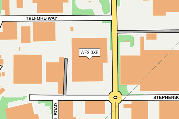
WF2 0XE is located in the Wrenthorpe and Outwood West electoral ward, within the metropolitan district of Wakefield and the English Parliamentary constituency of Morley and Outwood. The Sub Integrated Care Board (ICB) Location is NHS West Yorkshire ICB - 03R and the police force is West Yorkshire. This postcode has been in use since January 1993.


GetTheData
Source: OS OpenMap – Local (Ordnance Survey)
Source: OS VectorMap District (Ordnance Survey)
Licence: Open Government Licence (requires attribution)
| Easting | 431704 |
| Northing | 424153 |
| Latitude | 53.712839 |
| Longitude | -1.521125 |
GetTheData
Source: Open Postcode Geo
Licence: Open Government Licence
| Country | England |
| Postcode District | WF2 |
➜ See where WF2 is on a map ➜ Where is Wakefield? | |
GetTheData
Source: Land Registry Price Paid Data
Licence: Open Government Licence
Elevation or altitude of WF2 0XE as distance above sea level:
| Metres | Feet | |
|---|---|---|
| Elevation | 90m | 295ft |
Elevation is measured from the approximate centre of the postcode, to the nearest point on an OS contour line from OS Terrain 50, which has contour spacing of ten vertical metres.
➜ How high above sea level am I? Find the elevation of your current position using your device's GPS.
GetTheData
Source: Open Postcode Elevation
Licence: Open Government Licence
| Ward | Wrenthorpe And Outwood West |
| Constituency | Morley And Outwood |
GetTheData
Source: ONS Postcode Database
Licence: Open Government Licence
| Kenmore Rd Telford Way (Kenmore Road) | Carr Gate | 178m |
| Kenmore Rd Telford Way (Kenmore Road) | Carr Gate | 185m |
| Kenmore Rd Stephenson Way (Kenmore Road) | Carr Gate | 224m |
| Outwood 41 Industrial Park (Kenmore Road) | Outwood | 390m |
| Potovens Lane Wakefield 41 Business Park (Potovens Lane) | Carr Gate | 531m |
| Outwood Station | 0.8km |
| Wakefield Westgate Station | 3.5km |
| Wakefield Kirkgate Station | 4.4km |
GetTheData
Source: NaPTAN
Licence: Open Government Licence
GetTheData
Source: ONS Postcode Database
Licence: Open Government Licence


➜ Get more ratings from the Food Standards Agency
GetTheData
Source: Food Standards Agency
Licence: FSA terms & conditions
| Last Collection | |||
|---|---|---|---|
| Location | Mon-Fri | Sat | Distance |
| Wakefield 41 Business Park | 18:30 | 238m | |
| Car Gate | 18:00 | 11:30 | 572m |
| Farm Stores | 17:45 | 11:00 | 708m |
GetTheData
Source: Dracos
Licence: Creative Commons Attribution-ShareAlike
The below table lists the International Territorial Level (ITL) codes (formerly Nomenclature of Territorial Units for Statistics (NUTS) codes) and Local Administrative Units (LAU) codes for WF2 0XE:
| ITL 1 Code | Name |
|---|---|
| TLE | Yorkshire and The Humber |
| ITL 2 Code | Name |
| TLE4 | West Yorkshire |
| ITL 3 Code | Name |
| TLE45 | Wakefield |
| LAU 1 Code | Name |
| E08000036 | Wakefield |
GetTheData
Source: ONS Postcode Directory
Licence: Open Government Licence
The below table lists the Census Output Area (OA), Lower Layer Super Output Area (LSOA), and Middle Layer Super Output Area (MSOA) for WF2 0XE:
| Code | Name | |
|---|---|---|
| OA | E00059951 | |
| LSOA | E01011885 | Wakefield 014A |
| MSOA | E02002451 | Wakefield 014 |
GetTheData
Source: ONS Postcode Directory
Licence: Open Government Licence
| WF2 0XW | Telford Way | 302m |
| WF2 0XG | Brunel Road | 332m |
| WF2 0UT | Lawns Court | 341m |
| WF2 0UU | Tudor Lawns | 350m |
| WF2 0XQ | Brindley Way | 412m |
| WF2 0QU | Lawns Lane | 479m |
| WF2 0QT | Bradford Road | 492m |
| WF2 0SW | Edward Court | 516m |
| WF2 0RA | Bradford Road | 566m |
| WF2 0QW | Bradford Road | 576m |
GetTheData
Source: Open Postcode Geo; Land Registry Price Paid Data
Licence: Open Government Licence