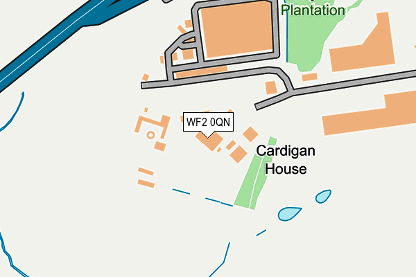
WF2 0QN lies on Grandstand Road in Wrenthorpe, Wakefield. WF2 0QN is located in the Wrenthorpe and Outwood West electoral ward, within the metropolitan district of Wakefield and the English Parliamentary constituency of Morley and Outwood. The Sub Integrated Care Board (ICB) Location is NHS West Yorkshire ICB - 03R and the police force is West Yorkshire. This postcode has been in use since December 2013.


GetTheData
Source: OS OpenMap – Local (Ordnance Survey)
Source: OS VectorMap District (Ordnance Survey)
Licence: Open Government Licence (requires attribution)
| Easting | 430714 |
| Northing | 424093 |
| Latitude | 53.712375 |
| Longitude | -1.536134 |
GetTheData
Source: Open Postcode Geo
Licence: Open Government Licence
| Street | Grandstand Road |
| Locality | Wrenthorpe |
| Town/City | Wakefield |
| Country | England |
| Postcode District | WF2 |
➜ See where WF2 is on a map | |
GetTheData
Source: Land Registry Price Paid Data
Licence: Open Government Licence
Elevation or altitude of WF2 0QN as distance above sea level:
| Metres | Feet | |
|---|---|---|
| Elevation | 80m | 262ft |
Elevation is measured from the approximate centre of the postcode, to the nearest point on an OS contour line from OS Terrain 50, which has contour spacing of ten vertical metres.
➜ How high above sea level am I? Find the elevation of your current position using your device's GPS.
GetTheData
Source: Open Postcode Elevation
Licence: Open Government Licence
| Ward | Wrenthorpe And Outwood West |
| Constituency | Morley And Outwood |
GetTheData
Source: ONS Postcode Database
Licence: Open Government Licence
| Bradford Road Carr Gate Farm (Bradford Road) | Carr Gate | 205m |
| Bradford Road Carr Gate Farm (Bradford Road) | Carr Gate | 242m |
| Bradford Road Providence Mount (Bradford Road) | Carr Gate | 493m |
| Royston Hill Stoney Lane (Royston Hill) | East Ardsley | 530m |
| Royston Hill Stoney Lane (Royston Hill) | East Ardsley | 606m |
| Outwood Station | 1.7km |
| Wakefield Westgate Station | 3.8km |
| Wakefield Kirkgate Station | 4.9km |
GetTheData
Source: NaPTAN
Licence: Open Government Licence
GetTheData
Source: ONS Postcode Database
Licence: Open Government Licence


➜ Get more ratings from the Food Standards Agency
GetTheData
Source: Food Standards Agency
Licence: FSA terms & conditions
| Last Collection | |||
|---|---|---|---|
| Location | Mon-Fri | Sat | Distance |
| Car Gate | 18:00 | 11:30 | 447m |
| 100 Yds Past Brandy Carr Road | 17:00 | 11:00 | 710m |
| 41 Royston Hill | 17:30 | 11:45 | 743m |
GetTheData
Source: Dracos
Licence: Creative Commons Attribution-ShareAlike
The below table lists the International Territorial Level (ITL) codes (formerly Nomenclature of Territorial Units for Statistics (NUTS) codes) and Local Administrative Units (LAU) codes for WF2 0QN:
| ITL 1 Code | Name |
|---|---|
| TLE | Yorkshire and The Humber |
| ITL 2 Code | Name |
| TLE4 | West Yorkshire |
| ITL 3 Code | Name |
| TLE45 | Wakefield |
| LAU 1 Code | Name |
| E08000036 | Wakefield |
GetTheData
Source: ONS Postcode Directory
Licence: Open Government Licence
The below table lists the Census Output Area (OA), Lower Layer Super Output Area (LSOA), and Middle Layer Super Output Area (MSOA) for WF2 0QN:
| Code | Name | |
|---|---|---|
| OA | E00059951 | |
| LSOA | E01011885 | Wakefield 014A |
| MSOA | E02002451 | Wakefield 014 |
GetTheData
Source: ONS Postcode Directory
Licence: Open Government Licence
| WF2 0QP | Carr Gate Mount | 283m |
| WF2 0QR | Carr Gate Crescent | 302m |
| WF2 0QS | Carr Gate Drive | 365m |
| WF2 0QW | Bradford Road | 417m |
| WF2 0SW | Edward Court | 480m |
| WF3 2HW | Stoney Lane | 499m |
| WF2 0QT | Bradford Road | 500m |
| WF2 0RA | Bradford Road | 508m |
| WF2 0QU | Lawns Lane | 520m |
| WF3 2HL | Royston Close | 522m |
GetTheData
Source: Open Postcode Geo; Land Registry Price Paid Data
Licence: Open Government Licence