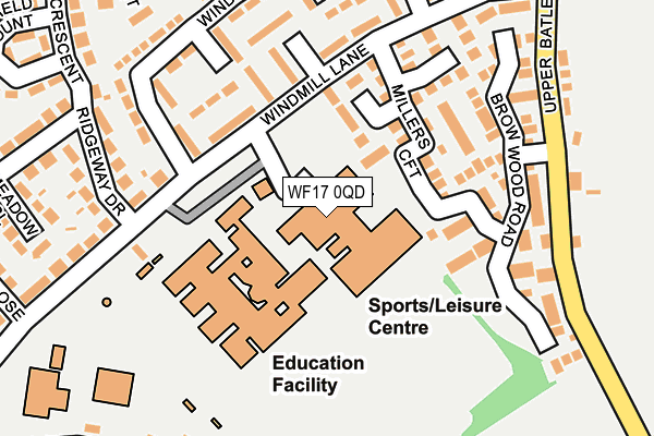
WF17 0QD is located in the Birstall and Birkenshaw electoral ward, within the metropolitan district of Kirklees and the English Parliamentary constituency of Batley and Spen. The Sub Integrated Care Board (ICB) Location is NHS West Yorkshire ICB - X2C4Y and the police force is West Yorkshire. This postcode has been in use since May 1994.


GetTheData
Source: OS OpenMap – Local (Ordnance Survey)
Source: OS VectorMap District (Ordnance Survey)
Licence: Open Government Licence (requires attribution)
| Easting | 423584 |
| Northing | 426296 |
| Latitude | 53.732528 |
| Longitude | -1.643987 |
GetTheData
Source: Open Postcode Geo
Licence: Open Government Licence
| Country | England |
| Postcode District | WF17 |
➜ See where WF17 is on a map ➜ Where is Batley? | |
GetTheData
Source: Land Registry Price Paid Data
Licence: Open Government Licence
Elevation or altitude of WF17 0QD as distance above sea level:
| Metres | Feet | |
|---|---|---|
| Elevation | 140m | 459ft |
Elevation is measured from the approximate centre of the postcode, to the nearest point on an OS contour line from OS Terrain 50, which has contour spacing of ten vertical metres.
➜ How high above sea level am I? Find the elevation of your current position using your device's GPS.
GetTheData
Source: Open Postcode Elevation
Licence: Open Government Licence
| Ward | Birstall And Birkenshaw |
| Constituency | Batley And Spen |
GetTheData
Source: ONS Postcode Database
Licence: Open Government Licence
| High School Windmill Lane (School/Sports Centre Approach) | Howden Clough | 103m |
| High School Windmill Lane (Howden Clough School/Sports Centre) | Howden Clough | 119m |
| Sports Centre Approach Windmill Lane (Howden Clough High School/Sports Centre Approach) | Howden Clough | 138m |
| Windsor Rd Windmill Lane (Windsor Road) | Howden Clough | 159m |
| Windsor Rd Windmill Lane (Windsor Road) | Howden Clough | 174m |
| Batley Station | 2.9km |
| Morley Station | 4km |
| Dewsbury Station | 4.6km |
GetTheData
Source: NaPTAN
Licence: Open Government Licence
GetTheData
Source: ONS Postcode Database
Licence: Open Government Licence


➜ Get more ratings from the Food Standards Agency
GetTheData
Source: Food Standards Agency
Licence: FSA terms & conditions
| Last Collection | |||
|---|---|---|---|
| Location | Mon-Fri | Sat | Distance |
| By Shops In Dudley Ave | 17:15 | 10:45 | 298m |
| Leeds Road Birstall | 17:15 | 10:45 | 417m |
| Woodlands Road / Swallow Hill | 16:00 | 11:00 | 485m |
GetTheData
Source: Dracos
Licence: Creative Commons Attribution-ShareAlike
The below table lists the International Territorial Level (ITL) codes (formerly Nomenclature of Territorial Units for Statistics (NUTS) codes) and Local Administrative Units (LAU) codes for WF17 0QD:
| ITL 1 Code | Name |
|---|---|
| TLE | Yorkshire and The Humber |
| ITL 2 Code | Name |
| TLE4 | West Yorkshire |
| ITL 3 Code | Name |
| TLE44 | Calderdale and Kirklees |
| LAU 1 Code | Name |
| E08000034 | Kirklees |
GetTheData
Source: ONS Postcode Directory
Licence: Open Government Licence
The below table lists the Census Output Area (OA), Lower Layer Super Output Area (LSOA), and Middle Layer Super Output Area (MSOA) for WF17 0QD:
| Code | Name | |
|---|---|---|
| OA | E00055721 | |
| LSOA | E01011052 | Kirklees 002D |
| MSOA | E02002272 | Kirklees 002 |
GetTheData
Source: ONS Postcode Directory
Licence: Open Government Licence
| WF17 0RN | Millers Croft | 89m |
| WF17 0RP | Leveret Way | 128m |
| WF17 0JU | Windmill Lane | 131m |
| WF17 0JP | Arundel Walk | 159m |
| WF17 0RL | Millers Croft | 163m |
| WF17 0RH | Brow Wood Road | 169m |
| WF17 0NT | Windmill Lane | 181m |
| WF17 0JT | Caernarvon Close | 184m |
| WF17 0JX | Windsor Road | 201m |
| WF17 0RJ | Brow Wood Road | 202m |
GetTheData
Source: Open Postcode Geo; Land Registry Price Paid Data
Licence: Open Government Licence