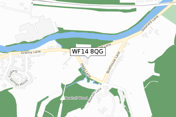
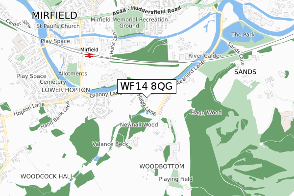
WF14 8QG is located in the Mirfield electoral ward, within the metropolitan district of Kirklees and the English Parliamentary constituency of Dewsbury. The Sub Integrated Care Board (ICB) Location is NHS West Yorkshire ICB - X2C4Y and the police force is West Yorkshire. This postcode has been in use since April 2018.


GetTheData
Source: OS Open Zoomstack (Ordnance Survey)
Licence: Open Government Licence (requires attribution)
Attribution: Contains OS data © Crown copyright and database right 2024
Source: Open Postcode Geo
Licence: Open Government Licence (requires attribution)
Attribution: Contains OS data © Crown copyright and database right 2024; Contains Royal Mail data © Royal Mail copyright and database right 2024; Source: Office for National Statistics licensed under the Open Government Licence v.3.0
| Easting | 420964 |
| Northing | 419093 |
| Latitude | 53.667914 |
| Longitude | -1.684189 |
GetTheData
Source: Open Postcode Geo
Licence: Open Government Licence
| Country | England |
| Postcode District | WF14 |
➜ See where WF14 is on a map ➜ Where is Mirfield? | |
GetTheData
Source: Land Registry Price Paid Data
Licence: Open Government Licence
| Ward | Mirfield |
| Constituency | Dewsbury |
GetTheData
Source: ONS Postcode Database
Licence: Open Government Licence
5, HAGG LANE, MIRFIELD, WF14 8QG 2018 14 SEP £666,667 |
7, HAGG LANE, MIRFIELD, WF14 8QG 2018 14 JUN £666,667 |
GetTheData
Source: HM Land Registry Price Paid Data
Licence: Contains HM Land Registry data © Crown copyright and database right 2024. This data is licensed under the Open Government Licence v3.0.
| Calder Road Granny Ln (Calder Road) | Lower Hopton | 656m |
| Calder Road Granny Ln (Calder Road) | Lower Hopton | 661m |
| Huddersfield Rd Parkfield Crescent (Huddersfield Road) | Mirfield | 741m |
| Huddersfield Rd Parkfield Crescent (Huddersfield Road) | Mirfield | 755m |
| Huddersfield Rd Parker Lane (Huddersfield Road) | Mirfield | 767m |
| Mirfield Station | 0.7km |
| Ravensthorpe Station | 2.1km |
| Dewsbury Station | 4.3km |
GetTheData
Source: NaPTAN
Licence: Open Government Licence
| Percentage of properties with Next Generation Access | 100.0% |
| Percentage of properties with Superfast Broadband | 100.0% |
| Percentage of properties with Ultrafast Broadband | 100.0% |
| Percentage of properties with Full Fibre Broadband | 0.0% |
Superfast Broadband is between 30Mbps and 300Mbps
Ultrafast Broadband is > 300Mbps
| Percentage of properties unable to receive 2Mbps | 0.0% |
| Percentage of properties unable to receive 5Mbps | 0.0% |
| Percentage of properties unable to receive 10Mbps | 0.0% |
| Percentage of properties unable to receive 30Mbps | 0.0% |
GetTheData
Source: Ofcom
Licence: Ofcom Terms of Use (requires attribution)
GetTheData
Source: ONS Postcode Database
Licence: Open Government Licence


➜ Get more ratings from the Food Standards Agency
GetTheData
Source: Food Standards Agency
Licence: FSA terms & conditions
| Last Collection | |||
|---|---|---|---|
| Location | Mon-Fri | Sat | Distance |
| Hagg Lane/Boathouse Lane | 17:00 | 10:30 | 164m |
| Granny Lane/Hopton New Lane | 17:00 | 10:30 | 580m |
| Parkfield | 17:45 | 12:15 | 717m |
GetTheData
Source: Dracos
Licence: Creative Commons Attribution-ShareAlike
The below table lists the International Territorial Level (ITL) codes (formerly Nomenclature of Territorial Units for Statistics (NUTS) codes) and Local Administrative Units (LAU) codes for WF14 8QG:
| ITL 1 Code | Name |
|---|---|
| TLE | Yorkshire and The Humber |
| ITL 2 Code | Name |
| TLE4 | West Yorkshire |
| ITL 3 Code | Name |
| TLE44 | Calderdale and Kirklees |
| LAU 1 Code | Name |
| E08000034 | Kirklees |
GetTheData
Source: ONS Postcode Directory
Licence: Open Government Licence
The below table lists the Census Output Area (OA), Lower Layer Super Output Area (LSOA), and Middle Layer Super Output Area (MSOA) for WF14 8QG:
| Code | Name | |
|---|---|---|
| OA | E00175529 | |
| LSOA | E01011215 | Kirklees 026D |
| MSOA | E02002296 | Kirklees 026 |
GetTheData
Source: ONS Postcode Directory
Licence: Open Government Licence
| WF14 8HA | Steanard Lane | 53m |
| WF14 8HQ | Boathouse Lane | 163m |
| WF14 8LD | Granny Lane | 243m |
| WF14 8HF | Woodbottom | 311m |
| WF14 8LQ | Gregory Springs Road | 368m |
| WF14 8LG | Gregory Springs Mount | 397m |
| WF14 8LE | Gregory Springs Lane | 485m |
| WF14 8LA | Granny Lane | 538m |
| WF14 8HE | Woodbottom | 551m |
| WF14 8LB | Four Acres | 586m |
GetTheData
Source: Open Postcode Geo; Land Registry Price Paid Data
Licence: Open Government Licence