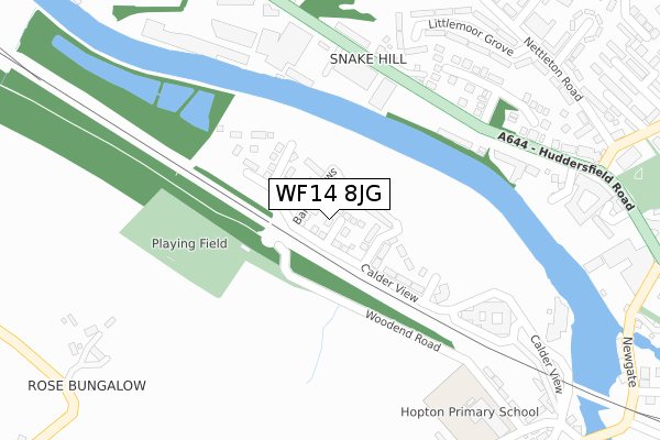
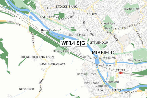
WF14 8JG is located in the Mirfield electoral ward, within the metropolitan district of Kirklees and the English Parliamentary constituency of Dewsbury. The Sub Integrated Care Board (ICB) Location is NHS West Yorkshire ICB - X2C4Y and the police force is West Yorkshire. This postcode has been in use since June 2018.


GetTheData
Source: OS Open Zoomstack (Ordnance Survey)
Licence: Open Government Licence (requires attribution)
Attribution: Contains OS data © Crown copyright and database right 2024
Source: Open Postcode Geo
Licence: Open Government Licence (requires attribution)
Attribution: Contains OS data © Crown copyright and database right 2024; Contains Royal Mail data © Royal Mail copyright and database right 2024; Source: Office for National Statistics licensed under the Open Government Licence v.3.0
| Easting | 419584 |
| Northing | 419891 |
| Latitude | 53.675140 |
| Longitude | -1.705024 |
GetTheData
Source: Open Postcode Geo
Licence: Open Government Licence
| Country | England |
| Postcode District | WF14 |
➜ See where WF14 is on a map ➜ Where is Mirfield? | |
GetTheData
Source: Land Registry Price Paid Data
Licence: Open Government Licence
| Ward | Mirfield |
| Constituency | Dewsbury |
GetTheData
Source: ONS Postcode Database
Licence: Open Government Licence
45, CALDER CLOSE, MIRFIELD, WF14 8JG 2021 26 AUG £187,995 |
15, CALDER CLOSE, MIRFIELD, WF14 8JG 2021 26 FEB £145,995 |
60, CALDER CLOSE, MIRFIELD, WF14 8JG 2020 23 DEC £169,995 |
62, CALDER CLOSE, MIRFIELD, WF14 8JG 2020 30 NOV £200,995 |
64, CALDER CLOSE, MIRFIELD, WF14 8JG 2020 30 OCT £203,995 |
58, CALDER CLOSE, MIRFIELD, WF14 8JG 2020 11 SEP £163,995 |
54, CALDER CLOSE, MIRFIELD, WF14 8JG 2020 24 JUL £175,995 |
50, CALDER CLOSE, MIRFIELD, WF14 8JG 2019 6 SEP £158,995 |
20, CALDER CLOSE, MIRFIELD, WF14 8JG 2019 30 MAY £149,995 |
26, CALDER CLOSE, MIRFIELD, WF14 8JG 2019 29 MAR £149,995 |
GetTheData
Source: HM Land Registry Price Paid Data
Licence: Contains HM Land Registry data © Crown copyright and database right 2024. This data is licensed under the Open Government Licence v3.0.
| Huddersfield Rd Wilson Terrace (Huddersfield Road) | Mirfield | 253m |
| Huddersfield Rd Wilson Terrace (Huddersfield Road) | Mirfield | 265m |
| Huddersfield Road Ebor Gdns (Huddersfield Road) | Mirfield | 331m |
| Huddersfield Rd Stocks Bank Road (Huddersfield Road) | Mirfield | 431m |
| Nettleton Road Littlemoor Grove (Nettleton Road) | Mirfield | 448m |
| Mirfield Station | 0.9km |
| Deighton Station | 3.2km |
| Ravensthorpe Station | 3.3km |
GetTheData
Source: NaPTAN
Licence: Open Government Licence
| Percentage of properties with Next Generation Access | 100.0% |
| Percentage of properties with Superfast Broadband | 100.0% |
| Percentage of properties with Ultrafast Broadband | 100.0% |
| Percentage of properties with Full Fibre Broadband | 100.0% |
Superfast Broadband is between 30Mbps and 300Mbps
Ultrafast Broadband is > 300Mbps
| Percentage of properties unable to receive 2Mbps | 0.0% |
| Percentage of properties unable to receive 5Mbps | 0.0% |
| Percentage of properties unable to receive 10Mbps | 0.0% |
| Percentage of properties unable to receive 30Mbps | 0.0% |
GetTheData
Source: Ofcom
Licence: Ofcom Terms of Use (requires attribution)
GetTheData
Source: ONS Postcode Database
Licence: Open Government Licence


➜ Get more ratings from the Food Standards Agency
GetTheData
Source: Food Standards Agency
Licence: FSA terms & conditions
| Last Collection | |||
|---|---|---|---|
| Location | Mon-Fri | Sat | Distance |
| Ings Grove | 17:45 | 11:00 | 548m |
| By Fish Shop Calder Road | 17:15 | 10:30 | 621m |
| Botthill | 17:45 | 12:15 | 652m |
GetTheData
Source: Dracos
Licence: Creative Commons Attribution-ShareAlike
The below table lists the International Territorial Level (ITL) codes (formerly Nomenclature of Territorial Units for Statistics (NUTS) codes) and Local Administrative Units (LAU) codes for WF14 8JG:
| ITL 1 Code | Name |
|---|---|
| TLE | Yorkshire and The Humber |
| ITL 2 Code | Name |
| TLE4 | West Yorkshire |
| ITL 3 Code | Name |
| TLE44 | Calderdale and Kirklees |
| LAU 1 Code | Name |
| E08000034 | Kirklees |
GetTheData
Source: ONS Postcode Directory
Licence: Open Government Licence
The below table lists the Census Output Area (OA), Lower Layer Super Output Area (LSOA), and Middle Layer Super Output Area (MSOA) for WF14 8JG:
| Code | Name | |
|---|---|---|
| OA | E00175533 | |
| LSOA | E01011215 | Kirklees 026D |
| MSOA | E02002296 | Kirklees 026 |
GetTheData
Source: ONS Postcode Directory
Licence: Open Government Licence
| WF14 8JJ | Banks Mews | 83m |
| WF14 8JF | Calder View | 166m |
| WF14 9DA | Huddersfield Road | 232m |
| WF14 8JD | Calder View | 259m |
| WF14 9PY | Huddersfield Road | 274m |
| HD5 0PY | Boyfe Hall | 355m |
| WF14 9PU | The Maltings | 359m |
| WF14 9AS | Wilson Road | 362m |
| WF14 9AR | Wilson Terrace | 380m |
| WF14 9BU | Ebor Gardens | 395m |
GetTheData
Source: Open Postcode Geo; Land Registry Price Paid Data
Licence: Open Government Licence