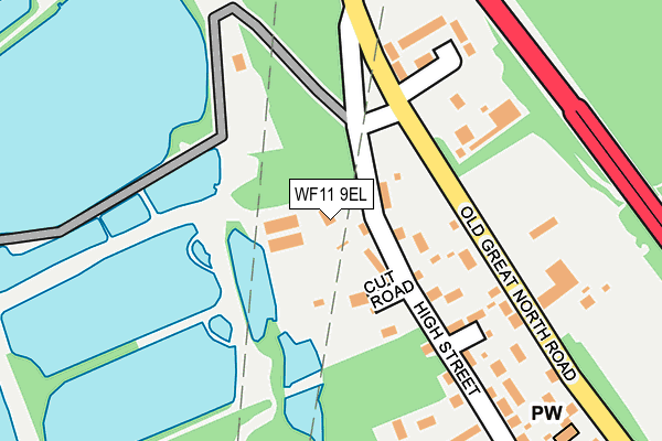
WF11 9EL is located in the Monk Fryston & South Milford electoral ward, within the unitary authority of North Yorkshire and the English Parliamentary constituency of Selby and Ainsty. The Sub Integrated Care Board (ICB) Location is NHS Humber and North Yorkshire ICB - 03Q and the police force is North Yorkshire. This postcode has been in use since April 1985.


GetTheData
Source: OS OpenMap – Local (Ordnance Survey)
Source: OS VectorMap District (Ordnance Survey)
Licence: Open Government Licence (requires attribution)
| Easting | 448004 |
| Northing | 426162 |
| Latitude | 53.729654 |
| Longitude | -1.273869 |
GetTheData
Source: Open Postcode Geo
Licence: Open Government Licence
| Country | England |
| Postcode District | WF11 |
➜ See where WF11 is on a map ➜ Where is Brotherton? | |
GetTheData
Source: Land Registry Price Paid Data
Licence: Open Government Licence
Elevation or altitude of WF11 9EL as distance above sea level:
| Metres | Feet | |
|---|---|---|
| Elevation | 20m | 66ft |
Elevation is measured from the approximate centre of the postcode, to the nearest point on an OS contour line from OS Terrain 50, which has contour spacing of ten vertical metres.
➜ How high above sea level am I? Find the elevation of your current position using your device's GPS.
GetTheData
Source: Open Postcode Elevation
Licence: Open Government Licence
| Ward | Monk Fryston & South Milford |
| Constituency | Selby And Ainsty |
GetTheData
Source: ONS Postcode Database
Licence: Open Government Licence
| The Bungalow (High Street) | Brotherton | 98m |
| Belmont (Old Great North Road) | Brotherton | 105m |
| Quarry (High Street) | Brotherton | 112m |
| Dobson's Yard (High Street) | Brotherton | 120m |
| Belmont (Old Great North Road) | Brotherton | 136m |
| Knottingley Station | 2.7km |
| Pontefract Monkhill Station | 3.9km |
| Pontefract Baghill Station | 4.6km |
GetTheData
Source: NaPTAN
Licence: Open Government Licence
GetTheData
Source: ONS Postcode Database
Licence: Open Government Licence


➜ Get more ratings from the Food Standards Agency
GetTheData
Source: Food Standards Agency
Licence: FSA terms & conditions
| Last Collection | |||
|---|---|---|---|
| Location | Mon-Fri | Sat | Distance |
| High Street / Church Street | 16:00 | 11:15 | 326m |
| Foxcliffe | 16:00 | 11:00 | 569m |
| The Punchbowl/Low Street | 16:15 | 11:15 | 706m |
GetTheData
Source: Dracos
Licence: Creative Commons Attribution-ShareAlike
The below table lists the International Territorial Level (ITL) codes (formerly Nomenclature of Territorial Units for Statistics (NUTS) codes) and Local Administrative Units (LAU) codes for WF11 9EL:
| ITL 1 Code | Name |
|---|---|
| TLE | Yorkshire and The Humber |
| ITL 2 Code | Name |
| TLE2 | North Yorkshire |
| ITL 3 Code | Name |
| TLE22 | North Yorkshire CC |
| LAU 1 Code | Name |
| E07000169 | Selby |
GetTheData
Source: ONS Postcode Directory
Licence: Open Government Licence
The below table lists the Census Output Area (OA), Lower Layer Super Output Area (LSOA), and Middle Layer Super Output Area (MSOA) for WF11 9EL:
| Code | Name | |
|---|---|---|
| OA | E00142094 | |
| LSOA | E01027892 | Selby 009B |
| MSOA | E02005817 | Selby 009 |
GetTheData
Source: ONS Postcode Directory
Licence: Open Government Licence
| WF11 9LH | Dale Stone Close | 150m |
| WF11 9EY | High Street | 176m |
| WF11 9EX | Belmont | 188m |
| WF11 9EP | North Road | 240m |
| WF11 9LQ | Norfolk Close | 241m |
| WF11 9EU | Gauk Street | 366m |
| WF11 9LG | Ramsden Close | 371m |
| WF11 9HE | Church Street | 373m |
| WF11 9HF | Hall Court | 395m |
| WF11 9GN | Vicars Mews | 403m |
GetTheData
Source: Open Postcode Geo; Land Registry Price Paid Data
Licence: Open Government Licence