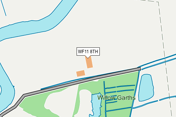
WF11 8TH is located in the Knottingley electoral ward, within the metropolitan district of Wakefield and the English Parliamentary constituency of Normanton, Pontefract and Castleford. The Sub Integrated Care Board (ICB) Location is NHS West Yorkshire ICB - 03R and the police force is West Yorkshire. This postcode has been in use since September 2010.


GetTheData
Source: OS OpenMap – Local (Ordnance Survey)
Source: OS VectorMap District (Ordnance Survey)
Licence: Open Government Licence (requires attribution)
| Easting | 451598 |
| Northing | 424203 |
| Latitude | 53.711705 |
| Longitude | -1.219725 |
GetTheData
Source: Open Postcode Geo
Licence: Open Government Licence
| Country | England |
| Postcode District | WF11 |
➜ See where WF11 is on a map ➜ Where is Knottingley? | |
GetTheData
Source: Land Registry Price Paid Data
Licence: Open Government Licence
Elevation or altitude of WF11 8TH as distance above sea level:
| Metres | Feet | |
|---|---|---|
| Elevation | 10m | 33ft |
Elevation is measured from the approximate centre of the postcode, to the nearest point on an OS contour line from OS Terrain 50, which has contour spacing of ten vertical metres.
➜ How high above sea level am I? Find the elevation of your current position using your device's GPS.
GetTheData
Source: Open Postcode Elevation
Licence: Open Government Licence
| Ward | Knottingley |
| Constituency | Normanton, Pontefract And Castleford |
GetTheData
Source: ONS Postcode Database
Licence: Open Government Licence
| Weeland Rd Southmoor Lane (Weeland Road) | Knottingley | 507m |
| Weeland Rd Southmoor Lane (Weeland Road) | Knottingley | 507m |
| Weeland Rd Chemical Works (Weeland Road) | Knottingley | 589m |
| Weeland Rd Chemical Works (Weeland Road) | Knottingley | 654m |
| Kellingley Colliery (Weeland Road) | Kellingley | 888m |
| Knottingley Station | 2.7km |
| Whitley Bridge Station | 4.3km |
GetTheData
Source: NaPTAN
Licence: Open Government Licence
| Percentage of properties with Next Generation Access | 100.0% |
| Percentage of properties with Superfast Broadband | 50.0% |
| Percentage of properties with Ultrafast Broadband | 0.0% |
| Percentage of properties with Full Fibre Broadband | 0.0% |
Superfast Broadband is between 30Mbps and 300Mbps
Ultrafast Broadband is > 300Mbps
| Percentage of properties unable to receive 2Mbps | 0.0% |
| Percentage of properties unable to receive 5Mbps | 50.0% |
| Percentage of properties unable to receive 10Mbps | 50.0% |
| Percentage of properties unable to receive 30Mbps | 50.0% |
GetTheData
Source: Ofcom
Licence: Ofcom Terms of Use (requires attribution)
GetTheData
Source: ONS Postcode Database
Licence: Open Government Licence


➜ Get more ratings from the Food Standards Agency
GetTheData
Source: Food Standards Agency
Licence: FSA terms & conditions
| Last Collection | |||
|---|---|---|---|
| Location | Mon-Fri | Sat | Distance |
| The Colliery | 17:00 | 11:30 | 1,030m |
| By Cherry Tree/Marsh End | 17:45 | 10:45 | 1,104m |
| Broomhill Avenue / Place | 16:45 | 10:30 | 1,272m |
GetTheData
Source: Dracos
Licence: Creative Commons Attribution-ShareAlike
| Risk of WF11 8TH flooding from rivers and sea | High |
| ➜ WF11 8TH flood map | |
GetTheData
Source: Open Flood Risk by Postcode
Licence: Open Government Licence
The below table lists the International Territorial Level (ITL) codes (formerly Nomenclature of Territorial Units for Statistics (NUTS) codes) and Local Administrative Units (LAU) codes for WF11 8TH:
| ITL 1 Code | Name |
|---|---|
| TLE | Yorkshire and The Humber |
| ITL 2 Code | Name |
| TLE4 | West Yorkshire |
| ITL 3 Code | Name |
| TLE45 | Wakefield |
| LAU 1 Code | Name |
| E08000036 | Wakefield |
GetTheData
Source: ONS Postcode Directory
Licence: Open Government Licence
The below table lists the Census Output Area (OA), Lower Layer Super Output Area (LSOA), and Middle Layer Super Output Area (MSOA) for WF11 8TH:
| Code | Name | |
|---|---|---|
| OA | E00059528 | |
| LSOA | E01011810 | Wakefield 010D |
| MSOA | E02002447 | Wakefield 010 |
GetTheData
Source: ONS Postcode Directory
Licence: Open Government Licence
| WF11 8DA | Weeland Road | 594m |
| WF11 8DL | Kellingley Road | 817m |
| WF11 8DN | Weeland Road | 843m |
| WF11 9DQ | West Ings Mews | 871m |
| WF11 9ER | Marsh Lane | 895m |
| WF11 9DR | West Ings Crescent | 908m |
| WF11 9DE | Marsh Lane | 924m |
| WF11 9AR | West Ings Way | 927m |
| WF11 8DE | Fernley Green Court | 928m |
| WF11 8DS | Glebelands | 933m |
GetTheData
Source: Open Postcode Geo; Land Registry Price Paid Data
Licence: Open Government Licence