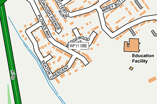
WF11 0BE is located in the Pontefract North electoral ward, within the metropolitan district of Wakefield and the English Parliamentary constituency of Normanton, Pontefract and Castleford. The Sub Integrated Care Board (ICB) Location is NHS West Yorkshire ICB - 03R and the police force is West Yorkshire. This postcode has been in use since July 2017.


GetTheData
Source: OS OpenMap – Local (Ordnance Survey)
Source: OS VectorMap District (Ordnance Survey)
Licence: Open Government Licence (requires attribution)
| Easting | 448178 |
| Northing | 422163 |
| Latitude | 53.693715 |
| Longitude | -1.271854 |
GetTheData
Source: Open Postcode Geo
Licence: Open Government Licence
| Country | England |
| Postcode District | WF11 |
➜ See where WF11 is on a map | |
GetTheData
Source: Land Registry Price Paid Data
Licence: Open Government Licence
| Ward | Pontefract North |
| Constituency | Normanton, Pontefract And Castleford |
GetTheData
Source: ONS Postcode Database
Licence: Open Government Licence
| Ferrybridge Service Station (Ferrybridge Power Station - Stranglands Lane) | Knottingley | 629m |
| Knottingley Rd Shillinghill Lane (Knottingley Road) | Ferrybridge | 902m |
| Knottingley Rd Shillinghill Lane (Knottingley Road) | Ferrybridge | 906m |
| Knottingley Rd Lower Taythes Lane (Knottingley Road) | Ferrybridge | 973m |
| Knottingley Rd Lower Taythes Lane (Knottingley Road) | Ferrybridge | 973m |
| Knottingley Station | 1.7km |
| Pontefract Baghill Station | 2.1km |
| Pontefract Monkhill Station | 2.2km |
GetTheData
Source: NaPTAN
Licence: Open Government Licence
GetTheData
Source: ONS Postcode Database
Licence: Open Government Licence


➜ Get more ratings from the Food Standards Agency
GetTheData
Source: Food Standards Agency
Licence: FSA terms & conditions
| Last Collection | |||
|---|---|---|---|
| Location | Mon-Fri | Sat | Distance |
| Ingram Cres / Cotterill Road | 18:00 | 10:30 | 1,147m |
| Eastbourne Vw/Eastbourne Ter | 17:30 | 11:15 | 1,155m |
| Pinewood Place P.o. | 18:00 | 12:00 | 1,264m |
GetTheData
Source: Dracos
Licence: Creative Commons Attribution-ShareAlike
The below table lists the International Territorial Level (ITL) codes (formerly Nomenclature of Territorial Units for Statistics (NUTS) codes) and Local Administrative Units (LAU) codes for WF11 0BE:
| ITL 1 Code | Name |
|---|---|
| TLE | Yorkshire and The Humber |
| ITL 2 Code | Name |
| TLE4 | West Yorkshire |
| ITL 3 Code | Name |
| TLE45 | Wakefield |
| LAU 1 Code | Name |
| E08000036 | Wakefield |
GetTheData
Source: ONS Postcode Directory
Licence: Open Government Licence
The below table lists the Census Output Area (OA), Lower Layer Super Output Area (LSOA), and Middle Layer Super Output Area (MSOA) for WF11 0BE:
| Code | Name | |
|---|---|---|
| OA | E00059539 | |
| LSOA | E01011803 | Wakefield 011A |
| MSOA | E02002448 | Wakefield 011 |
GetTheData
Source: ONS Postcode Directory
Licence: Open Government Licence
| WF11 0AB | Great North Road | 317m |
| WF11 0AD | Great North Road | 703m |
| WF11 0AA | Cattlelaith Lane | 724m |
| WF11 0HU | Seaton Crescent | 929m |
| WF8 2LB | Knottingley Road | 959m |
| WF11 0HT | Plowes Way | 961m |
| WF8 2TH | Knottingley Road | 983m |
| WF11 0BD | Plowes Way | 986m |
| WF11 0BP | Knottingley Road | 1002m |
| WF11 0NT | Ennerdale Drive | 1013m |
GetTheData
Source: Open Postcode Geo; Land Registry Price Paid Data
Licence: Open Government Licence