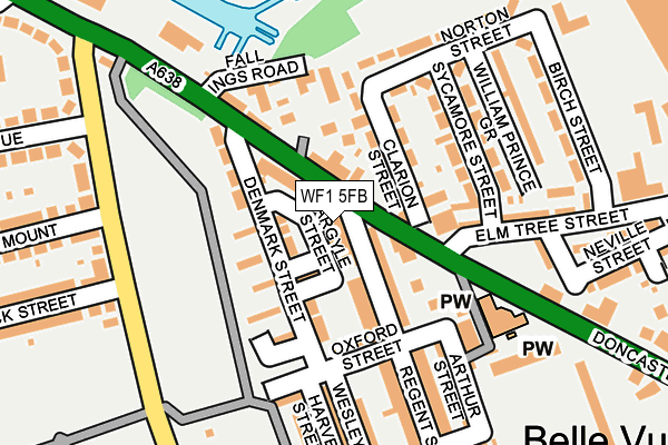
WF1 5FB is located in the Wakefield South electoral ward, within the metropolitan district of Wakefield and the English Parliamentary constituency of Hemsworth. The Sub Integrated Care Board (ICB) Location is NHS West Yorkshire ICB - 03R and the police force is West Yorkshire. This postcode has been in use since July 2017.


GetTheData
Source: OS OpenMap – Local (Ordnance Survey)
Source: OS VectorMap District (Ordnance Survey)
Licence: Open Government Licence (requires attribution)
| Easting | 434293 |
| Northing | 419574 |
| Latitude | 53.671537 |
| Longitude | -1.482407 |
GetTheData
Source: Open Postcode Geo
Licence: Open Government Licence
| Country | England |
| Postcode District | WF1 |
➜ See where WF1 is on a map ➜ Where is Wakefield? | |
GetTheData
Source: Land Registry Price Paid Data
Licence: Open Government Licence
| Ward | Wakefield South |
| Constituency | Hemsworth |
GetTheData
Source: ONS Postcode Database
Licence: Open Government Licence
| Doncaster Road Elm Tree St (Doncaster Road) | Belle Vue | 155m |
| Doncaster Road Elm Tree St (Doncaster Road) | Belle Vue | 163m |
| Doncaster Road Sugar Ln (Doncaster Road) | Belle Vue | 199m |
| Doncaster Road Sugar Ln (Doncaster Road) | Belle Vue | 216m |
| Fall Ings Business Park (Doncaster Road) | Belle Isle | 396m |
| Wakefield Kirkgate Station | 0.9km |
| Sandal & Agbrigg Station | 0.9km |
| Wakefield Westgate Station | 2km |
GetTheData
Source: NaPTAN
Licence: Open Government Licence
| Percentage of properties with Next Generation Access | 100.0% |
| Percentage of properties with Superfast Broadband | 100.0% |
| Percentage of properties with Ultrafast Broadband | 0.0% |
| Percentage of properties with Full Fibre Broadband | 0.0% |
Superfast Broadband is between 30Mbps and 300Mbps
Ultrafast Broadband is > 300Mbps
| Percentage of properties unable to receive 2Mbps | 0.0% |
| Percentage of properties unable to receive 5Mbps | 0.0% |
| Percentage of properties unable to receive 10Mbps | 0.0% |
| Percentage of properties unable to receive 30Mbps | 0.0% |
GetTheData
Source: Ofcom
Licence: Ofcom Terms of Use (requires attribution)
GetTheData
Source: ONS Postcode Database
Licence: Open Government Licence


➜ Get more ratings from the Food Standards Agency
GetTheData
Source: Food Standards Agency
Licence: FSA terms & conditions
| Last Collection | |||
|---|---|---|---|
| Location | Mon-Fri | Sat | Distance |
| Belle Vue | 17:30 | 11:00 | 18m |
| Dunbar Street | 17:30 | 11:00 | 374m |
| Belle Isle | 17:45 | 12:00 | 436m |
GetTheData
Source: Dracos
Licence: Creative Commons Attribution-ShareAlike
The below table lists the International Territorial Level (ITL) codes (formerly Nomenclature of Territorial Units for Statistics (NUTS) codes) and Local Administrative Units (LAU) codes for WF1 5FB:
| ITL 1 Code | Name |
|---|---|
| TLE | Yorkshire and The Humber |
| ITL 2 Code | Name |
| TLE4 | West Yorkshire |
| ITL 3 Code | Name |
| TLE45 | Wakefield |
| LAU 1 Code | Name |
| E08000036 | Wakefield |
GetTheData
Source: ONS Postcode Directory
Licence: Open Government Licence
The below table lists the Census Output Area (OA), Lower Layer Super Output Area (LSOA), and Middle Layer Super Output Area (MSOA) for WF1 5FB:
| Code | Name | |
|---|---|---|
| OA | E00060048 | |
| LSOA | E01011917 | Wakefield 030D |
| MSOA | E02002467 | Wakefield 030 |
GetTheData
Source: ONS Postcode Directory
Licence: Open Government Licence
| WF1 5JF | Doncaster Road | 44m |
| WF1 5HN | Claremont Street | 48m |
| WF1 5DY | Doncaster Road | 53m |
| WF1 5HW | Regent Street | 59m |
| WF1 5JE | Denmark Street | 71m |
| WF1 5JD | Denmark Street | 80m |
| WF1 5EX | Clarion Street | 98m |
| WF1 5HZ | Oxford Street | 108m |
| WF1 5JB | Bevitt Street | 115m |
| WF1 5DX | Doncaster Road | 138m |
GetTheData
Source: Open Postcode Geo; Land Registry Price Paid Data
Licence: Open Government Licence