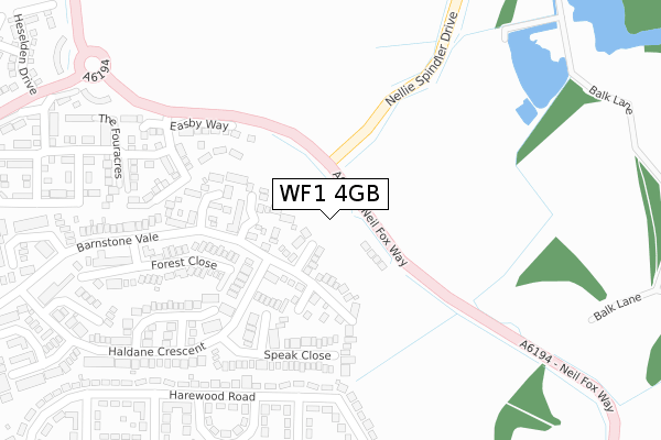
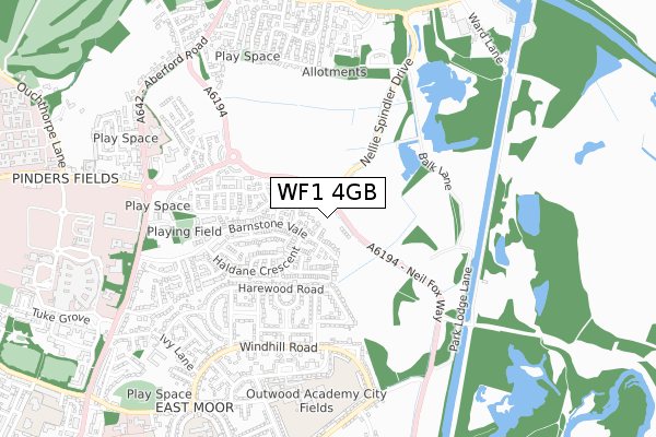
WF1 4GB is located in the Stanley and Outwood East electoral ward, within the metropolitan district of Wakefield and the English Parliamentary constituency of Morley and Outwood. The Sub Integrated Care Board (ICB) Location is NHS West Yorkshire ICB - 03R and the police force is West Yorkshire. This postcode has been in use since April 2019.


GetTheData
Source: OS Open Zoomstack (Ordnance Survey)
Licence: Open Government Licence (requires attribution)
Attribution: Contains OS data © Crown copyright and database right 2025
Source: Open Postcode Geo
Licence: Open Government Licence (requires attribution)
Attribution: Contains OS data © Crown copyright and database right 2025; Contains Royal Mail data © Royal Mail copyright and database right 2025; Source: Office for National Statistics licensed under the Open Government Licence v.3.0
| Easting | 434830 |
| Northing | 422148 |
| Latitude | 53.694636 |
| Longitude | -1.473992 |
GetTheData
Source: Open Postcode Geo
Licence: Open Government Licence
| Country | England |
| Postcode District | WF1 |
➜ See where WF1 is on a map ➜ Where is Wakefield? | |
GetTheData
Source: Land Registry Price Paid Data
Licence: Open Government Licence
| Ward | Stanley And Outwood East |
| Constituency | Morley And Outwood |
GetTheData
Source: ONS Postcode Database
Licence: Open Government Licence
16, SWITHENS CLOSE, WAKEFIELD, WF1 4GB 2021 22 OCT £234,450 |
14, SWITHENS CLOSE, WAKEFIELD, WF1 4GB 2021 15 OCT £232,950 |
12, SWITHENS CLOSE, WAKEFIELD, WF1 4GB 2021 24 SEP £363,950 |
10, SWITHENS CLOSE, WAKEFIELD, WF1 4GB 2021 6 AUG £304,950 |
8, SWITHENS CLOSE, WAKEFIELD, WF1 4GB 2021 6 AUG £364,950 |
6, SWITHENS CLOSE, WAKEFIELD, WF1 4GB 2021 29 JUN £339,950 |
2, SWITHENS CLOSE, WAKEFIELD, WF1 4GB 2021 28 JUN £399,950 |
4, SWITHENS CLOSE, WAKEFIELD, WF1 4GB 2021 28 JUN £339,950 |
9, SWITHENS CLOSE, WAKEFIELD, WF1 4GB 2021 19 MAR £365,000 |
105, SWITHENS CLOSE, WAKEFIELD, WF1 4GB 2021 19 MAR £394,950 |
GetTheData
Source: HM Land Registry Price Paid Data
Licence: Contains HM Land Registry data © Crown copyright and database right 2025. This data is licensed under the Open Government Licence v3.0.
| Harewood Road Garsdale Grove (Harewood Road) | East Moor | 281m |
| Harewood Rd Halton Road (Harewood Road) | East Moor | 353m |
| Gisburn Rd Dent Drive (Gisburn Road) | East Moor | 369m |
| Windhill Rd Arncliffe Road (Windhill Road) | East Moor | 490m |
| Windhill Rd Arncliffe Road (Windhill Road) | East Moor | 498m |
| Wakefield Kirkgate Station | 2km |
| Wakefield Westgate Station | 2.5km |
| Outwood Station | 3.3km |
GetTheData
Source: NaPTAN
Licence: Open Government Licence
| Percentage of properties with Next Generation Access | 100.0% |
| Percentage of properties with Superfast Broadband | 100.0% |
| Percentage of properties with Ultrafast Broadband | 0.0% |
| Percentage of properties with Full Fibre Broadband | 0.0% |
Superfast Broadband is between 30Mbps and 300Mbps
Ultrafast Broadband is > 300Mbps
| Percentage of properties unable to receive 2Mbps | 0.0% |
| Percentage of properties unable to receive 5Mbps | 0.0% |
| Percentage of properties unable to receive 10Mbps | 0.0% |
| Percentage of properties unable to receive 30Mbps | 0.0% |
GetTheData
Source: Ofcom
Licence: Ofcom Terms of Use (requires attribution)
GetTheData
Source: ONS Postcode Database
Licence: Open Government Licence


➜ Get more ratings from the Food Standards Agency
GetTheData
Source: Food Standards Agency
Licence: FSA terms & conditions
| Last Collection | |||
|---|---|---|---|
| Location | Mon-Fri | Sat | Distance |
| Pinders Heath | 17:30 | 11:45 | 310m |
| Windhill Road P.o. | 18:00 | 12:15 | 534m |
| Stanley Road | 17:45 | 11:45 | 691m |
GetTheData
Source: Dracos
Licence: Creative Commons Attribution-ShareAlike
The below table lists the International Territorial Level (ITL) codes (formerly Nomenclature of Territorial Units for Statistics (NUTS) codes) and Local Administrative Units (LAU) codes for WF1 4GB:
| ITL 1 Code | Name |
|---|---|
| TLE | Yorkshire and The Humber |
| ITL 2 Code | Name |
| TLE4 | West Yorkshire |
| ITL 3 Code | Name |
| TLE45 | Wakefield |
| LAU 1 Code | Name |
| E08000036 | Wakefield |
GetTheData
Source: ONS Postcode Directory
Licence: Open Government Licence
The below table lists the Census Output Area (OA), Lower Layer Super Output Area (LSOA), and Middle Layer Super Output Area (MSOA) for WF1 4GB:
| Code | Name | |
|---|---|---|
| OA | E00059904 | |
| LSOA | E01011876 | Wakefield 007B |
| MSOA | E02002444 | Wakefield 007 |
GetTheData
Source: ONS Postcode Directory
Licence: Open Government Licence
| WF1 4TW | Barnstone Vale | 88m |
| WF1 4TR | Glastonbury Avenue | 107m |
| WF1 4TP | Barnstone Vale | 127m |
| WF1 4TG | Speak Close | 200m |
| WF1 4TQ | Fountains Way | 203m |
| WF1 4TL | Forest Close | 246m |
| WF1 4JQ | Dent Drive | 254m |
| WF1 4TF | Birchtree Close | 290m |
| WF1 4BW | Harewood Road | 291m |
| WF1 4TJ | Barnstone Vale | 319m |
GetTheData
Source: Open Postcode Geo; Land Registry Price Paid Data
Licence: Open Government Licence