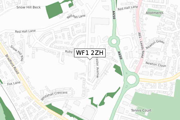
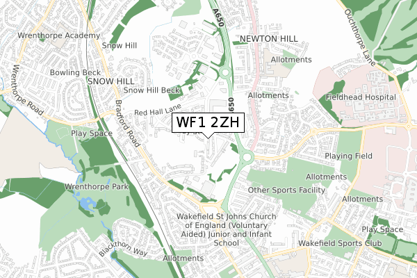
WF1 2ZH is located in the Wakefield North electoral ward, within the metropolitan district of Wakefield and the English Parliamentary constituency of Wakefield. The Sub Integrated Care Board (ICB) Location is NHS West Yorkshire ICB - 03R and the police force is West Yorkshire. This postcode has been in use since February 2018.


GetTheData
Source: OS Open Zoomstack (Ordnance Survey)
Licence: Open Government Licence (requires attribution)
Attribution: Contains OS data © Crown copyright and database right 2025
Source: Open Postcode Geo
Licence: Open Government Licence (requires attribution)
Attribution: Contains OS data © Crown copyright and database right 2025; Contains Royal Mail data © Royal Mail copyright and database right 2025; Source: Office for National Statistics licensed under the Open Government Licence v.3.0
| Easting | 432614 |
| Northing | 422233 |
| Latitude | 53.695543 |
| Longitude | -1.507542 |
GetTheData
Source: Open Postcode Geo
Licence: Open Government Licence
| Country | England |
| Postcode District | WF1 |
➜ See where WF1 is on a map ➜ Where is Wakefield? | |
GetTheData
Source: Land Registry Price Paid Data
Licence: Open Government Licence
| Ward | Wakefield North |
| Constituency | Wakefield |
GetTheData
Source: ONS Postcode Database
Licence: Open Government Licence
16, MILTHORP CARR ROAD, WAKEFIELD, WF1 2ZH 2019 28 JUN £343,000 |
3, MILTHORP CARR ROAD, WAKEFIELD, WF1 2ZH 2019 28 JUN £335,000 |
12, MILTHORP CARR ROAD, WAKEFIELD, WF1 2ZH 2019 27 JUN £296,400 |
14, MILTHORP CARR ROAD, WAKEFIELD, WF1 2ZH 2019 27 JUN £296,400 |
8, MILTHORP CARR ROAD, WAKEFIELD, WF1 2ZH 2019 18 APR £345,000 |
10, MILTHORP CARR ROAD, WAKEFIELD, WF1 2ZH 2018 7 DEC £343,000 |
6, MILTHORP CARR ROAD, WAKEFIELD, WF1 2ZH 2018 24 SEP £340,000 |
4, MILTHORP CARR ROAD, WAKEFIELD, WF1 2ZH 2018 29 JUN £295,000 |
GetTheData
Source: HM Land Registry Price Paid Data
Licence: Contains HM Land Registry data © Crown copyright and database right 2025. This data is licensed under the Open Government Licence v3.0.
| Leeds Rd Newton Close (Leeds Road) | Newton Hill | 286m |
| Leeds Rd Newton Close (Leeds Road) | Newton Hill | 301m |
| Leeds Road Newton Bar (Leeds Road) | Newton Bar | 338m |
| Bradford Rd Whitehall Crescent (Bradford Road) | Newton Bar | 361m |
| Leeds Road Newton Hill (Leeds Road) | Newton Hill | 371m |
| Wakefield Westgate Station | 1.4km |
| Outwood Station | 2.2km |
| Wakefield Kirkgate Station | 2.3km |
GetTheData
Source: NaPTAN
Licence: Open Government Licence
| Percentage of properties with Next Generation Access | 100.0% |
| Percentage of properties with Superfast Broadband | 100.0% |
| Percentage of properties with Ultrafast Broadband | 81.8% |
| Percentage of properties with Full Fibre Broadband | 81.8% |
Superfast Broadband is between 30Mbps and 300Mbps
Ultrafast Broadband is > 300Mbps
| Percentage of properties unable to receive 2Mbps | 0.0% |
| Percentage of properties unable to receive 5Mbps | 0.0% |
| Percentage of properties unable to receive 10Mbps | 0.0% |
| Percentage of properties unable to receive 30Mbps | 0.0% |
GetTheData
Source: Ofcom
Licence: Ofcom Terms of Use (requires attribution)
GetTheData
Source: ONS Postcode Database
Licence: Open Government Licence


➜ Get more ratings from the Food Standards Agency
GetTheData
Source: Food Standards Agency
Licence: FSA terms & conditions
| Last Collection | |||
|---|---|---|---|
| Location | Mon-Fri | Sat | Distance |
| Leeds Road | 18:00 | 12:15 | 410m |
| Cypruss Street | 17:30 | 11:00 | 460m |
| Boundary Drive | 17:30 | 12:00 | 564m |
GetTheData
Source: Dracos
Licence: Creative Commons Attribution-ShareAlike
The below table lists the International Territorial Level (ITL) codes (formerly Nomenclature of Territorial Units for Statistics (NUTS) codes) and Local Administrative Units (LAU) codes for WF1 2ZH:
| ITL 1 Code | Name |
|---|---|
| TLE | Yorkshire and The Humber |
| ITL 2 Code | Name |
| TLE4 | West Yorkshire |
| ITL 3 Code | Name |
| TLE45 | Wakefield |
| LAU 1 Code | Name |
| E08000036 | Wakefield |
GetTheData
Source: ONS Postcode Directory
Licence: Open Government Licence
The below table lists the Census Output Area (OA), Lower Layer Super Output Area (LSOA), and Middle Layer Super Output Area (MSOA) for WF1 2ZH:
| Code | Name | |
|---|---|---|
| OA | E00059987 | |
| LSOA | E01011887 | Wakefield 008B |
| MSOA | E02002445 | Wakefield 008 |
GetTheData
Source: ONS Postcode Directory
Licence: Open Government Licence
| WF1 2AD | Bradford Road | 170m |
| WF1 2AF | Whitehall Crescent | 254m |
| WF1 2AG | Whitehall Avenue | 287m |
| WF1 2PS | Leeds Road | 288m |
| WF1 2QD | Leeds Road | 317m |
| WF1 2AQ | Whitehall Crescent | 326m |
| WF1 2AE | Bradford Road | 339m |
| WF1 2QA | Leeds Road | 355m |
| WF1 2AH | Bradford Road | 357m |
| WF1 2QG | Newton Close | 357m |
GetTheData
Source: Open Postcode Geo; Land Registry Price Paid Data
Licence: Open Government Licence