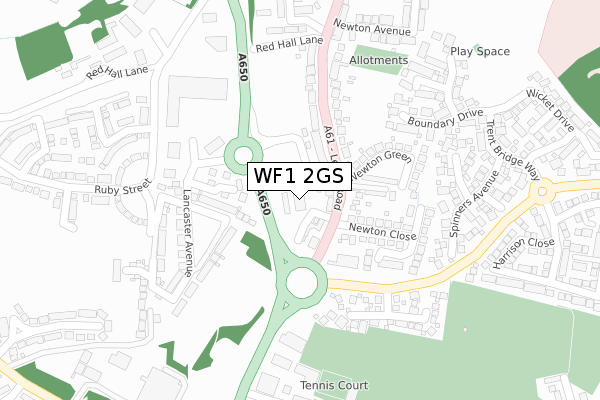
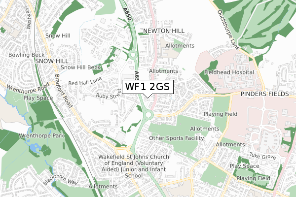
WF1 2GS is located in the Wrenthorpe and Outwood West electoral ward, within the metropolitan district of Wakefield and the English Parliamentary constituency of Morley and Outwood. The Sub Integrated Care Board (ICB) Location is NHS West Yorkshire ICB - 03R and the police force is West Yorkshire. This postcode has been in use since May 2019.


GetTheData
Source: OS Open Zoomstack (Ordnance Survey)
Licence: Open Government Licence (requires attribution)
Attribution: Contains OS data © Crown copyright and database right 2025
Source: Open Postcode Geo
Licence: Open Government Licence (requires attribution)
Attribution: Contains OS data © Crown copyright and database right 2025; Contains Royal Mail data © Royal Mail copyright and database right 2025; Source: Office for National Statistics licensed under the Open Government Licence v.3.0
| Easting | 432842 |
| Northing | 422262 |
| Latitude | 53.695789 |
| Longitude | -1.504086 |
GetTheData
Source: Open Postcode Geo
Licence: Open Government Licence
| Country | England |
| Postcode District | WF1 |
➜ See where WF1 is on a map ➜ Where is Wakefield? | |
GetTheData
Source: Land Registry Price Paid Data
Licence: Open Government Licence
| Ward | Wrenthorpe And Outwood West |
| Constituency | Morley And Outwood |
GetTheData
Source: ONS Postcode Database
Licence: Open Government Licence
| Leeds Rd Newton Close (Leeds Road) | Newton Hill | 58m |
| Leeds Rd Newton Close (Leeds Road) | Newton Hill | 75m |
| Leeds Road Newton Hill (Leeds Road) | Newton Hill | 228m |
| Leeds Rd Red Hall Lane (Leeds Road) | Newton Hill | 293m |
| Leeds Road Newton Bar (Leeds Road) | Newton Bar | 370m |
| Wakefield Westgate Station | 1.4km |
| Wakefield Kirkgate Station | 2.2km |
| Outwood Station | 2.2km |
GetTheData
Source: NaPTAN
Licence: Open Government Licence
GetTheData
Source: ONS Postcode Database
Licence: Open Government Licence


➜ Get more ratings from the Food Standards Agency
GetTheData
Source: Food Standards Agency
Licence: FSA terms & conditions
| Last Collection | |||
|---|---|---|---|
| Location | Mon-Fri | Sat | Distance |
| Leeds Road | 18:00 | 12:15 | 285m |
| Boundary Drive | 17:30 | 12:00 | 342m |
| Cypruss Street | 17:30 | 11:00 | 549m |
GetTheData
Source: Dracos
Licence: Creative Commons Attribution-ShareAlike
The below table lists the International Territorial Level (ITL) codes (formerly Nomenclature of Territorial Units for Statistics (NUTS) codes) and Local Administrative Units (LAU) codes for WF1 2GS:
| ITL 1 Code | Name |
|---|---|
| TLE | Yorkshire and The Humber |
| ITL 2 Code | Name |
| TLE4 | West Yorkshire |
| ITL 3 Code | Name |
| TLE45 | Wakefield |
| LAU 1 Code | Name |
| E08000036 | Wakefield |
GetTheData
Source: ONS Postcode Directory
Licence: Open Government Licence
The below table lists the Census Output Area (OA), Lower Layer Super Output Area (LSOA), and Middle Layer Super Output Area (MSOA) for WF1 2GS:
| Code | Name | |
|---|---|---|
| OA | E00059987 | |
| LSOA | E01011887 | Wakefield 008B |
| MSOA | E02002445 | Wakefield 008 |
GetTheData
Source: ONS Postcode Directory
Licence: Open Government Licence
| WF1 2QD | Leeds Road | 90m |
| WF1 2PS | Leeds Road | 102m |
| WF1 2QG | Newton Close | 135m |
| WF1 2QB | Newton Green | 176m |
| WF1 2SB | Newton Gardens | 180m |
| WF1 2QA | Leeds Road | 191m |
| WF1 2QQ | Newton Close | 214m |
| WF1 3AB | Headingley Mews | 241m |
| WF1 2PU | Red Hall Lane | 254m |
| WF1 3QB | The Oval | 257m |
GetTheData
Source: Open Postcode Geo; Land Registry Price Paid Data
Licence: Open Government Licence