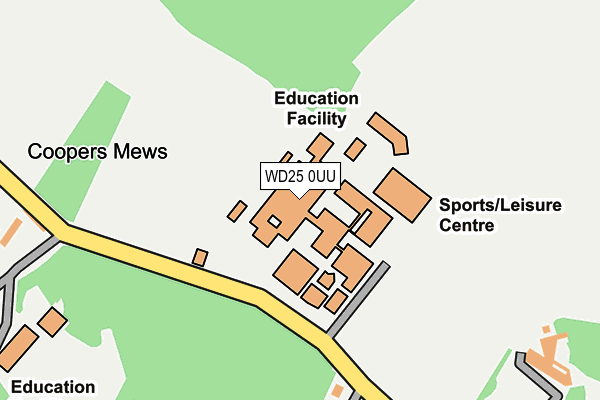
WD25 0UU is located in the Leavesden electoral ward, within the local authority district of Three Rivers and the English Parliamentary constituency of Watford. The Sub Integrated Care Board (ICB) Location is NHS Hertfordshire and West Essex ICB - 06N and the police force is Hertfordshire. This postcode has been in use since December 2000.


GetTheData
Source: OS OpenMap – Local (Ordnance Survey)
Source: OS VectorMap District (Ordnance Survey)
Licence: Open Government Licence (requires attribution)
| Easting | 511392 |
| Northing | 201727 |
| Latitude | 51.703238 |
| Longitude | -0.389441 |
GetTheData
Source: Open Postcode Geo
Licence: Open Government Licence
| Country | England |
| Postcode District | WD25 |
➜ See where WD25 is on a map | |
GetTheData
Source: Land Registry Price Paid Data
Licence: Open Government Licence
Elevation or altitude of WD25 0UU as distance above sea level:
| Metres | Feet | |
|---|---|---|
| Elevation | 80m | 262ft |
Elevation is measured from the approximate centre of the postcode, to the nearest point on an OS contour line from OS Terrain 50, which has contour spacing of ten vertical metres.
➜ How high above sea level am I? Find the elevation of your current position using your device's GPS.
GetTheData
Source: Open Postcode Elevation
Licence: Open Government Licence
| Ward | Leavesden |
| Constituency | Watford |
GetTheData
Source: ONS Postcode Database
Licence: Open Government Licence
| Parmiter's School (High Elms Lane) | Garston | 105m |
| St Michael's Rc School (High Elms Lane) | Garston | 443m |
| Bucknalls Lane (North Orbital Road) | Garston | 577m |
| Bucknalls Lane (North Orbital Road) | Garston | 609m |
| Boundary Way (Horseshoe Lane) | Woodside | 628m |
| Garston (Herts) Station | 1.9km |
| Bricket Wood Station | 2.1km |
| Watford North Station | 3.1km |
GetTheData
Source: NaPTAN
Licence: Open Government Licence
GetTheData
Source: ONS Postcode Database
Licence: Open Government Licence


➜ Get more ratings from the Food Standards Agency
GetTheData
Source: Food Standards Agency
Licence: FSA terms & conditions
| Last Collection | |||
|---|---|---|---|
| Location | Mon-Fri | Sat | Distance |
| Katherine Place | 17:00 | 12:00 | 1,056m |
| Ferndene | 17:30 | 12:00 | 1,317m |
| Abbey Drive | 17:00 | 12:00 | 1,427m |
GetTheData
Source: Dracos
Licence: Creative Commons Attribution-ShareAlike
The below table lists the International Territorial Level (ITL) codes (formerly Nomenclature of Territorial Units for Statistics (NUTS) codes) and Local Administrative Units (LAU) codes for WD25 0UU:
| ITL 1 Code | Name |
|---|---|
| TLH | East |
| ITL 2 Code | Name |
| TLH2 | Bedfordshire and Hertfordshire |
| ITL 3 Code | Name |
| TLH23 | Hertfordshire CC |
| LAU 1 Code | Name |
| E07000102 | Three Rivers |
GetTheData
Source: ONS Postcode Directory
Licence: Open Government Licence
The below table lists the Census Output Area (OA), Lower Layer Super Output Area (LSOA), and Middle Layer Super Output Area (MSOA) for WD25 0UU:
| Code | Name | |
|---|---|---|
| OA | E00121021 | |
| LSOA | E01023832 | Three Rivers 002C |
| MSOA | E02004957 | Three Rivers 002 |
GetTheData
Source: ONS Postcode Directory
Licence: Open Government Licence
| WD25 0JD | Coopers Mews | 278m |
| WD25 0JX | High Elms Lane | 312m |
| WD25 0JN | Hop Garden Way | 341m |
| WD25 0JL | The Shires | 390m |
| WD25 0JW | Barley Brow | 393m |
| WD25 7SP | Starling Place | 409m |
| WD25 7SW | Starling Place | 447m |
| WD25 7SU | Throstle Place | 469m |
| WD25 0GB | St Albans Road | 492m |
| WD25 7SX | Throstle Place | 499m |
GetTheData
Source: Open Postcode Geo; Land Registry Price Paid Data
Licence: Open Government Licence