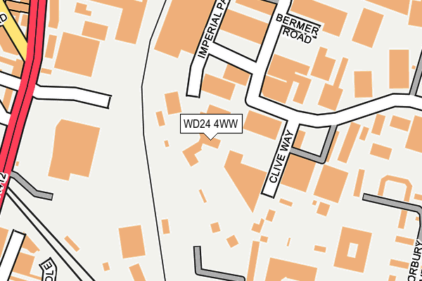
WD24 4WW is located in the Tudor electoral ward, within the local authority district of Watford and the English Parliamentary constituency of Watford. The Sub Integrated Care Board (ICB) Location is NHS Hertfordshire and West Essex ICB - 06N and the police force is Hertfordshire. This postcode has been in use since December 2000.


GetTheData
Source: OS OpenMap – Local (Ordnance Survey)
Source: OS VectorMap District (Ordnance Survey)
Licence: Open Government Licence (requires attribution)
| Easting | 511137 |
| Northing | 197621 |
| Latitude | 51.666385 |
| Longitude | -0.394435 |
GetTheData
Source: Open Postcode Geo
Licence: Open Government Licence
| Country | England |
| Postcode District | WD24 |
➜ See where WD24 is on a map ➜ Where is Watford? | |
GetTheData
Source: Land Registry Price Paid Data
Licence: Open Government Licence
Elevation or altitude of WD24 4WW as distance above sea level:
| Metres | Feet | |
|---|---|---|
| Elevation | 70m | 230ft |
Elevation is measured from the approximate centre of the postcode, to the nearest point on an OS contour line from OS Terrain 50, which has contour spacing of ten vertical metres.
➜ How high above sea level am I? Find the elevation of your current position using your device's GPS.
GetTheData
Source: Open Postcode Elevation
Licence: Open Government Licence
| Ward | Tudor |
| Constituency | Watford |
GetTheData
Source: ONS Postcode Database
Licence: Open Government Licence
| Clive Way (Colonial Way) | North Watford | 126m |
| Clive Way (Colonial Way) | North Watford | 151m |
| Bermer Road (Imperial Way) | North Watford | 218m |
| Bermer Road (Imperial Way) | North Watford | 221m |
| Hallam Close (Reeds Crescent) | Watford | 285m |
| Watford Junction Station | 0.3km |
| Watford North Station | 1.1km |
| Watford High Street Station | 1.5km |
GetTheData
Source: NaPTAN
Licence: Open Government Licence
GetTheData
Source: ONS Postcode Database
Licence: Open Government Licence


➜ Get more ratings from the Food Standards Agency
GetTheData
Source: Food Standards Agency
Licence: FSA terms & conditions
| Last Collection | |||
|---|---|---|---|
| Location | Mon-Fri | Sat | Distance |
| Watford Junction Station | 18:30 | 11:30 | 373m |
| Watford Junction | 18:30 | 375m | |
| Leavesden Road | 18:30 | 12:00 | 422m |
GetTheData
Source: Dracos
Licence: Creative Commons Attribution-ShareAlike
The below table lists the International Territorial Level (ITL) codes (formerly Nomenclature of Territorial Units for Statistics (NUTS) codes) and Local Administrative Units (LAU) codes for WD24 4WW:
| ITL 1 Code | Name |
|---|---|
| TLH | East |
| ITL 2 Code | Name |
| TLH2 | Bedfordshire and Hertfordshire |
| ITL 3 Code | Name |
| TLH23 | Hertfordshire CC |
| LAU 1 Code | Name |
| E07000103 | Watford |
GetTheData
Source: ONS Postcode Directory
Licence: Open Government Licence
The below table lists the Census Output Area (OA), Lower Layer Super Output Area (LSOA), and Middle Layer Super Output Area (MSOA) for WD24 4WW:
| Code | Name | |
|---|---|---|
| OA | E00121348 | |
| LSOA | E01023895 | Watford 005A |
| MSOA | E02004972 | Watford 005 |
GetTheData
Source: ONS Postcode Directory
Licence: Open Government Licence
| WD24 4YR | Colonial Way | 113m |
| WD24 4PR | Colonial Business Park | 238m |
| WD24 4PE | Norbury Avenue | 269m |
| WD24 4DP | Ellenbrook Close | 279m |
| WD24 4DX | Brixton Road | 289m |
| WD24 4PT | Colonial Way | 290m |
| WD24 4PL | Norbury Avenue | 292m |
| WD24 4BN | Exeter Close | 298m |
| WD24 4RL | Hallam Close | 306m |
| WD24 4WP | Watford Interchange | 308m |
GetTheData
Source: Open Postcode Geo; Land Registry Price Paid Data
Licence: Open Government Licence