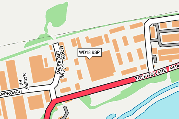
WD18 9SP lies on Moor Park Industrial Centre in Watford. WD18 9SP is located in the Moor Park & Eastbury electoral ward, within the local authority district of Three Rivers and the English Parliamentary constituency of South West Hertfordshire. The Sub Integrated Care Board (ICB) Location is NHS Hertfordshire and West Essex ICB - 06N and the police force is Hertfordshire. This postcode has been in use since October 2000.


GetTheData
Source: OS OpenMap – Local (Ordnance Survey)
Source: OS VectorMap District (Ordnance Survey)
Licence: Open Government Licence (requires attribution)
| Easting | 508380 |
| Northing | 194589 |
| Latitude | 51.639672 |
| Longitude | -0.435222 |
GetTheData
Source: Open Postcode Geo
Licence: Open Government Licence
| Street | Moor Park Industrial Centre |
| Town/City | Watford |
| Country | England |
| Postcode District | WD18 |
➜ See where WD18 is on a map ➜ Where is Watford? | |
GetTheData
Source: Land Registry Price Paid Data
Licence: Open Government Licence
Elevation or altitude of WD18 9SP as distance above sea level:
| Metres | Feet | |
|---|---|---|
| Elevation | 50m | 164ft |
Elevation is measured from the approximate centre of the postcode, to the nearest point on an OS contour line from OS Terrain 50, which has contour spacing of ten vertical metres.
➜ How high above sea level am I? Find the elevation of your current position using your device's GPS.
GetTheData
Source: Open Postcode Elevation
Licence: Open Government Licence
| Ward | Moor Park & Eastbury |
| Constituency | South West Hertfordshire |
GetTheData
Source: ONS Postcode Database
Licence: Open Government Licence
| Caxton Court (Caxton Way) | Holywell | 584m |
| Hatters Lane | Holywell | 585m |
| Magnet (Caxton Way) | Holywell | 688m |
| Croxley Park Management Centre (Hatters Lane) | Holywell | 774m |
| Croxley Park Management Centre (Hatters Lane) | Holywell | 780m |
| Croxley Underground Station | Croxley Green | 935m |
| Moor Park Underground Station | Moor Park | 1,110m |
| Rickmansworth Station | 2.6km |
| Watford High Street Station | 3.3km |
| Bushey Station | 3.5km |
GetTheData
Source: NaPTAN
Licence: Open Government Licence
| Median download speed | 74.0Mbps |
| Average download speed | 60.5Mbps |
| Maximum download speed | 80.00Mbps |
| Median upload speed | 19.9Mbps |
| Average upload speed | 14.4Mbps |
| Maximum upload speed | 20.00Mbps |
GetTheData
Source: Ofcom
Licence: Ofcom Terms of Use (requires attribution)
GetTheData
Source: ONS Postcode Database
Licence: Open Government Licence


➜ Get more ratings from the Food Standards Agency
GetTheData
Source: Food Standards Agency
Licence: FSA terms & conditions
| Last Collection | |||
|---|---|---|---|
| Location | Mon-Fri | Sat | Distance |
| Dwight Road | 18:30 | 12:00 | 567m |
| Dwight Road | 573m | ||
| Watford Road Croxley Green | 17:30 | 12:00 | 940m |
GetTheData
Source: Dracos
Licence: Creative Commons Attribution-ShareAlike
The below table lists the International Territorial Level (ITL) codes (formerly Nomenclature of Territorial Units for Statistics (NUTS) codes) and Local Administrative Units (LAU) codes for WD18 9SP:
| ITL 1 Code | Name |
|---|---|
| TLH | East |
| ITL 2 Code | Name |
| TLH2 | Bedfordshire and Hertfordshire |
| ITL 3 Code | Name |
| TLH23 | Hertfordshire CC |
| LAU 1 Code | Name |
| E07000102 | Three Rivers |
GetTheData
Source: ONS Postcode Directory
Licence: Open Government Licence
The below table lists the Census Output Area (OA), Lower Layer Super Output Area (LSOA), and Middle Layer Super Output Area (MSOA) for WD18 9SP:
| Code | Name | |
|---|---|---|
| OA | E00121054 | |
| LSOA | E01023841 | Three Rivers 011C |
| MSOA | E02004966 | Three Rivers 011 |
GetTheData
Source: ONS Postcode Directory
Licence: Open Government Licence
| WD18 9RS | Century Court | 60m |
| WD18 9QN | Moor Lane Crossing | 129m |
| WD18 9SB | The Metro Centre | 133m |
| WD18 9UD | The Metro Centre | 192m |
| WD18 9QG | Tolpits Lane | 219m |
| WD18 9TB | Olds Approach | 232m |
| WD18 9DA | Orbital 25 Business Park | 294m |
| WD18 9TD | Olds Approach | 373m |
| WD18 9RU | Olds Close | 438m |
| WD18 9QP | Vale Industrial Estate | 439m |
GetTheData
Source: Open Postcode Geo; Land Registry Price Paid Data
Licence: Open Government Licence