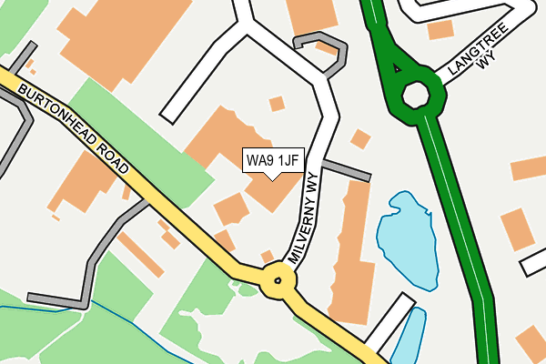
WA9 1JF is located in the Peasley Cross & Fingerpost electoral ward, within the metropolitan district of St. Helens and the English Parliamentary constituency of St Helens South and Whiston. The Sub Integrated Care Board (ICB) Location is NHS Cheshire and Merseyside ICB - 01X and the police force is Merseyside. This postcode has been in use since June 2001.


GetTheData
Source: OS OpenMap – Local (Ordnance Survey)
Source: OS VectorMap District (Ordnance Survey)
Licence: Open Government Licence (requires attribution)
| Easting | 351397 |
| Northing | 394409 |
| Latitude | 53.444212 |
| Longitude | -2.733207 |
GetTheData
Source: Open Postcode Geo
Licence: Open Government Licence
| Country | England |
| Postcode District | WA9 |
➜ See where WA9 is on a map ➜ Where is St Helens? | |
GetTheData
Source: Land Registry Price Paid Data
Licence: Open Government Licence
Elevation or altitude of WA9 1JF as distance above sea level:
| Metres | Feet | |
|---|---|---|
| Elevation | 30m | 98ft |
Elevation is measured from the approximate centre of the postcode, to the nearest point on an OS contour line from OS Terrain 50, which has contour spacing of ten vertical metres.
➜ How high above sea level am I? Find the elevation of your current position using your device's GPS.
GetTheData
Source: Open Postcode Elevation
Licence: Open Government Licence
| Ward | Peasley Cross & Fingerpost |
| Constituency | St Helens South And Whiston |
GetTheData
Source: ONS Postcode Database
Licence: Open Government Licence
| Ravenhead Retail Park (Milverny Way) | Sutton | 81m |
| Ravenhead Retail Park (Milverny Way) | Sutton | 89m |
| Ravenhead Retail Park (Milverny Way) | Derbyshire Hill | 265m |
| Delphwood Drive (Sherdley Road) | Peasley Cross | 471m |
| Harris Gardens (Sherdley Road) | Peasley Cross | 565m |
| St Helens Central Station | 1km |
| Thatto Heath Station | 1.9km |
| Lea Green Station | 2km |
GetTheData
Source: NaPTAN
Licence: Open Government Licence
| Median download speed | 12.7Mbps |
| Average download speed | 12.4Mbps |
| Maximum download speed | 17.21Mbps |
| Median upload speed | 0.8Mbps |
| Average upload speed | 0.8Mbps |
| Maximum upload speed | 1.11Mbps |
GetTheData
Source: Ofcom
Licence: Ofcom Terms of Use (requires attribution)
GetTheData
Source: ONS Postcode Database
Licence: Open Government Licence
➜ Get more ratings from the Food Standards Agency
GetTheData
Source: Food Standards Agency
Licence: FSA terms & conditions
| Last Collection | |||
|---|---|---|---|
| Location | Mon-Fri | Sat | Distance |
| Peasley Cross Post Office | 17:00 | 11:00 | 783m |
| Bridge Street Post Office | 18:00 | 12:30 | 886m |
| Marshalls Cross | 17:30 | 11:00 | 921m |
GetTheData
Source: Dracos
Licence: Creative Commons Attribution-ShareAlike
The below table lists the International Territorial Level (ITL) codes (formerly Nomenclature of Territorial Units for Statistics (NUTS) codes) and Local Administrative Units (LAU) codes for WA9 1JF:
| ITL 1 Code | Name |
|---|---|
| TLD | North West (England) |
| ITL 2 Code | Name |
| TLD7 | Merseyside |
| ITL 3 Code | Name |
| TLD71 | East Merseyside |
| LAU 1 Code | Name |
| E08000013 | St. Helens |
GetTheData
Source: ONS Postcode Directory
Licence: Open Government Licence
The below table lists the Census Output Area (OA), Lower Layer Super Output Area (LSOA), and Middle Layer Super Output Area (MSOA) for WA9 1JF:
| Code | Name | |
|---|---|---|
| OA | E00035035 | |
| LSOA | E01006912 | St. Helens 019G |
| MSOA | E02001424 | St. Helens 019 |
GetTheData
Source: ONS Postcode Directory
Licence: Open Government Licence
| WA9 5AA | Wharton Street | 504m |
| WA9 5AD | Sherdley Road | 513m |
| WA9 5AB | Sherdley Road | 571m |
| WA9 5DR | Bourne Gardens | 662m |
| WA10 3JZ | Yorkshire Gardens | 751m |
| WA9 3BP | Peasley Cross Lane | 754m |
| WA9 3BJ | Marshalls Cross Road | 785m |
| WA9 5GH | Tall Trees | 789m |
| WA10 3XU | Lanark Close | 796m |
| WA10 3XT | Glamorgan Close | 800m |
GetTheData
Source: Open Postcode Geo; Land Registry Price Paid Data
Licence: Open Government Licence