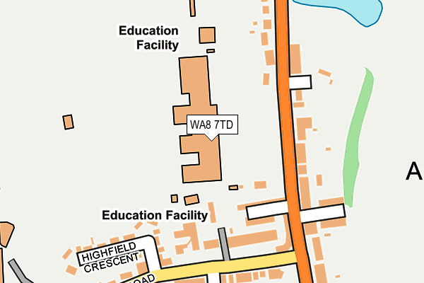
WA8 7TD is located in the Highfield electoral ward, within the unitary authority of Halton and the English Parliamentary constituency of Halton. The Sub Integrated Care Board (ICB) Location is NHS Cheshire and Merseyside ICB - 01F and the police force is Cheshire. This postcode has been in use since July 2013.


GetTheData
Source: OS OpenMap – Local (Ordnance Survey)
Source: OS VectorMap District (Ordnance Survey)
Licence: Open Government Licence (requires attribution)
| Easting | 351195 |
| Northing | 386733 |
| Latitude | 53.375187 |
| Longitude | -2.735058 |
GetTheData
Source: Open Postcode Geo
Licence: Open Government Licence
| Country | England |
| Postcode District | WA8 |
➜ See where WA8 is on a map ➜ Where is Widnes? | |
GetTheData
Source: Land Registry Price Paid Data
Licence: Open Government Licence
Elevation or altitude of WA8 7TD as distance above sea level:
| Metres | Feet | |
|---|---|---|
| Elevation | 30m | 98ft |
Elevation is measured from the approximate centre of the postcode, to the nearest point on an OS contour line from OS Terrain 50, which has contour spacing of ten vertical metres.
➜ How high above sea level am I? Find the elevation of your current position using your device's GPS.
GetTheData
Source: Open Postcode Elevation
Licence: Open Government Licence
| Ward | Highfield |
| Constituency | Halton |
GetTheData
Source: ONS Postcode Database
Licence: Open Government Licence
| Wade Deacon (Birchfield Road) | Widnes | 108m |
| Birchfield Road | Victoria Park | 206m |
| Birchfield Road | Widnes | 223m |
| Horse & Jockey (Birchfield Road) | Victoria Park | 244m |
| Lockett Road | Victoria Park | 289m |
| Widnes Station | 0.4km |
| Hough Green Station | 2.7km |
| Runcorn Station | 4.1km |
GetTheData
Source: NaPTAN
Licence: Open Government Licence
GetTheData
Source: ONS Postcode Database
Licence: Open Government Licence


➜ Get more ratings from the Food Standards Agency
GetTheData
Source: Food Standards Agency
Licence: FSA terms & conditions
| Last Collection | |||
|---|---|---|---|
| Location | Mon-Fri | Sat | Distance |
| Appleton Village | 17:30 | 11:00 | 388m |
| Greenway Road | 17:30 | 11:00 | 447m |
| Lytham Road | 17:30 | 11:00 | 741m |
GetTheData
Source: Dracos
Licence: Creative Commons Attribution-ShareAlike
The below table lists the International Territorial Level (ITL) codes (formerly Nomenclature of Territorial Units for Statistics (NUTS) codes) and Local Administrative Units (LAU) codes for WA8 7TD:
| ITL 1 Code | Name |
|---|---|
| TLD | North West (England) |
| ITL 2 Code | Name |
| TLD7 | Merseyside |
| ITL 3 Code | Name |
| TLD71 | East Merseyside |
| LAU 1 Code | Name |
| E06000006 | Halton |
GetTheData
Source: ONS Postcode Directory
Licence: Open Government Licence
The below table lists the Census Output Area (OA), Lower Layer Super Output Area (LSOA), and Middle Layer Super Output Area (MSOA) for WA8 7TD:
| Code | Name | |
|---|---|---|
| OA | E00062684 | |
| LSOA | E01012426 | Halton 005D |
| MSOA | E02002578 | Halton 005 |
GetTheData
Source: ONS Postcode Directory
Licence: Open Government Licence
| WA8 6PZ | Bradshaw Street | 110m |
| WA8 7TE | Birchfield Road | 131m |
| WA8 7TF | Birchfield Road | 136m |
| WA8 7TB | Birchfield Road | 147m |
| WA8 7DH | Highfield Road | 148m |
| WA8 7TA | Birchfield Road | 152m |
| WA8 7TG | Birchfield Road | 168m |
| WA8 7SZ | Birchfield Road | 175m |
| WA8 6PX | Birchfield Avenue | 185m |
| WA8 7DN | Highfield Crescent | 200m |
GetTheData
Source: Open Postcode Geo; Land Registry Price Paid Data
Licence: Open Government Licence