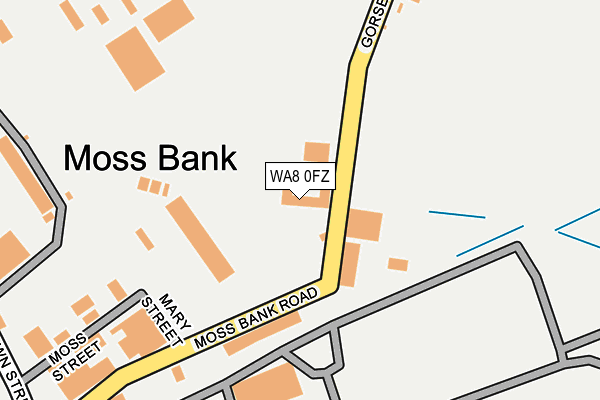
WA8 0FZ is located in the Halton View electoral ward, within the unitary authority of Halton and the English Parliamentary constituency of Halton. The Sub Integrated Care Board (ICB) Location is NHS Cheshire and Merseyside ICB - 01F and the police force is Cheshire. This postcode has been in use since December 1996.


GetTheData
Source: OS OpenMap – Local (Ordnance Survey)
Source: OS VectorMap District (Ordnance Survey)
Licence: Open Government Licence (requires attribution)
| Easting | 353026 |
| Northing | 385576 |
| Latitude | 53.364954 |
| Longitude | -2.707366 |
GetTheData
Source: Open Postcode Geo
Licence: Open Government Licence
| Country | England |
| Postcode District | WA8 |
➜ See where WA8 is on a map ➜ Where is Widnes? | |
GetTheData
Source: Land Registry Price Paid Data
Licence: Open Government Licence
Elevation or altitude of WA8 0FZ as distance above sea level:
| Metres | Feet | |
|---|---|---|
| Elevation | 10m | 33ft |
Elevation is measured from the approximate centre of the postcode, to the nearest point on an OS contour line from OS Terrain 50, which has contour spacing of ten vertical metres.
➜ How high above sea level am I? Find the elevation of your current position using your device's GPS.
GetTheData
Source: Open Postcode Elevation
Licence: Open Government Licence
| Ward | Halton View |
| Constituency | Halton |
GetTheData
Source: ONS Postcode Database
Licence: Open Government Licence
| Suttons (Gorseyn Lane) | Moss Bank | 45m |
| Suttons (Gorsey Lane) | Moss Bank | 55m |
| Moss Bank Road | Moss Bank | 411m |
| Moss Bank Road | Moss Bank | 444m |
| Tanhouse Lane | Lugsdale | 520m |
| Widnes Station | 2.3km |
| Runcorn Station | 3.6km |
| Hough Green Station | 4.6km |
GetTheData
Source: NaPTAN
Licence: Open Government Licence
GetTheData
Source: ONS Postcode Database
Licence: Open Government Licence


➜ Get more ratings from the Food Standards Agency
GetTheData
Source: Food Standards Agency
Licence: FSA terms & conditions
| Last Collection | |||
|---|---|---|---|
| Location | Mon-Fri | Sat | Distance |
| Elliott Street | 17:30 | 11:00 | 1,410m |
| Moorfield Road | 18:00 | 11:00 | 1,523m |
| Head Office | 18:30 | 12:30 | 1,599m |
GetTheData
Source: Dracos
Licence: Creative Commons Attribution-ShareAlike
The below table lists the International Territorial Level (ITL) codes (formerly Nomenclature of Territorial Units for Statistics (NUTS) codes) and Local Administrative Units (LAU) codes for WA8 0FZ:
| ITL 1 Code | Name |
|---|---|
| TLD | North West (England) |
| ITL 2 Code | Name |
| TLD7 | Merseyside |
| ITL 3 Code | Name |
| TLD71 | East Merseyside |
| LAU 1 Code | Name |
| E06000006 | Halton |
GetTheData
Source: ONS Postcode Directory
Licence: Open Government Licence
The below table lists the Census Output Area (OA), Lower Layer Super Output Area (LSOA), and Middle Layer Super Output Area (MSOA) for WA8 0FZ:
| Code | Name | |
|---|---|---|
| OA | E00062614 | |
| LSOA | E01012412 | Halton 003C |
| MSOA | E02002576 | Halton 003 |
GetTheData
Source: ONS Postcode Directory
Licence: Open Government Licence
| WA8 0YZ | Gorsey Lane | 260m |
| WA8 0SW | Tanhouse Lane | 411m |
| WA8 0BT | French Street | 622m |
| WA8 0BU | Green Oaks Path | 634m |
| WA8 0BS | Naylor Road | 690m |
| WA8 0AP | Warrington Road | 695m |
| WA8 0BA | Warrington Road | 729m |
| WA8 0GU | Dennis Road | 744m |
| WA8 0AW | Black Dentons Place | 758m |
| WA8 0AS | Warrington Road | 783m |
GetTheData
Source: Open Postcode Geo; Land Registry Price Paid Data
Licence: Open Government Licence