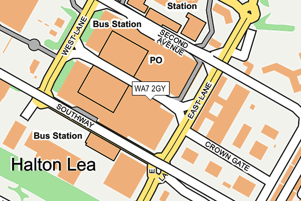
WA7 2GY is located in the Halton Lea electoral ward, within the unitary authority of Halton and the English Parliamentary constituency of Weaver Vale. The Sub Integrated Care Board (ICB) Location is NHS Cheshire and Merseyside ICB - 01F and the police force is Cheshire. This postcode has been in use since June 1996.


GetTheData
Source: OS OpenMap – Local (Ordnance Survey)
Source: OS VectorMap District (Ordnance Survey)
Licence: Open Government Licence (requires attribution)
| Easting | 353656 |
| Northing | 381375 |
| Latitude | 53.327267 |
| Longitude | -2.697284 |
GetTheData
Source: Open Postcode Geo
Licence: Open Government Licence
| Country | England |
| Postcode District | WA7 |
➜ See where WA7 is on a map ➜ Where is Runcorn? | |
GetTheData
Source: Land Registry Price Paid Data
Licence: Open Government Licence
Elevation or altitude of WA7 2GY as distance above sea level:
| Metres | Feet | |
|---|---|---|
| Elevation | 60m | 197ft |
Elevation is measured from the approximate centre of the postcode, to the nearest point on an OS contour line from OS Terrain 50, which has contour spacing of ten vertical metres.
➜ How high above sea level am I? Find the elevation of your current position using your device's GPS.
GetTheData
Source: Open Postcode Elevation
Licence: Open Government Licence
| Ward | Halton Lea |
| Constituency | Weaver Vale |
GetTheData
Source: ONS Postcode Database
Licence: Open Government Licence
| Halton Lea South (Busway) | Palace Fields | 120m |
| Halton Lea North (Busway) | Palace Fields | 154m |
| Asda- Halton Lea | Palace Fields | 293m |
| Halton Hospital (Busway (Halton Lea)) | Palace Fields | 407m |
| Halton Hospital (Busway (Halton Lea)) | Palace Fields | 421m |
| Runcorn East Station | 2.1km |
| Runcorn Station | 3.1km |
| Frodsham Station | 3.9km |
GetTheData
Source: NaPTAN
Licence: Open Government Licence
GetTheData
Source: ONS Postcode Database
Licence: Open Government Licence


➜ Get more ratings from the Food Standards Agency
GetTheData
Source: Food Standards Agency
Licence: FSA terms & conditions
| Last Collection | |||
|---|---|---|---|
| Location | Mon-Fri | Sat | Distance |
| Hallwood Park | 17:30 | 11:00 | 512m |
| Delivery Office | 18:15 | 12:00 | 539m |
| Worthington Close | 16:45 | 11:00 | 546m |
GetTheData
Source: Dracos
Licence: Creative Commons Attribution-ShareAlike
The below table lists the International Territorial Level (ITL) codes (formerly Nomenclature of Territorial Units for Statistics (NUTS) codes) and Local Administrative Units (LAU) codes for WA7 2GY:
| ITL 1 Code | Name |
|---|---|
| TLD | North West (England) |
| ITL 2 Code | Name |
| TLD7 | Merseyside |
| ITL 3 Code | Name |
| TLD71 | East Merseyside |
| LAU 1 Code | Name |
| E06000006 | Halton |
GetTheData
Source: ONS Postcode Directory
Licence: Open Government Licence
The below table lists the Census Output Area (OA), Lower Layer Super Output Area (LSOA), and Middle Layer Super Output Area (MSOA) for WA7 2GY:
| Code | Name | |
|---|---|---|
| OA | E00062587 | |
| LSOA | E01012408 | Halton 013F |
| MSOA | E02002586 | Halton 013 |
GetTheData
Source: ONS Postcode Directory
Licence: Open Government Licence
| WA7 2BP | Astmoor Lane | 244m |
| WA7 2UT | Hospital Way | 277m |
| WA7 2UD | The Uplands | 314m |
| WA7 2UQ | The Knoll | 364m |
| WA7 2AY | Holt Lane | 383m |
| WA7 2UH | The Knoll | 397m |
| WA7 2FB | Kestrels Way | 413m |
| WA7 2UB | The Uplands | 420m |
| WA7 2AT | Main Street | 422m |
| WA7 2UE | The Uplands | 431m |
GetTheData
Source: Open Postcode Geo; Land Registry Price Paid Data
Licence: Open Government Licence