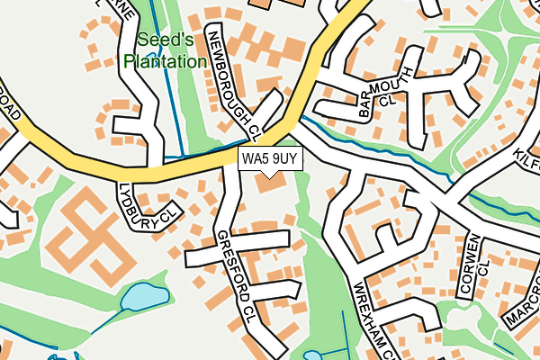
WA5 9UY is located in the Westbrook electoral ward, within the unitary authority of Warrington and the English Parliamentary constituency of Warrington North. The Sub Integrated Care Board (ICB) Location is NHS Cheshire and Merseyside ICB - 02E and the police force is Cheshire. This postcode has been in use since June 2001.


GetTheData
Source: OS OpenMap – Local (Ordnance Survey)
Source: OS VectorMap District (Ordnance Survey)
Licence: Open Government Licence (requires attribution)
| Easting | 359057 |
| Northing | 390556 |
| Latitude | 53.410217 |
| Longitude | -2.617389 |
GetTheData
Source: Open Postcode Geo
Licence: Open Government Licence
| Country | England |
| Postcode District | WA5 |
➜ See where WA5 is on a map ➜ Where is Warrington? | |
GetTheData
Source: Land Registry Price Paid Data
Licence: Open Government Licence
Elevation or altitude of WA5 9UY as distance above sea level:
| Metres | Feet | |
|---|---|---|
| Elevation | 10m | 33ft |
Elevation is measured from the approximate centre of the postcode, to the nearest point on an OS contour line from OS Terrain 50, which has contour spacing of ten vertical metres.
➜ How high above sea level am I? Find the elevation of your current position using your device's GPS.
GetTheData
Source: Open Postcode Elevation
Licence: Open Government Licence
| Ward | Westbrook |
| Constituency | Warrington North |
GetTheData
Source: ONS Postcode Database
Licence: Open Government Licence
| Lydbury Close (Callands Road) | Dallam | 98m |
| Barmouth Close (Callands Road) | Dallam | 106m |
| Lydbury Close (Callands Road) | Dallam | 114m |
| Barmouth Close (Callands Road) | Dallam | 159m |
| Pensarn Gardens (Callands Road) | Old Hall | 336m |
| Warrington Central Station | 2.6km |
| Warrington Bank Quay Station | 2.9km |
| Sankey for Penketh Station | 3km |
GetTheData
Source: NaPTAN
Licence: Open Government Licence
GetTheData
Source: ONS Postcode Database
Licence: Open Government Licence


➜ Get more ratings from the Food Standards Agency
GetTheData
Source: Food Standards Agency
Licence: FSA terms & conditions
| Last Collection | |||
|---|---|---|---|
| Location | Mon-Fri | Sat | Distance |
| Cardigan Close | 17:30 | 11:00 | 578m |
| Toys R Us | 18:00 | 11:00 | 881m |
| Westbrook Crescent | 17:30 | 11:00 | 881m |
GetTheData
Source: Dracos
Licence: Creative Commons Attribution-ShareAlike
The below table lists the International Territorial Level (ITL) codes (formerly Nomenclature of Territorial Units for Statistics (NUTS) codes) and Local Administrative Units (LAU) codes for WA5 9UY:
| ITL 1 Code | Name |
|---|---|
| TLD | North West (England) |
| ITL 2 Code | Name |
| TLD6 | Cheshire |
| ITL 3 Code | Name |
| TLD61 | Warrington |
| LAU 1 Code | Name |
| E06000007 | Warrington |
GetTheData
Source: ONS Postcode Directory
Licence: Open Government Licence
The below table lists the Census Output Area (OA), Lower Layer Super Output Area (LSOA), and Middle Layer Super Output Area (MSOA) for WA5 9UY:
| Code | Name | |
|---|---|---|
| OA | E00063356 | |
| LSOA | E01012564 | Warrington 010B |
| MSOA | E02002599 | Warrington 010 |
GetTheData
Source: ONS Postcode Directory
Licence: Open Government Licence
| WA5 9RY | Gresford Close | 87m |
| WA5 9RX | Lydbury Close | 119m |
| WA5 9JG | Newborough Close | 119m |
| WA5 9RL | Wrexham Close | 149m |
| WA5 9RU | Barmouth Close | 159m |
| WA5 9RW | Barmouth Close | 219m |
| WA5 9SN | North Park Brook Road | 254m |
| WA5 9RH | Corwen Close | 255m |
| WA5 9YB | Ridgebourne Close | 264m |
| WA5 9SP | Tintern Close | 287m |
GetTheData
Source: Open Postcode Geo; Land Registry Price Paid Data
Licence: Open Government Licence