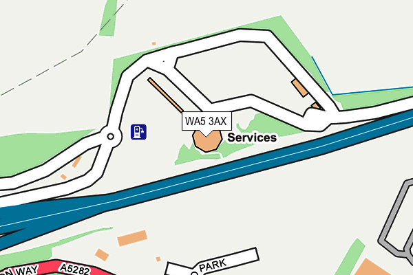
WA5 3AX is located in the Burtonwood and Winwick electoral ward, within the unitary authority of Warrington and the English Parliamentary constituency of Warrington North. The Sub Integrated Care Board (ICB) Location is NHS Cheshire and Merseyside ICB - 02E and the police force is Cheshire. This postcode has been in use since January 1980.


GetTheData
Source: OS OpenMap – Local (Ordnance Survey)
Source: OS VectorMap District (Ordnance Survey)
Licence: Open Government Licence (requires attribution)
| Easting | 357697 |
| Northing | 391350 |
| Latitude | 53.417246 |
| Longitude | -2.637953 |
GetTheData
Source: Open Postcode Geo
Licence: Open Government Licence
| Country | England |
| Postcode District | WA5 |
➜ See where WA5 is on a map | |
GetTheData
Source: Land Registry Price Paid Data
Licence: Open Government Licence
Elevation or altitude of WA5 3AX as distance above sea level:
| Metres | Feet | |
|---|---|---|
| Elevation | 20m | 66ft |
Elevation is measured from the approximate centre of the postcode, to the nearest point on an OS contour line from OS Terrain 50, which has contour spacing of ten vertical metres.
➜ How high above sea level am I? Find the elevation of your current position using your device's GPS.
GetTheData
Source: Open Postcode Elevation
Licence: Open Government Licence
| Ward | Burtonwood And Winwick |
| Constituency | Warrington North |
GetTheData
Source: ONS Postcode Database
Licence: Open Government Licence
| Marks & Spencer (Europa Boulevard) | Old Hall | 492m |
| Marks & Spencer (Europa Boulevard) | Old Hall | 515m |
| Falconers Green (Kingswood Road) | Old Hall | 520m |
| Falconers Green (Kingswood Road) | Old Hall | 530m |
| Europa Boulevard | Old Hall | 593m |
| Sankey for Penketh Station | 2.9km |
| Earlestown Station | 3.8km |
| Warrington Central Station | 4.1km |
GetTheData
Source: NaPTAN
Licence: Open Government Licence
GetTheData
Source: ONS Postcode Database
Licence: Open Government Licence


➜ Get more ratings from the Food Standards Agency
GetTheData
Source: Food Standards Agency
Licence: FSA terms & conditions
| Last Collection | |||
|---|---|---|---|
| Location | Mon-Fri | Sat | Distance |
| Castle Green | 17:30 | 10:30 | 626m |
| Gemini Busines Park | 18:30 | 971m | |
| Toys R Us | 18:00 | 11:00 | 990m |
GetTheData
Source: Dracos
Licence: Creative Commons Attribution-ShareAlike
The below table lists the International Territorial Level (ITL) codes (formerly Nomenclature of Territorial Units for Statistics (NUTS) codes) and Local Administrative Units (LAU) codes for WA5 3AX:
| ITL 1 Code | Name |
|---|---|
| TLD | North West (England) |
| ITL 2 Code | Name |
| TLD6 | Cheshire |
| ITL 3 Code | Name |
| TLD61 | Warrington |
| LAU 1 Code | Name |
| E06000007 | Warrington |
GetTheData
Source: ONS Postcode Directory
Licence: Open Government Licence
The below table lists the Census Output Area (OA), Lower Layer Super Output Area (LSOA), and Middle Layer Super Output Area (MSOA) for WA5 3AX:
| Code | Name | |
|---|---|---|
| OA | E00062877 | |
| LSOA | E01012469 | Warrington 003C |
| MSOA | E02002592 | Warrington 003 |
GetTheData
Source: ONS Postcode Directory
Licence: Open Government Licence
| WA5 7YA | Apollo Park | 232m |
| WA5 7XU | Butts Green | 316m |
| WA5 7XT | Butts Green | 368m |
| WA5 7XS | Archers Green Road | 403m |
| WA5 7XF | Falconers Green | 407m |
| WA5 7AD | Butts Green | 484m |
| WA5 7XD | Falconers Green | 522m |
| WA5 7XQ | Kingswood Road | 523m |
| WA5 7AA | Partisan Green | 582m |
| WA5 7XN | Tourney Green | 675m |
GetTheData
Source: Open Postcode Geo; Land Registry Price Paid Data
Licence: Open Government Licence