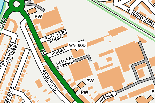
WA4 6QD is located in the Latchford West electoral ward, within the unitary authority of Warrington and the English Parliamentary constituency of Warrington South. The Sub Integrated Care Board (ICB) Location is NHS Cheshire and Merseyside ICB - 02E and the police force is Cheshire. This postcode has been in use since January 1980.


GetTheData
Source: OS OpenMap – Local (Ordnance Survey)
Source: OS VectorMap District (Ordnance Survey)
Licence: Open Government Licence (requires attribution)
| Easting | 360961 |
| Northing | 387353 |
| Latitude | 53.381573 |
| Longitude | -2.588350 |
GetTheData
Source: Open Postcode Geo
Licence: Open Government Licence
| Country | England |
| Postcode District | WA4 |
➜ See where WA4 is on a map ➜ Where is Warrington? | |
GetTheData
Source: Land Registry Price Paid Data
Licence: Open Government Licence
Elevation or altitude of WA4 6QD as distance above sea level:
| Metres | Feet | |
|---|---|---|
| Elevation | 10m | 33ft |
Elevation is measured from the approximate centre of the postcode, to the nearest point on an OS contour line from OS Terrain 50, which has contour spacing of ten vertical metres.
➜ How high above sea level am I? Find the elevation of your current position using your device's GPS.
GetTheData
Source: Open Postcode Elevation
Licence: Open Government Licence
| Ward | Latchford West |
| Constituency | Warrington South |
GetTheData
Source: ONS Postcode Database
Licence: Open Government Licence
| Central Avenue (Wilderspool Causeway) | Wilderspool | 109m |
| Central Avenue (Wilderspool Causeway) | Wilderspool | 137m |
| St James' Court (Wilderspool Causeway) | Wilderspool | 179m |
| St James' Court (Wilderspool Causeway) | Wilderspool | 192m |
| Bus Depot (Wilderspool Causeway) | Warrington | 262m |
| Warrington Bank Quay Station | 1.1km |
| Warrington Central Station | 1.2km |
| Padgate Station | 3.4km |
GetTheData
Source: NaPTAN
Licence: Open Government Licence
GetTheData
Source: ONS Postcode Database
Licence: Open Government Licence


➜ Get more ratings from the Food Standards Agency
GetTheData
Source: Food Standards Agency
Licence: FSA terms & conditions
| Last Collection | |||
|---|---|---|---|
| Location | Mon-Fri | Sat | Distance |
| Causeway | 17:30 | 11:00 | 174m |
| Adamson Street | 17:00 | 11:00 | 341m |
| Centre Park | 17:30 | 11:00 | 520m |
GetTheData
Source: Dracos
Licence: Creative Commons Attribution-ShareAlike
| Risk of WA4 6QD flooding from rivers and sea | Low |
| ➜ WA4 6QD flood map | |
GetTheData
Source: Open Flood Risk by Postcode
Licence: Open Government Licence
The below table lists the International Territorial Level (ITL) codes (formerly Nomenclature of Territorial Units for Statistics (NUTS) codes) and Local Administrative Units (LAU) codes for WA4 6QD:
| ITL 1 Code | Name |
|---|---|
| TLD | North West (England) |
| ITL 2 Code | Name |
| TLD6 | Cheshire |
| ITL 3 Code | Name |
| TLD61 | Warrington |
| LAU 1 Code | Name |
| E06000007 | Warrington |
GetTheData
Source: ONS Postcode Directory
Licence: Open Government Licence
The below table lists the Census Output Area (OA), Lower Layer Super Output Area (LSOA), and Middle Layer Super Output Area (MSOA) for WA4 6QD:
| Code | Name | |
|---|---|---|
| OA | E00063099 | |
| LSOA | E01012510 | Warrington 017D |
| MSOA | E02002606 | Warrington 017 |
GetTheData
Source: ONS Postcode Directory
Licence: Open Government Licence
| WA4 6PZ | Priory Street | 65m |
| WA4 6PY | Fletcher Street | 95m |
| WA4 6PX | Wilderspool Causeway | 138m |
| WA4 6QA | Wilderspool Causeway | 143m |
| WA4 6PU | Wilderspool Causeway | 185m |
| WA4 6QE | Wilderspool Causeway | 195m |
| WA4 6QF | Wilderspool Causeway | 235m |
| WA4 1BX | York Street | 247m |
| WA4 1BU | Canterbury Street | 251m |
| WA4 1BZ | Lord Street | 263m |
GetTheData
Source: Open Postcode Geo; Land Registry Price Paid Data
Licence: Open Government Licence