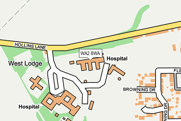
WA2 8WA is located in the Burtonwood and Winwick electoral ward, within the unitary authority of Warrington and the English Parliamentary constituency of Warrington North. The Sub Integrated Care Board (ICB) Location is NHS Cheshire and Merseyside ICB - 02E and the police force is Cheshire. This postcode has been in use since December 1997.


GetTheData
Source: OS OpenMap – Local (Ordnance Survey)
Source: OS VectorMap District (Ordnance Survey)
Licence: Open Government Licence (requires attribution)
| Easting | 359775 |
| Northing | 392697 |
| Latitude | 53.429516 |
| Longitude | -2.606862 |
GetTheData
Source: Open Postcode Geo
Licence: Open Government Licence
| Country | England |
| Postcode District | WA2 |
➜ See where WA2 is on a map | |
GetTheData
Source: Land Registry Price Paid Data
Licence: Open Government Licence
Elevation or altitude of WA2 8WA as distance above sea level:
| Metres | Feet | |
|---|---|---|
| Elevation | 20m | 66ft |
Elevation is measured from the approximate centre of the postcode, to the nearest point on an OS contour line from OS Terrain 50, which has contour spacing of ten vertical metres.
➜ How high above sea level am I? Find the elevation of your current position using your device's GPS.
GetTheData
Source: Open Postcode Elevation
Licence: Open Government Licence
| Ward | Burtonwood And Winwick |
| Constituency | Warrington North |
GetTheData
Source: ONS Postcode Database
Licence: Open Government Licence
| Hollins Park Hospital (Hollins Lane) | Winwick | 161m |
| Hollins Park Hospital (Hollins Lane) | Winwick | 195m |
| Winwick Park (Hollins Lane) | Winwick | 298m |
| Winwick Park (Hollins Lane) | Winwick | 326m |
| St Oswald Church (Hollins Lane) | Winwick | 477m |
| Newton-le-Willows Station | 2.7km |
| Earlestown Station | 3.2km |
| Padgate Station | 4.2km |
GetTheData
Source: NaPTAN
Licence: Open Government Licence
GetTheData
Source: ONS Postcode Database
Licence: Open Government Licence


➜ Get more ratings from the Food Standards Agency
GetTheData
Source: Food Standards Agency
Licence: FSA terms & conditions
| Last Collection | |||
|---|---|---|---|
| Location | Mon-Fri | Sat | Distance |
| Winwick Park | 16:00 | 11:00 | 393m |
| Winwick So | 17:30 | 12:00 | 687m |
| Birch Avenue | 16:00 | 11:00 | 1,156m |
GetTheData
Source: Dracos
Licence: Creative Commons Attribution-ShareAlike
The below table lists the International Territorial Level (ITL) codes (formerly Nomenclature of Territorial Units for Statistics (NUTS) codes) and Local Administrative Units (LAU) codes for WA2 8WA:
| ITL 1 Code | Name |
|---|---|
| TLD | North West (England) |
| ITL 2 Code | Name |
| TLD6 | Cheshire |
| ITL 3 Code | Name |
| TLD61 | Warrington |
| LAU 1 Code | Name |
| E06000007 | Warrington |
GetTheData
Source: ONS Postcode Directory
Licence: Open Government Licence
The below table lists the Census Output Area (OA), Lower Layer Super Output Area (LSOA), and Middle Layer Super Output Area (MSOA) for WA2 8WA:
| Code | Name | |
|---|---|---|
| OA | E00173153 | |
| LSOA | E01012468 | Warrington 003B |
| MSOA | E02002592 | Warrington 003 |
GetTheData
Source: ONS Postcode Directory
Licence: Open Government Licence
| WA2 8RU | Hollins Lane | 214m |
| WA2 8XL | Browning Drive | 294m |
| WA2 8XP | Fleming Drive | 330m |
| WA2 8XQ | Crompton Drive | 331m |
| WA2 8RS | Hollins Drive | 337m |
| WA2 8HD | Ballantyne Place | 376m |
| WA2 8XN | Alcott Place | 403m |
| WA2 8XA | Winwick Park Avenue | 415m |
| WA2 8XB | Winwick Park Avenue | 427m |
| WA2 8XH | Masefield Drive | 438m |
GetTheData
Source: Open Postcode Geo; Land Registry Price Paid Data
Licence: Open Government Licence