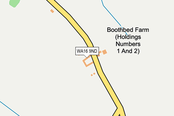
WA16 9ND is located in the Shakerley electoral ward, within the unitary authority of Cheshire West and Chester and the English Parliamentary constituency of Tatton. The Sub Integrated Care Board (ICB) Location is NHS Cheshire and Merseyside ICB - 27D and the police force is Cheshire. This postcode has been in use since January 1980.


GetTheData
Source: OS OpenMap – Local (Ordnance Survey)
Source: OS VectorMap District (Ordnance Survey)
Licence: Open Government Licence (requires attribution)
| Easting | 375969 |
| Northing | 371306 |
| Latitude | 53.238250 |
| Longitude | -2.361514 |
GetTheData
Source: Open Postcode Geo
Licence: Open Government Licence
| Country | England |
| Postcode District | WA16 |
➜ See where WA16 is on a map | |
GetTheData
Source: Land Registry Price Paid Data
Licence: Open Government Licence
Elevation or altitude of WA16 9ND as distance above sea level:
| Metres | Feet | |
|---|---|---|
| Elevation | 50m | 164ft |
Elevation is measured from the approximate centre of the postcode, to the nearest point on an OS contour line from OS Terrain 50, which has contour spacing of ten vertical metres.
➜ How high above sea level am I? Find the elevation of your current position using your device's GPS.
GetTheData
Source: Open Postcode Elevation
Licence: Open Government Licence
| Ward | Shakerley |
| Constituency | Tatton |
GetTheData
Source: ONS Postcode Database
Licence: Open Government Licence
| Townfield Lane (London Road) | Boots Green | 1,347m |
| Booth Bed Lane (Main Road) | Goostrey | 1,414m |
| Booth Bed Lane (Main Road) | Goostrey | 1,431m |
| Princess Road (Chapel Lane) | Allostock | 1,478m |
| Princess Road (Chapel Lane) | Allostock | 1,484m |
| Goostrey Station | 2.9km |
| Holmes Chapel Station | 4.4km |
| Plumley Station | 5.6km |
GetTheData
Source: NaPTAN
Licence: Open Government Licence
| Median download speed | 31.6Mbps |
| Average download speed | 28.6Mbps |
| Maximum download speed | 38.55Mbps |
| Median upload speed | 4.0Mbps |
| Average upload speed | 4.5Mbps |
| Maximum upload speed | 7.08Mbps |
GetTheData
Source: Ofcom
Licence: Ofcom Terms of Use (requires attribution)
GetTheData
Source: ONS Postcode Database
Licence: Open Government Licence


➜ Get more ratings from the Food Standards Agency
GetTheData
Source: Food Standards Agency
Licence: FSA terms & conditions
| Last Collection | |||
|---|---|---|---|
| Location | Mon-Fri | Sat | Distance |
| Booth Bed Lane | 17:00 | 12:00 | 1,404m |
| Chapel Lane | 16:00 | 09:30 | 1,480m |
| Long Lane | 16:00 | 09:45 | 1,797m |
GetTheData
Source: Dracos
Licence: Creative Commons Attribution-ShareAlike
The below table lists the International Territorial Level (ITL) codes (formerly Nomenclature of Territorial Units for Statistics (NUTS) codes) and Local Administrative Units (LAU) codes for WA16 9ND:
| ITL 1 Code | Name |
|---|---|
| TLD | North West (England) |
| ITL 2 Code | Name |
| TLD6 | Cheshire |
| ITL 3 Code | Name |
| TLD63 | Cheshire West and Chester |
| LAU 1 Code | Name |
| E06000050 | Cheshire West and Chester |
GetTheData
Source: ONS Postcode Directory
Licence: Open Government Licence
The below table lists the Census Output Area (OA), Lower Layer Super Output Area (LSOA), and Middle Layer Super Output Area (MSOA) for WA16 9ND:
| Code | Name | |
|---|---|---|
| OA | E00094507 | |
| LSOA | E01018722 | Cheshire West and Chester 017E |
| MSOA | E02003878 | Cheshire West and Chester 017 |
GetTheData
Source: ONS Postcode Directory
Licence: Open Government Licence
| WA16 9NB | Booth Bed Lane | 369m |
| WA16 9LZ | Brick Bank Lane | 448m |
| WA16 9NA | Booth Bed Lane | 496m |
| WA16 9LY | Brick Bank Lane | 723m |
| WA16 9NF | Booth Bed Lane | 734m |
| WA16 9NH | Boots Green Lane | 974m |
| CW4 8ND | Eaton Lane | 1017m |
| CW4 8NB | Booth Bed Lane | 1018m |
| WA16 9NJ | Booth Bed Lane | 1021m |
| CW4 8NP | Harrison Drive | 1031m |
GetTheData
Source: Open Postcode Geo; Land Registry Price Paid Data
Licence: Open Government Licence