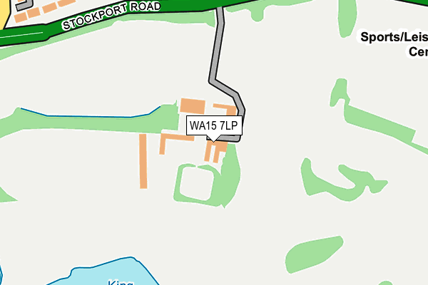
WA15 7LP lies on Stockport Road in Timperley, Altrincham. WA15 7LP is located in the Altrincham electoral ward, within the metropolitan district of Trafford and the English Parliamentary constituency of Altrincham and Sale West. The Sub Integrated Care Board (ICB) Location is NHS Greater Manchester ICB - 02A and the police force is Greater Manchester. This postcode has been in use since January 1980.


GetTheData
Source: OS OpenMap – Local (Ordnance Survey)
Source: OS VectorMap District (Ordnance Survey)
Licence: Open Government Licence (requires attribution)
| Easting | 377733 |
| Northing | 388172 |
| Latitude | 53.389928 |
| Longitude | -2.336275 |
GetTheData
Source: Open Postcode Geo
Licence: Open Government Licence
| Street | Stockport Road |
| Locality | Timperley |
| Town/City | Altrincham |
| Country | England |
| Postcode District | WA15 |
➜ See where WA15 is on a map | |
GetTheData
Source: Land Registry Price Paid Data
Licence: Open Government Licence
Elevation or altitude of WA15 7LP as distance above sea level:
| Metres | Feet | |
|---|---|---|
| Elevation | 30m | 98ft |
Elevation is measured from the approximate centre of the postcode, to the nearest point on an OS contour line from OS Terrain 50, which has contour spacing of ten vertical metres.
➜ How high above sea level am I? Find the elevation of your current position using your device's GPS.
GetTheData
Source: Open Postcode Elevation
Licence: Open Government Licence
| Ward | Altrincham |
| Constituency | Altrincham And Sale West |
GetTheData
Source: ONS Postcode Database
Licence: Open Government Licence
| Stockport Road/The Old Hall (Stockport Road) | Timperley | 195m |
| Stockport Road/The Old Hall (Stockport Road) | Timperley | 203m |
| Stockport Road/Hare And Hounds (Stockport Road) | Timperley | 404m |
| St Vincents School (Orchard Road) | Altrincham | 416m |
| Urban Rd/Blessed Thomas Holford (Urban Road) | Altrincham | 534m |
| Altrincham (Manchester Metrolink) (Stamford New Road) | Altrincham | 742m |
| Navigation Road (Manchester Metrolink) (Navigation Road) | Navigation Road | 756m |
| Altrincham Station | 0.7km |
| Navigation Road Station | 0.8km |
| Hale Station | 1.4km |
GetTheData
Source: NaPTAN
Licence: Open Government Licence
GetTheData
Source: ONS Postcode Database
Licence: Open Government Licence


➜ Get more ratings from the Food Standards Agency
GetTheData
Source: Food Standards Agency
Licence: FSA terms & conditions
| Last Collection | |||
|---|---|---|---|
| Location | Mon-Fri | Sat | Distance |
| Beeston Avenue | 16:00 | 11:00 | 355m |
| Delivery Office | 18:30 | 489m | |
| Delivery Office | 18:30 | 12:00 | 495m |
GetTheData
Source: Dracos
Licence: Creative Commons Attribution-ShareAlike
The below table lists the International Territorial Level (ITL) codes (formerly Nomenclature of Territorial Units for Statistics (NUTS) codes) and Local Administrative Units (LAU) codes for WA15 7LP:
| ITL 1 Code | Name |
|---|---|
| TLD | North West (England) |
| ITL 2 Code | Name |
| TLD3 | Greater Manchester |
| ITL 3 Code | Name |
| TLD34 | Greater Manchester South West |
| LAU 1 Code | Name |
| E08000009 | Trafford |
GetTheData
Source: ONS Postcode Directory
Licence: Open Government Licence
The below table lists the Census Output Area (OA), Lower Layer Super Output Area (LSOA), and Middle Layer Super Output Area (MSOA) for WA15 7LP:
| Code | Name | |
|---|---|---|
| OA | E00031410 | |
| LSOA | E01006192 | Trafford 023C |
| MSOA | E02001281 | Trafford 023 |
GetTheData
Source: ONS Postcode Directory
Licence: Open Government Licence
| WA15 7LR | Stockport Road | 242m |
| WA15 7LH | Stockport Road | 269m |
| WA15 7RX | Beeston Avenue | 291m |
| WA15 7RJ | Wellington Road | 301m |
| WA15 7RY | Southvale Crescent | 316m |
| WA15 7QQ | Woodlands Court | 324m |
| WA15 7RH | Wellington Road | 334m |
| WA15 7GP | Lynton Grove | 343m |
| WA15 7RL | Westvale Road | 345m |
| WA15 7QN | Woodlands Parkway | 364m |
GetTheData
Source: Open Postcode Geo; Land Registry Price Paid Data
Licence: Open Government Licence