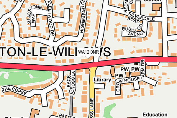
WA12 0NR is located in the Newton-le-Willows West electoral ward, within the metropolitan district of St. Helens and the English Parliamentary constituency of St Helens North. The Sub Integrated Care Board (ICB) Location is NHS Cheshire and Merseyside ICB - 01X and the police force is Merseyside. This postcode has been in use since January 2014.


GetTheData
Source: OS OpenMap – Local (Ordnance Survey)
Source: OS VectorMap District (Ordnance Survey)
Licence: Open Government Licence (requires attribution)
| Easting | 357686 |
| Northing | 395704 |
| Latitude | 53.456379 |
| Longitude | -2.638706 |
GetTheData
Source: Open Postcode Geo
Licence: Open Government Licence
| Country | England |
| Postcode District | WA12 |
➜ See where WA12 is on a map ➜ Where is Newton-le-Willows? | |
GetTheData
Source: Land Registry Price Paid Data
Licence: Open Government Licence
Elevation or altitude of WA12 0NR as distance above sea level:
| Metres | Feet | |
|---|---|---|
| Elevation | 30m | 98ft |
Elevation is measured from the approximate centre of the postcode, to the nearest point on an OS contour line from OS Terrain 50, which has contour spacing of ten vertical metres.
➜ How high above sea level am I? Find the elevation of your current position using your device's GPS.
GetTheData
Source: Open Postcode Elevation
Licence: Open Government Licence
| Ward | Newton-le-willows West |
| Constituency | St Helens North |
GetTheData
Source: ONS Postcode Database
Licence: Open Government Licence
| Black Cross Lane (Crow Lane West) | Crow Lane | 63m |
| Crow Lane East (Cross Lane) | Earlestown | 88m |
| Crow Lane West (Cross Lane) | Earlestown | 139m |
| The Copse (Crow Lane West) | Crow Lane | 169m |
| Silverdale Road (Belvedere Road) | Crow Lane | 202m |
| Earlestown Station | 0.6km |
| Newton-le-Willows Station | 1.7km |
| Garswood Station | 4.2km |
GetTheData
Source: NaPTAN
Licence: Open Government Licence
GetTheData
Source: ONS Postcode Database
Licence: Open Government Licence


➜ Get more ratings from the Food Standards Agency
GetTheData
Source: Food Standards Agency
Licence: FSA terms & conditions
| Last Collection | |||
|---|---|---|---|
| Location | Mon-Fri | Sat | Distance |
| Crow Lane S.o. | 16:30 | 12:00 | 342m |
| 101 Vista Road | 16:15 | 11:00 | 465m |
| Makerfield Drive | 16:15 | 11:00 | 513m |
GetTheData
Source: Dracos
Licence: Creative Commons Attribution-ShareAlike
The below table lists the International Territorial Level (ITL) codes (formerly Nomenclature of Territorial Units for Statistics (NUTS) codes) and Local Administrative Units (LAU) codes for WA12 0NR:
| ITL 1 Code | Name |
|---|---|
| TLD | North West (England) |
| ITL 2 Code | Name |
| TLD7 | Merseyside |
| ITL 3 Code | Name |
| TLD71 | East Merseyside |
| LAU 1 Code | Name |
| E08000013 | St. Helens |
GetTheData
Source: ONS Postcode Directory
Licence: Open Government Licence
The below table lists the Census Output Area (OA), Lower Layer Super Output Area (LSOA), and Middle Layer Super Output Area (MSOA) for WA12 0NR:
| Code | Name | |
|---|---|---|
| OA | E00034800 | |
| LSOA | E01006867 | St. Helens 010B |
| MSOA | E02001415 | St. Helens 010 |
GetTheData
Source: ONS Postcode Directory
Licence: Open Government Licence
| WA12 9WG | Randall Close | 43m |
| WA12 9YD | Crow Lane West | 54m |
| WA12 0JJ | Belvedere Road | 91m |
| WA12 9WQ | Townfield Walk | 93m |
| WA12 9QA | Cross Lane | 112m |
| WA12 9QB | Cross Lane | 132m |
| WA12 9TY | Crow House Farm Drive | 151m |
| WA12 9TX | Crow Lane East | 153m |
| WA12 9WN | Assheton Close | 157m |
| WA12 9WF | Highmarsh Crescent | 176m |
GetTheData
Source: Open Postcode Geo; Land Registry Price Paid Data
Licence: Open Government Licence