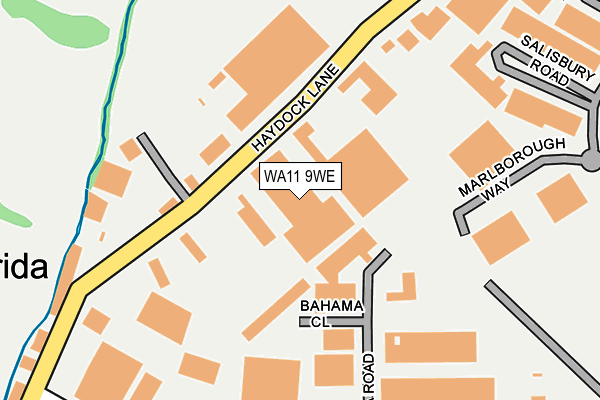
WA11 9WE is located in the Haydock electoral ward, within the metropolitan district of St. Helens and the English Parliamentary constituency of St Helens North. The Sub Integrated Care Board (ICB) Location is NHS Cheshire and Merseyside ICB - 01X and the police force is Merseyside. This postcode has been in use since February 2010.


GetTheData
Source: OS OpenMap – Local (Ordnance Survey)
Source: OS VectorMap District (Ordnance Survey)
Licence: Open Government Licence (requires attribution)
| Easting | 355900 |
| Northing | 397830 |
| Latitude | 53.475340 |
| Longitude | -2.665899 |
GetTheData
Source: Open Postcode Geo
Licence: Open Government Licence
| Country | England |
| Postcode District | WA11 |
➜ See where WA11 is on a map ➜ Where is Haydock? | |
GetTheData
Source: Land Registry Price Paid Data
Licence: Open Government Licence
Elevation or altitude of WA11 9WE as distance above sea level:
| Metres | Feet | |
|---|---|---|
| Elevation | 60m | 197ft |
Elevation is measured from the approximate centre of the postcode, to the nearest point on an OS contour line from OS Terrain 50, which has contour spacing of ten vertical metres.
➜ How high above sea level am I? Find the elevation of your current position using your device's GPS.
GetTheData
Source: Open Postcode Elevation
Licence: Open Government Licence
| Ward | Haydock |
| Constituency | St Helens North |
GetTheData
Source: ONS Postcode Database
Licence: Open Government Licence
| Andover Road (Millfield Lane) | North Florida | 465m |
| Andover Road (Millfield Lane) | North Florida | 484m |
| Bluebell Avenue (Piele Road) | New Boston | 502m |
| Bluebell Avenue (Piele Road) | New Boston | 516m |
| Piele Road (Millfield Lane) | North Florida | 549m |
| Garswood Station | 1.5km |
| Bryn Station | 3km |
| Earlestown Station | 3.3km |
GetTheData
Source: NaPTAN
Licence: Open Government Licence
GetTheData
Source: ONS Postcode Database
Licence: Open Government Licence


➜ Get more ratings from the Food Standards Agency
GetTheData
Source: Food Standards Agency
Licence: FSA terms & conditions
| Last Collection | |||
|---|---|---|---|
| Location | Mon-Fri | Sat | Distance |
| North Florida Road | 18:15 | 321m | |
| North Florida Road | 18:15 | 07:15 | 322m |
| Kilbuck Lane | 18:15 | 708m | |
GetTheData
Source: Dracos
Licence: Creative Commons Attribution-ShareAlike
The below table lists the International Territorial Level (ITL) codes (formerly Nomenclature of Territorial Units for Statistics (NUTS) codes) and Local Administrative Units (LAU) codes for WA11 9WE:
| ITL 1 Code | Name |
|---|---|
| TLD | North West (England) |
| ITL 2 Code | Name |
| TLD7 | Merseyside |
| ITL 3 Code | Name |
| TLD71 | East Merseyside |
| LAU 1 Code | Name |
| E08000013 | St. Helens |
GetTheData
Source: ONS Postcode Directory
Licence: Open Government Licence
The below table lists the Census Output Area (OA), Lower Layer Super Output Area (LSOA), and Middle Layer Super Output Area (MSOA) for WA11 9WE:
| Code | Name | |
|---|---|---|
| OA | E00034681 | |
| LSOA | E01006840 | St. Helens 005C |
| MSOA | E02001410 | St. Helens 005 |
GetTheData
Source: ONS Postcode Directory
Licence: Open Government Licence
| WA11 9UY | Haydock Lane | 133m |
| WA11 0GR | Galway Crescent | 344m |
| WA11 0GA | Bluebell Avenue | 432m |
| WA11 9TB | Millfield Lane | 455m |
| WA11 0GN | Cavan Drive | 458m |
| WA11 0GB | Peach Grove | 474m |
| WA11 0GD | Primrose Grove | 482m |
| WA11 0YE | Great Delph | 491m |
| WA11 0FE | Chisledon Close | 540m |
| WA11 0GP | Wexford Close | 547m |
GetTheData
Source: Open Postcode Geo; Land Registry Price Paid Data
Licence: Open Government Licence