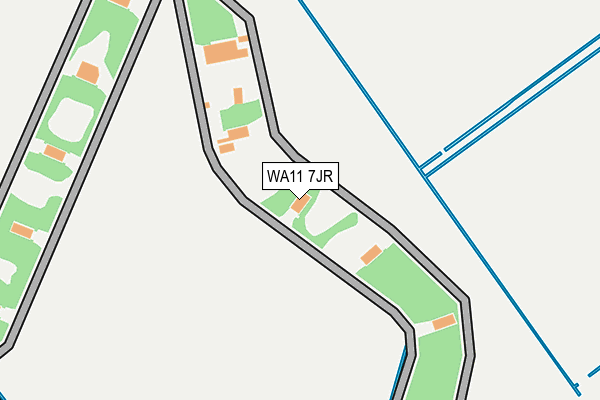
WA11 7JR is located in the Rainford electoral ward, within the metropolitan district of St. Helens and the English Parliamentary constituency of St Helens North. The Sub Integrated Care Board (ICB) Location is NHS Cheshire and Merseyside ICB - 01X and the police force is Merseyside. This postcode has been in use since June 1998.


GetTheData
Source: OS OpenMap – Local (Ordnance Survey)
Source: OS VectorMap District (Ordnance Survey)
Licence: Open Government Licence (requires attribution)
| Easting | 346334 |
| Northing | 400529 |
| Latitude | 53.498707 |
| Longitude | -2.810473 |
GetTheData
Source: Open Postcode Geo
Licence: Open Government Licence
| Country | England |
| Postcode District | WA11 |
➜ See where WA11 is on a map | |
GetTheData
Source: Land Registry Price Paid Data
Licence: Open Government Licence
Elevation or altitude of WA11 7JR as distance above sea level:
| Metres | Feet | |
|---|---|---|
| Elevation | 40m | 131ft |
Elevation is measured from the approximate centre of the postcode, to the nearest point on an OS contour line from OS Terrain 50, which has contour spacing of ten vertical metres.
➜ How high above sea level am I? Find the elevation of your current position using your device's GPS.
GetTheData
Source: Open Postcode Elevation
Licence: Open Government Licence
| Ward | Rainford |
| Constituency | St Helens North |
GetTheData
Source: ONS Postcode Database
Licence: Open Government Licence
| Moss Brow (Ormskirk Road) | Rainford | 1,370m |
| Old Lane (Ormskirk Road) | Rainford | 1,387m |
| Lords Fold (Ormskirk Road) | Rainford | 1,403m |
| Lords Fold (Ormskirk Road) | Rainford | 1,403m |
| Alfred Street (Ormskirk Road) | Rainford | 1,441m |
| Rainford Station | 2.5km |
| Upholland Station | 5.6km |
GetTheData
Source: NaPTAN
Licence: Open Government Licence
GetTheData
Source: ONS Postcode Database
Licence: Open Government Licence


➜ Get more ratings from the Food Standards Agency
GetTheData
Source: Food Standards Agency
Licence: FSA terms & conditions
| Last Collection | |||
|---|---|---|---|
| Location | Mon-Fri | Sat | Distance |
| Ormskirk Road | 17:15 | 09:30 | 1,450m |
| Ormskirk Road | 17:30 | 11:00 | 1,487m |
| Rainford Post Office | 17:30 | 12:00 | 1,659m |
GetTheData
Source: Dracos
Licence: Creative Commons Attribution-ShareAlike
The below table lists the International Territorial Level (ITL) codes (formerly Nomenclature of Territorial Units for Statistics (NUTS) codes) and Local Administrative Units (LAU) codes for WA11 7JR:
| ITL 1 Code | Name |
|---|---|
| TLD | North West (England) |
| ITL 2 Code | Name |
| TLD7 | Merseyside |
| ITL 3 Code | Name |
| TLD71 | East Merseyside |
| LAU 1 Code | Name |
| E08000013 | St. Helens |
GetTheData
Source: ONS Postcode Directory
Licence: Open Government Licence
The below table lists the Census Output Area (OA), Lower Layer Super Output Area (LSOA), and Middle Layer Super Output Area (MSOA) for WA11 7JR:
| Code | Name | |
|---|---|---|
| OA | E00034906 | |
| LSOA | E01006883 | St. Helens 001B |
| MSOA | E02001406 | St. Helens 001 |
GetTheData
Source: ONS Postcode Directory
Licence: Open Government Licence
| WA11 7JQ | Dairy Farm Road | 458m |
| WA11 8AB | Lords Fold | 1095m |
| WA11 8AD | Parsons Brow | 1152m |
| WA11 8HP | Lords Fold | 1157m |
| WA11 8DP | Pine Dale | 1189m |
| WA11 8DZ | Fern Bank | 1209m |
| WA11 8DL | Beech Gardens | 1215m |
| WA11 8AF | Moss Nook Lane | 1234m |
| WA11 8DN | Beech Gardens | 1252m |
| WA11 8DF | Brookside Avenue | 1253m |
GetTheData
Source: Open Postcode Geo; Land Registry Price Paid Data
Licence: Open Government Licence