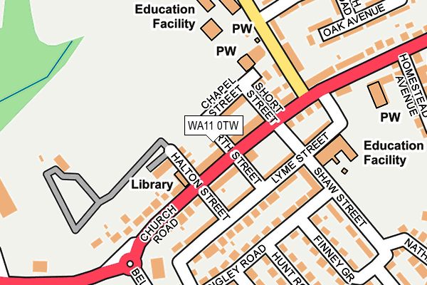
WA11 0TW lies on North Street in Haydock, St. Helens. WA11 0TW is located in the Haydock electoral ward, within the metropolitan district of St. Helens and the English Parliamentary constituency of St Helens North. The Sub Integrated Care Board (ICB) Location is NHS Cheshire and Merseyside ICB - 01X and the police force is Merseyside. This postcode has been in use since January 1980.


GetTheData
Source: OS OpenMap – Local (Ordnance Survey)
Source: OS VectorMap District (Ordnance Survey)
Licence: Open Government Licence (requires attribution)
| Easting | 356096 |
| Northing | 396926 |
| Latitude | 53.467232 |
| Longitude | -2.662820 |
GetTheData
Source: Open Postcode Geo
Licence: Open Government Licence
| Street | North Street |
| Locality | Haydock |
| Town/City | St. Helens |
| Country | England |
| Postcode District | WA11 |
➜ See where WA11 is on a map ➜ Where is Haydock? | |
GetTheData
Source: Land Registry Price Paid Data
Licence: Open Government Licence
Elevation or altitude of WA11 0TW as distance above sea level:
| Metres | Feet | |
|---|---|---|
| Elevation | 50m | 164ft |
Elevation is measured from the approximate centre of the postcode, to the nearest point on an OS contour line from OS Terrain 50, which has contour spacing of ten vertical metres.
➜ How high above sea level am I? Find the elevation of your current position using your device's GPS.
GetTheData
Source: Open Postcode Elevation
Licence: Open Government Licence
| Ward | Haydock |
| Constituency | St Helens North |
GetTheData
Source: ONS Postcode Database
Licence: Open Government Licence
| North Street (Church Road) | New Boston | 48m |
| North Street (Church Road) | New Boston | 57m |
| Halton Street (Church Road) | New Boston | 165m |
| Birch Road (Piele Road) | New Boston | 248m |
| Bellerophon Way (Church Road) | New Boston | 253m |
| Garswood Station | 2.4km |
| Earlestown Station | 2.4km |
| Newton-le-Willows Station | 3.6km |
GetTheData
Source: NaPTAN
Licence: Open Government Licence
GetTheData
Source: ONS Postcode Database
Licence: Open Government Licence


➜ Get more ratings from the Food Standards Agency
GetTheData
Source: Food Standards Agency
Licence: FSA terms & conditions
| Last Collection | |||
|---|---|---|---|
| Location | Mon-Fri | Sat | Distance |
| North Florida Road | 18:15 | 844m | |
| North Florida Road | 18:15 | 07:15 | 846m |
| Cooper Lane | 16:45 | 11:00 | 890m |
GetTheData
Source: Dracos
Licence: Creative Commons Attribution-ShareAlike
The below table lists the International Territorial Level (ITL) codes (formerly Nomenclature of Territorial Units for Statistics (NUTS) codes) and Local Administrative Units (LAU) codes for WA11 0TW:
| ITL 1 Code | Name |
|---|---|
| TLD | North West (England) |
| ITL 2 Code | Name |
| TLD7 | Merseyside |
| ITL 3 Code | Name |
| TLD71 | East Merseyside |
| LAU 1 Code | Name |
| E08000013 | St. Helens |
GetTheData
Source: ONS Postcode Directory
Licence: Open Government Licence
The below table lists the Census Output Area (OA), Lower Layer Super Output Area (LSOA), and Middle Layer Super Output Area (MSOA) for WA11 0TW:
| Code | Name | |
|---|---|---|
| OA | E00034665 | |
| LSOA | E01006838 | St. Helens 006B |
| MSOA | E02001411 | St. Helens 006 |
GetTheData
Source: ONS Postcode Directory
Licence: Open Government Licence
| WA11 0TP | Church Road | 28m |
| WA11 0TN | Church Road | 50m |
| WA11 0TL | Church Road | 54m |
| WA11 0JX | Chapel Street | 71m |
| WA11 0TS | Chapel Street | 74m |
| WA11 0NL | Lyme Street | 84m |
| WA11 0LA | Church Road | 110m |
| WA11 0TQ | Church Road | 113m |
| WA11 0TH | Church Road | 133m |
| WA11 0NU | Wrigley Road | 141m |
GetTheData
Source: Open Postcode Geo; Land Registry Price Paid Data
Licence: Open Government Licence