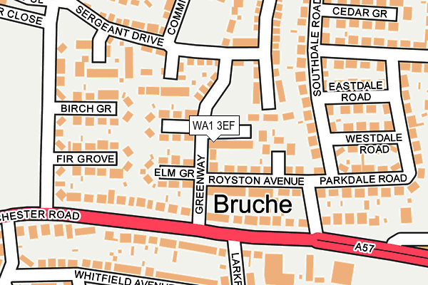
WA1 3EF is located in the Poulton South electoral ward, within the unitary authority of Warrington and the English Parliamentary constituency of Warrington North. The Sub Integrated Care Board (ICB) Location is NHS Cheshire and Merseyside ICB - 02E and the police force is Cheshire. This postcode has been in use since January 1980.


GetTheData
Source: OS OpenMap – Local (Ordnance Survey)
Source: OS VectorMap District (Ordnance Survey)
Licence: Open Government Licence (requires attribution)
| Easting | 362973 |
| Northing | 389239 |
| Latitude | 53.398670 |
| Longitude | -2.558327 |
GetTheData
Source: Open Postcode Geo
Licence: Open Government Licence
| Country | England |
| Postcode District | WA1 |
➜ See where WA1 is on a map ➜ Where is Warrington? | |
GetTheData
Source: Land Registry Price Paid Data
Licence: Open Government Licence
Elevation or altitude of WA1 3EF as distance above sea level:
| Metres | Feet | |
|---|---|---|
| Elevation | 10m | 33ft |
Elevation is measured from the approximate centre of the postcode, to the nearest point on an OS contour line from OS Terrain 50, which has contour spacing of ten vertical metres.
➜ How high above sea level am I? Find the elevation of your current position using your device's GPS.
GetTheData
Source: Open Postcode Elevation
Licence: Open Government Licence
| Ward | Poulton South |
| Constituency | Warrington North |
GetTheData
Source: ONS Postcode Database
Licence: Open Government Licence
| Greenway (Manchester Road) | Bruche | 134m |
| Greenway (Manchester Road) | Bruche | 136m |
| Bruche Bridge (Manchester Road) | Bruche | 332m |
| Alford Hall (Manchester Road) | Bruche | 479m |
| Shops (Green Lane) | Paddington | 565m |
| Padgate Station | 0.8km |
| Warrington Central Station | 2.4km |
| Birchwood Station | 2.7km |
GetTheData
Source: NaPTAN
Licence: Open Government Licence
GetTheData
Source: ONS Postcode Database
Licence: Open Government Licence


➜ Get more ratings from the Food Standards Agency
GetTheData
Source: Food Standards Agency
Licence: FSA terms & conditions
| Last Collection | |||
|---|---|---|---|
| Location | Mon-Fri | Sat | Distance |
| Lambs Lane | 17:30 | 11:00 | 145m |
| Bruche S0 | 17:30 | 12:00 | 432m |
| Bruche Heath Gardens | 17:30 | 11:00 | 543m |
GetTheData
Source: Dracos
Licence: Creative Commons Attribution-ShareAlike
The below table lists the International Territorial Level (ITL) codes (formerly Nomenclature of Territorial Units for Statistics (NUTS) codes) and Local Administrative Units (LAU) codes for WA1 3EF:
| ITL 1 Code | Name |
|---|---|
| TLD | North West (England) |
| ITL 2 Code | Name |
| TLD6 | Cheshire |
| ITL 3 Code | Name |
| TLD61 | Warrington |
| LAU 1 Code | Name |
| E06000007 | Warrington |
GetTheData
Source: ONS Postcode Directory
Licence: Open Government Licence
The below table lists the Census Output Area (OA), Lower Layer Super Output Area (LSOA), and Middle Layer Super Output Area (MSOA) for WA1 3EF:
| Code | Name | |
|---|---|---|
| OA | E00063289 | |
| LSOA | E01012550 | Warrington 012E |
| MSOA | E02002601 | Warrington 012 |
GetTheData
Source: ONS Postcode Directory
Licence: Open Government Licence
| WA1 3EE | Greenway | 31m |
| WA1 3EA | Westbridge Mews | 45m |
| WA1 3GS | Commander Drive | 71m |
| WA1 3EQ | Hawthorne Grove | 78m |
| WA1 3EH | Elm Grove | 90m |
| WA1 3EJ | Royston Avenue | 90m |
| WA1 3EL | Beech Grove | 93m |
| WA1 3HT | Manchester Road | 129m |
| WA1 3HL | Southdale Road | 142m |
| WA1 3HU | Manchester Road | 144m |
GetTheData
Source: Open Postcode Geo; Land Registry Price Paid Data
Licence: Open Government Licence