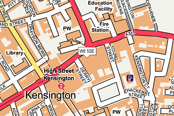
W8 5SE is located in the Queen's Gate electoral ward, within the London borough of Kensington and Chelsea and the English Parliamentary constituency of Kensington. The Sub Integrated Care Board (ICB) Location is NHS North West London ICB - W2U3Z and the police force is Metropolitan Police. This postcode has been in use since January 1980.


GetTheData
Source: OS OpenMap – Local (Ordnance Survey)
Source: OS VectorMap District (Ordnance Survey)
Licence: Open Government Licence (requires attribution)
| Easting | 525652 |
| Northing | 179627 |
| Latitude | 51.501621 |
| Longitude | -0.191098 |
GetTheData
Source: Open Postcode Geo
Licence: Open Government Licence
| Country | England |
| Postcode District | W8 |
➜ See where W8 is on a map ➜ Where is Kensington? | |
GetTheData
Source: Land Registry Price Paid Data
Licence: Open Government Licence
Elevation or altitude of W8 5SE as distance above sea level:
| Metres | Feet | |
|---|---|---|
| Elevation | 10m | 33ft |
Elevation is measured from the approximate centre of the postcode, to the nearest point on an OS contour line from OS Terrain 50, which has contour spacing of ten vertical metres.
➜ How high above sea level am I? Find the elevation of your current position using your device's GPS.
GetTheData
Source: Open Postcode Elevation
Licence: Open Government Licence
| Ward | Queen's Gate |
| Constituency | Kensington |
GetTheData
Source: ONS Postcode Database
Licence: Open Government Licence
| High Street Kensington (Kensington High Street) | High Street Kensington | 70m |
| High Street Kensington (Kensington High Street) | High Street Kensington | 85m |
| High Street Kensington (Kensington High Street) | High Street Kensington | 159m |
| Holland St High St Kensington (Kensington Church Street) | Kensington | 168m |
| High Street Kensington (Kensington High Street) | High Street Kensington | 176m |
| High Street Kensington Underground Station | High Street Kensington | 133m |
| Notting Hill Gate Underground Station | Notting Hill | 904m |
| Gloucester Road Underground Station | Gloucester Road | 1,002m |
| Queensway Underground Station | Queensway | 1,005m |
| Earl's Court Underground Station | Earls Court | 1,075m |
| Kensington (Olympia) Station | 1.4km |
| West Brompton Station | 1.6km |
| Shepherds Bush Station | 1.9km |
GetTheData
Source: NaPTAN
Licence: Open Government Licence
GetTheData
Source: ONS Postcode Database
Licence: Open Government Licence


➜ Get more ratings from the Food Standards Agency
GetTheData
Source: Food Standards Agency
Licence: FSA terms & conditions
| Last Collection | |||
|---|---|---|---|
| Location | Mon-Fri | Sat | Distance |
| High Street Kensington | 18:30 | 12:00 | 52m |
| Young Street | 18:30 | 12:00 | 77m |
| Wrights Lane | 17:30 | 12:00 | 216m |
GetTheData
Source: Dracos
Licence: Creative Commons Attribution-ShareAlike
The below table lists the International Territorial Level (ITL) codes (formerly Nomenclature of Territorial Units for Statistics (NUTS) codes) and Local Administrative Units (LAU) codes for W8 5SE:
| ITL 1 Code | Name |
|---|---|
| TLI | London |
| ITL 2 Code | Name |
| TLI3 | Inner London - West |
| ITL 3 Code | Name |
| TLI33 | Kensington & Chelsea and Hammersmith & Fulham |
| LAU 1 Code | Name |
| E09000020 | Kensington and Chelsea |
GetTheData
Source: ONS Postcode Directory
Licence: Open Government Licence
The below table lists the Census Output Area (OA), Lower Layer Super Output Area (LSOA), and Middle Layer Super Output Area (MSOA) for W8 5SE:
| Code | Name | |
|---|---|---|
| OA | E00014519 | |
| LSOA | E01002889 | Kensington and Chelsea 010B |
| MSOA | E02000586 | Kensington and Chelsea 010 |
GetTheData
Source: ONS Postcode Directory
Licence: Open Government Licence
| W8 4SP | Kensington Church Court | 63m |
| W8 4SG | Kensington High Street | 78m |
| W8 5HP | Kensington Square | 90m |
| W8 4PD | Old Court Place | 115m |
| W8 5ED | Kensington High Street | 119m |
| W8 4EP | Kensington Church Street | 126m |
| W8 4LD | Kensington Church Street | 127m |
| W8 4LZ | Hornton Place | 135m |
| W8 5BB | Palace Place Mansions | 136m |
| W8 5BA | Kensington High Street | 146m |
GetTheData
Source: Open Postcode Geo; Land Registry Price Paid Data
Licence: Open Government Licence