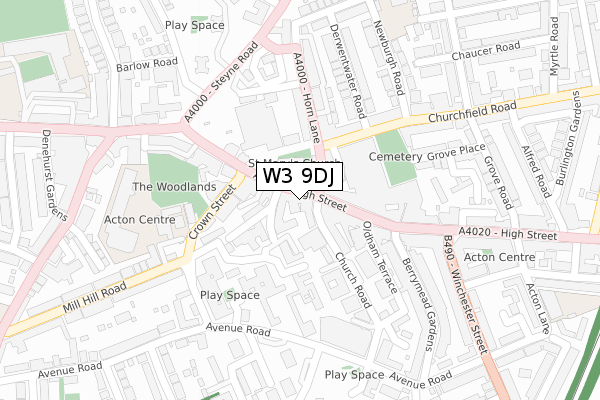
W3 9DJ lies on High Street in London. W3 9DJ is located in the South Acton electoral ward, within the London borough of Ealing and the English Parliamentary constituency of Ealing Central and Acton. The Sub Integrated Care Board (ICB) Location is NHS North West London ICB - W2U3Z and the police force is Metropolitan Police. This postcode has been in use since January 1980.


GetTheData
Source: OS Open Zoomstack (Ordnance Survey)
Licence: Open Government Licence (requires attribution)
Attribution: Contains OS data © Crown copyright and database right 2025
Source: Open Postcode Geo
Licence: Open Government Licence (requires attribution)
Attribution: Contains OS data © Crown copyright and database right 2025; Contains Royal Mail data © Royal Mail copyright and database right 2025; Source: Office for National Statistics licensed under the Open Government Licence v.3.0
| Easting | 520042 |
| Northing | 180116 |
| Latitude | 51.507234 |
| Longitude | -0.271716 |
GetTheData
Source: Open Postcode Geo
Licence: Open Government Licence
| Street | High Street |
| Town/City | London |
| Country | England |
| Postcode District | W3 |
➜ See where W3 is on a map ➜ Where is Acton? | |
GetTheData
Source: Land Registry Price Paid Data
Licence: Open Government Licence
Elevation or altitude of W3 9DJ as distance above sea level:
| Metres | Feet | |
|---|---|---|
| Elevation | 20m | 66ft |
Elevation is measured from the approximate centre of the postcode, to the nearest point on an OS contour line from OS Terrain 50, which has contour spacing of ten vertical metres.
➜ How high above sea level am I? Find the elevation of your current position using your device's GPS.
GetTheData
Source: Open Postcode Elevation
Licence: Open Government Licence
| Ward | South Acton |
| Constituency | Ealing Central And Acton |
GetTheData
Source: ONS Postcode Database
Licence: Open Government Licence
| King Street (W3) (Acton High Street) | Acton | 121m |
| Acton Market Place | Acton | 144m |
| Steyne Road (Acton High Street) | Acton | 176m |
| Rectory Road Acton | Acton | 180m |
| Acton Old Town Hall (Acton High Street) | Acton | 204m |
| Acton Town Underground Station | Acton Town | 765m |
| Ealing Common Underground Station | Ealing Common | 1,193m |
| West Acton Underground Station | West Acton | 1,359m |
| Chiswick Park Underground Station | Chiswick Park | 1,426m |
| North Ealing Underground Station | North Ealing | 1,650m |
| Acton Central Station | 0.6km |
| South Acton Station | 0.8km |
| Acton Main Line Station | 1.2km |
GetTheData
Source: NaPTAN
Licence: Open Government Licence
GetTheData
Source: ONS Postcode Database
Licence: Open Government Licence


➜ Get more ratings from the Food Standards Agency
GetTheData
Source: Food Standards Agency
Licence: FSA terms & conditions
| Last Collection | |||
|---|---|---|---|
| Location | Mon-Fri | Sat | Distance |
| Acton Post Office | 18:30 | 12:00 | 89m |
| High Street | 17:30 | 12:00 | 123m |
| Mill Hill Road | 17:30 | 12:00 | 229m |
GetTheData
Source: Dracos
Licence: Creative Commons Attribution-ShareAlike
The below table lists the International Territorial Level (ITL) codes (formerly Nomenclature of Territorial Units for Statistics (NUTS) codes) and Local Administrative Units (LAU) codes for W3 9DJ:
| ITL 1 Code | Name |
|---|---|
| TLI | London |
| ITL 2 Code | Name |
| TLI7 | Outer London - West and North West |
| ITL 3 Code | Name |
| TLI73 | Ealing |
| LAU 1 Code | Name |
| E09000009 | Ealing |
GetTheData
Source: ONS Postcode Directory
Licence: Open Government Licence
The below table lists the Census Output Area (OA), Lower Layer Super Output Area (LSOA), and Middle Layer Super Output Area (MSOA) for W3 9DJ:
| Code | Name | |
|---|---|---|
| OA | E00006752 | |
| LSOA | E01001351 | Ealing 025E |
| MSOA | E02000262 | Ealing 025 |
GetTheData
Source: ONS Postcode Directory
Licence: Open Government Licence
| W3 9NN | High Street | 27m |
| W3 8PN | Church Road | 46m |
| W3 9DF | High Street | 57m |
| W3 6AL | Market Place | 61m |
| W3 9DD | High Street | 74m |
| W3 6LP | High Street | 75m |
| W3 8PU | Church Road | 77m |
| W3 6QZ | High Street | 82m |
| W3 6QS | Market Place | 85m |
| W3 6AJ | Hoopers Mews | 88m |
GetTheData
Source: Open Postcode Geo; Land Registry Price Paid Data
Licence: Open Government Licence