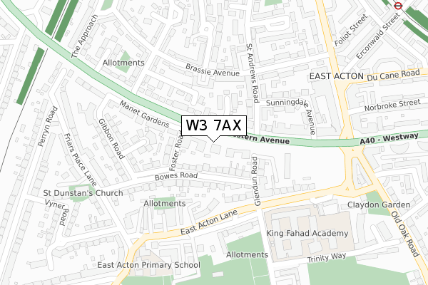
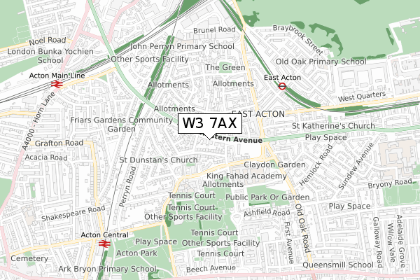
W3 7AX is located in the East Acton electoral ward, within the London borough of Ealing and the English Parliamentary constituency of Ealing Central and Acton. The Sub Integrated Care Board (ICB) Location is NHS North West London ICB - W2U3Z and the police force is Metropolitan Police. This postcode has been in use since February 2019.


GetTheData
Source: OS Open Zoomstack (Ordnance Survey)
Licence: Open Government Licence (requires attribution)
Attribution: Contains OS data © Crown copyright and database right 2025
Source: Open Postcode Geo
Licence: Open Government Licence (requires attribution)
Attribution: Contains OS data © Crown copyright and database right 2025; Contains Royal Mail data © Royal Mail copyright and database right 2025; Source: Office for National Statistics licensed under the Open Government Licence v.3.0
| Easting | 521350 |
| Northing | 180865 |
| Latitude | 51.513688 |
| Longitude | -0.252598 |
GetTheData
Source: Open Postcode Geo
Licence: Open Government Licence
| Country | England |
| Postcode District | W3 |
➜ See where W3 is on a map ➜ Where is Acton? | |
GetTheData
Source: Land Registry Price Paid Data
Licence: Open Government Licence
| Ward | East Acton |
| Constituency | Ealing Central And Acton |
GetTheData
Source: ONS Postcode Database
Licence: Open Government Licence
| Foster Road (Western Avenue) | East Acton | 101m |
| Western Avenuesavoy Circus | East Acton | 108m |
| King Fahad Academy (East Acton Lane) | East Acton | 155m |
| Glendun Road (East Acton Lane) | East Acton | 157m |
| Western Avenuesavoy Circus | East Acton | 190m |
| East Acton Underground Station | East Acton | 495m |
| North Acton Underground Station | North Acton | 1,201m |
| Acton Central Station | 0.9km |
| Acton Main Line Station | 1.1km |
| South Acton Station | 2km |
GetTheData
Source: NaPTAN
Licence: Open Government Licence
| Percentage of properties with Next Generation Access | 100.0% |
| Percentage of properties with Superfast Broadband | 100.0% |
| Percentage of properties with Ultrafast Broadband | 0.0% |
| Percentage of properties with Full Fibre Broadband | 0.0% |
Superfast Broadband is between 30Mbps and 300Mbps
Ultrafast Broadband is > 300Mbps
| Percentage of properties unable to receive 2Mbps | 0.0% |
| Percentage of properties unable to receive 5Mbps | 0.0% |
| Percentage of properties unable to receive 10Mbps | 0.0% |
| Percentage of properties unable to receive 30Mbps | 0.0% |
GetTheData
Source: Ofcom
Licence: Ofcom Terms of Use (requires attribution)
GetTheData
Source: ONS Postcode Database
Licence: Open Government Licence


➜ Get more ratings from the Food Standards Agency
GetTheData
Source: Food Standards Agency
Licence: FSA terms & conditions
| Last Collection | |||
|---|---|---|---|
| Location | Mon-Fri | Sat | Distance |
| East Lane | 17:30 | 12:00 | 123m |
| East Acton Lane | 17:30 | 12:00 | 260m |
| East Acton Post Office | 18:30 | 12:00 | 276m |
GetTheData
Source: Dracos
Licence: Creative Commons Attribution-ShareAlike
The below table lists the International Territorial Level (ITL) codes (formerly Nomenclature of Territorial Units for Statistics (NUTS) codes) and Local Administrative Units (LAU) codes for W3 7AX:
| ITL 1 Code | Name |
|---|---|
| TLI | London |
| ITL 2 Code | Name |
| TLI7 | Outer London - West and North West |
| ITL 3 Code | Name |
| TLI73 | Ealing |
| LAU 1 Code | Name |
| E09000009 | Ealing |
GetTheData
Source: ONS Postcode Directory
Licence: Open Government Licence
The below table lists the Census Output Area (OA), Lower Layer Super Output Area (LSOA), and Middle Layer Super Output Area (MSOA) for W3 7AX:
| Code | Name | |
|---|---|---|
| OA | E00006215 | |
| LSOA | E01001241 | Ealing 024B |
| MSOA | E02000261 | Ealing 024 |
GetTheData
Source: ONS Postcode Directory
Licence: Open Government Licence
| W3 7AJ | Glendun Road | 54m |
| W3 7TY | Western Avenue | 72m |
| W3 7AD | Bowes Road | 87m |
| W3 7EF | Western Avenue | 97m |
| W3 7TZ | Western Avenue | 114m |
| W3 7EG | East Acton Lane | 125m |
| W3 7NE | St Andrews Road | 127m |
| W3 7AB | Bowes Road | 128m |
| W3 7EQ | East Acton Lane | 129m |
| W3 7UA | Kingsdown Avenue | 141m |
GetTheData
Source: Open Postcode Geo; Land Registry Price Paid Data
Licence: Open Government Licence