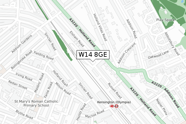
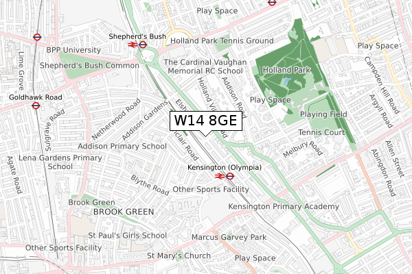
W14 8GE is located in the Holland electoral ward, within the London borough of Kensington and Chelsea and the English Parliamentary constituency of Kensington. The Sub Integrated Care Board (ICB) Location is NHS North West London ICB - W2U3Z and the police force is Metropolitan Police. This postcode has been in use since June 2019.


GetTheData
Source: OS Open Zoomstack (Ordnance Survey)
Licence: Open Government Licence (requires attribution)
Attribution: Contains OS data © Crown copyright and database right 2025
Source: Open Postcode Geo
Licence: Open Government Licence (requires attribution)
Attribution: Contains OS data © Crown copyright and database right 2025; Contains Royal Mail data © Royal Mail copyright and database right 2025; Source: Office for National Statistics licensed under the Open Government Licence v.3.0
| Easting | 524220 |
| Northing | 179423 |
| Latitude | 51.500105 |
| Longitude | -0.211767 |
GetTheData
Source: Open Postcode Geo
Licence: Open Government Licence
| Country | England |
| Postcode District | W14 |
➜ See where W14 is on a map ➜ Where is Kensington? | |
GetTheData
Source: Land Registry Price Paid Data
Licence: Open Government Licence
| Ward | Holland |
| Constituency | Kensington |
GetTheData
Source: ONS Postcode Database
Licence: Open Government Licence
| Russell Gardens | Olympia | 65m |
| Russell Gardens (Holland Road) | Olympia | 87m |
| Lower Addison Gardens (Holland Road) | Holland Park | 216m |
| Holland Gardens (Holland Road) | Earls Court | 241m |
| Lower Addison Gardens (Holland Road) | Holland Park | 251m |
| Kensington (Olympia) Underground Station | Olympia | 302m |
| Shepherd's Bush (Central) Underground Station | Shepherd's Bush | 681m |
| Holland Park Underground Station | Holland Park | 890m |
| Goldhawk Road Underground Station | Goldhawk Road | 1,057m |
| Barons Court Underground Station | Barons Court | 1,095m |
| Kensington (Olympia) Station | 0.3km |
| Shepherds Bush Station | 0.7km |
| West Brompton Station | 1.8km |
GetTheData
Source: NaPTAN
Licence: Open Government Licence
GetTheData
Source: ONS Postcode Database
Licence: Open Government Licence


➜ Get more ratings from the Food Standards Agency
GetTheData
Source: Food Standards Agency
Licence: FSA terms & conditions
| Last Collection | |||
|---|---|---|---|
| Location | Mon-Fri | Sat | Distance |
| Russell Gardens | 17:30 | 12:00 | 47m |
| Russell Road | 17:30 | 12:00 | 120m |
| Holland Villas Road | 17:30 | 12:00 | 170m |
GetTheData
Source: Dracos
Licence: Creative Commons Attribution-ShareAlike
| Risk of W14 8GE flooding from rivers and sea | Very Low |
| ➜ W14 8GE flood map | |
GetTheData
Source: Open Flood Risk by Postcode
Licence: Open Government Licence
The below table lists the International Territorial Level (ITL) codes (formerly Nomenclature of Territorial Units for Statistics (NUTS) codes) and Local Administrative Units (LAU) codes for W14 8GE:
| ITL 1 Code | Name |
|---|---|
| TLI | London |
| ITL 2 Code | Name |
| TLI3 | Inner London - West |
| ITL 3 Code | Name |
| TLI33 | Kensington & Chelsea and Hammersmith & Fulham |
| LAU 1 Code | Name |
| E09000020 | Kensington and Chelsea |
GetTheData
Source: ONS Postcode Directory
Licence: Open Government Licence
The below table lists the Census Output Area (OA), Lower Layer Super Output Area (LSOA), and Middle Layer Super Output Area (MSOA) for W14 8GE:
| Code | Name | |
|---|---|---|
| OA | E00014394 | |
| LSOA | E01002866 | Kensington and Chelsea 009B |
| MSOA | E02000585 | Kensington and Chelsea 009 |
GetTheData
Source: ONS Postcode Directory
Licence: Open Government Licence
| W14 8EZ | Russell Gardens | 41m |
| W14 8HS | Holland Road | 72m |
| W14 8HH | Elsham Road | 73m |
| W14 8EU | Russell Gardens Mews | 75m |
| W14 8HA | Elsham Road | 78m |
| W14 0NJ | Sinclair Road | 125m |
| W14 8DH | Holland Villas Road | 126m |
| W14 8HT | Russell Road | 138m |
| W14 0NR | Sinclair Road | 157m |
| W14 8JP | Addison Crescent | 158m |
GetTheData
Source: Open Postcode Geo; Land Registry Price Paid Data
Licence: Open Government Licence