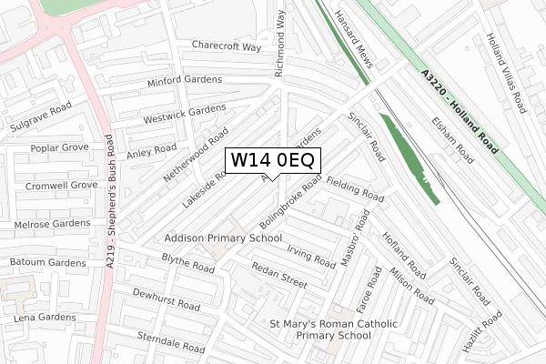
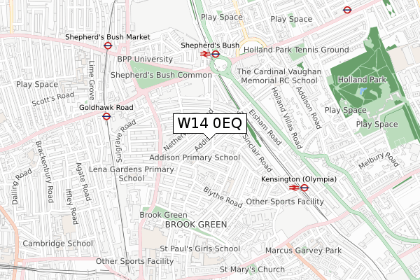
W14 0EQ is located in the Brook Green electoral ward, within the London borough of Hammersmith and Fulham and the English Parliamentary constituency of Hammersmith. The Sub Integrated Care Board (ICB) Location is NHS North West London ICB - W2U3Z and the police force is Metropolitan Police. This postcode has been in use since April 2020.


GetTheData
Source: OS Open Zoomstack (Ordnance Survey)
Licence: Open Government Licence (requires attribution)
Attribution: Contains OS data © Crown copyright and database right 2025
Source: Open Postcode Geo
Licence: Open Government Licence (requires attribution)
Attribution: Contains OS data © Crown copyright and database right 2025; Contains Royal Mail data © Royal Mail copyright and database right 2025; Source: Office for National Statistics licensed under the Open Government Licence v.3.0
| Easting | 524030 |
| Northing | 179189 |
| Latitude | 51.498044 |
| Longitude | -0.214585 |
GetTheData
Source: Open Postcode Geo
Licence: Open Government Licence
| Country | England |
| Postcode District | W14 |
➜ See where W14 is on a map ➜ Where is Kensington? | |
GetTheData
Source: Land Registry Price Paid Data
Licence: Open Government Licence
| Ward | Brook Green |
| Constituency | Hammersmith |
GetTheData
Source: ONS Postcode Database
Licence: Open Government Licence
| Russell Gardens | Olympia | 362m |
| Russell Gardens (Holland Road) | Olympia | 382m |
| Holland Gardens (Holland Road) | Earls Court | 399m |
| North End Rd Hammersmith Rd (Hammersmith Road) | West Kensington | 403m |
| North End Rd Hammersmith Rd | West Kensington | 403m |
| Kensington (Olympia) Underground Station | Olympia | 322m |
| Shepherd's Bush (Central) Underground Station | Shepherd's Bush | 762m |
| Barons Court Underground Station | Barons Court | 864m |
| Hammersmith (H&c Line) Underground Station | Hammersmith | 879m |
| Hammersmith (Dist&picc Line) Underground Station | Hammersmith | 894m |
| Kensington (Olympia) Station | 0.3km |
| Shepherds Bush Station | 0.8km |
| West Brompton Station | 1.8km |
GetTheData
Source: NaPTAN
Licence: Open Government Licence
GetTheData
Source: ONS Postcode Database
Licence: Open Government Licence


➜ Get more ratings from the Food Standards Agency
GetTheData
Source: Food Standards Agency
Licence: FSA terms & conditions
| Last Collection | |||
|---|---|---|---|
| Location | Mon-Fri | Sat | Distance |
| Blythe Road | 17:30 | 12:00 | 119m |
| Masbro Road | 17:30 | 12:00 | 154m |
| Sinclair Road | 17:30 | 12:00 | 181m |
GetTheData
Source: Dracos
Licence: Creative Commons Attribution-ShareAlike
The below table lists the International Territorial Level (ITL) codes (formerly Nomenclature of Territorial Units for Statistics (NUTS) codes) and Local Administrative Units (LAU) codes for W14 0EQ:
| ITL 1 Code | Name |
|---|---|
| TLI | London |
| ITL 2 Code | Name |
| TLI3 | Inner London - West |
| ITL 3 Code | Name |
| TLI33 | Kensington & Chelsea and Hammersmith & Fulham |
| LAU 1 Code | Name |
| E09000013 | Hammersmith and Fulham |
GetTheData
Source: ONS Postcode Directory
Licence: Open Government Licence
The below table lists the Census Output Area (OA), Lower Layer Super Output Area (LSOA), and Middle Layer Super Output Area (MSOA) for W14 0EQ:
| Code | Name | |
|---|---|---|
| OA | E00009336 | |
| LSOA | E01001873 | Hammersmith and Fulham 010E |
| MSOA | E02000381 | Hammersmith and Fulham 010 |
GetTheData
Source: ONS Postcode Directory
Licence: Open Government Licence
| W14 0LZ | Porten Road | 28m |
| W14 0PY | Ceylon Road | 33m |
| W14 0PL | Blythe Road | 41m |
| W14 0LQ | Porten Road | 61m |
| W14 0EL | Faroe Road | 69m |
| W14 0JX | Gratton Road | 78m |
| W14 0LB | Milson Road | 79m |
| W14 0PZ | Ceylon Road | 81m |
| W14 0PW | Blythe Road | 91m |
| W14 0PN | Blythe Road | 93m |
GetTheData
Source: Open Postcode Geo; Land Registry Price Paid Data
Licence: Open Government Licence