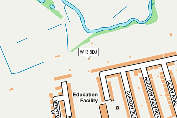
W13 8DJ is located in the Pitshanger electoral ward, within the London borough of Ealing and the English Parliamentary constituency of Ealing North. The Sub Integrated Care Board (ICB) Location is NHS North West London ICB - W2U3Z and the police force is Metropolitan Police. This postcode has been in use since January 1980.


GetTheData
Source: OS OpenMap – Local (Ordnance Survey)
Source: OS VectorMap District (Ordnance Survey)
Licence: Open Government Licence (requires attribution)
| Easting | 516723 |
| Northing | 182354 |
| Latitude | 51.528043 |
| Longitude | -0.318776 |
GetTheData
Source: Open Postcode Geo
Licence: Open Government Licence
| Country | England |
| Postcode District | W13 |
➜ See where W13 is on a map ➜ Where is Ealing? | |
GetTheData
Source: Land Registry Price Paid Data
Licence: Open Government Licence
Elevation or altitude of W13 8DJ as distance above sea level:
| Metres | Feet | |
|---|---|---|
| Elevation | 20m | 66ft |
Elevation is measured from the approximate centre of the postcode, to the nearest point on an OS contour line from OS Terrain 50, which has contour spacing of ten vertical metres.
➜ How high above sea level am I? Find the elevation of your current position using your device's GPS.
GetTheData
Source: Open Postcode Elevation
Licence: Open Government Licence
| Ward | Pitshanger |
| Constituency | Ealing North |
GetTheData
Source: ONS Postcode Database
Licence: Open Government Licence
| Kent Gardens West Ealing | West Ealing | 323m |
| Kent Gardens West Ealing (Scotch Common) | West Ealing | 330m |
| Harrow View Road | Ealing | 360m |
| Pitshanger Library | Ealing | 402m |
| Scotch Common | West Ealing | 499m |
| Perivale Underground Station | Perivale | 1,018m |
| Ealing Broadway Underground Station | Ealing Broadway | 1,883m |
| Alperton Underground Station | Alperton | 1,931m |
| Castle Bar Park Station | 1.1km |
| South Greenford Station | 1.4km |
| Drayton Green Station | 1.5km |
GetTheData
Source: NaPTAN
Licence: Open Government Licence
GetTheData
Source: ONS Postcode Database
Licence: Open Government Licence


➜ Get more ratings from the Food Standards Agency
GetTheData
Source: Food Standards Agency
Licence: FSA terms & conditions
| Last Collection | |||
|---|---|---|---|
| Location | Mon-Fri | Sat | Distance |
| Perivale Gardens | 17:30 | 12:00 | 107m |
| Pitshanger Lane | 17:30 | 12:00 | 327m |
| Kent Gardens | 17:30 | 12:00 | 399m |
GetTheData
Source: Dracos
Licence: Creative Commons Attribution-ShareAlike
The below table lists the International Territorial Level (ITL) codes (formerly Nomenclature of Territorial Units for Statistics (NUTS) codes) and Local Administrative Units (LAU) codes for W13 8DJ:
| ITL 1 Code | Name |
|---|---|
| TLI | London |
| ITL 2 Code | Name |
| TLI7 | Outer London - West and North West |
| ITL 3 Code | Name |
| TLI73 | Ealing |
| LAU 1 Code | Name |
| E09000009 | Ealing |
GetTheData
Source: ONS Postcode Directory
Licence: Open Government Licence
The below table lists the Census Output Area (OA), Lower Layer Super Output Area (LSOA), and Middle Layer Super Output Area (MSOA) for W13 8DJ:
| Code | Name | |
|---|---|---|
| OA | E00006041 | |
| LSOA | E01001209 | Ealing 013A |
| MSOA | E02000250 | Ealing 013 |
GetTheData
Source: ONS Postcode Directory
Licence: Open Government Licence
| W5 1LT | Meadvale Road | 99m |
| W13 8DH | Perivale Gardens | 109m |
| W5 1NB | Meadvale Road | 110m |
| W5 1ND | Summerfield Road | 113m |
| W5 1NE | Curzon Road | 188m |
| W13 8DE | Bellevue Road | 209m |
| W5 1NF | Curzon Road | 209m |
| W13 8EH | Brentcot Close | 218m |
| W13 8DF | Bellevue Road | 243m |
| W5 1NA | Harrow View Road | 243m |
GetTheData
Source: Open Postcode Geo; Land Registry Price Paid Data
Licence: Open Government Licence