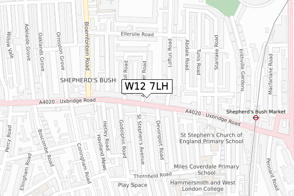
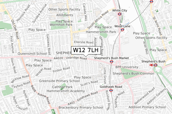
W12 7LH is located in the White City electoral ward, within the London borough of Hammersmith and Fulham and the English Parliamentary constituency of Hammersmith. The Sub Integrated Care Board (ICB) Location is NHS North West London ICB - W2U3Z and the police force is Metropolitan Police. This postcode has been in use since November 2019.


GetTheData
Source: OS Open Zoomstack (Ordnance Survey)
Licence: Open Government Licence (requires attribution)
Attribution: Contains OS data © Crown copyright and database right 2025
Source: Open Postcode Geo
Licence: Open Government Licence (requires attribution)
Attribution: Contains OS data © Crown copyright and database right 2025; Contains Royal Mail data © Royal Mail copyright and database right 2025; Source: Office for National Statistics licensed under the Open Government Licence v.3.0
| Easting | 522822 |
| Northing | 180100 |
| Latitude | 51.506495 |
| Longitude | -0.231662 |
GetTheData
Source: Open Postcode Geo
Licence: Open Government Licence
| Country | England |
| Postcode District | W12 |
➜ See where W12 is on a map | |
GetTheData
Source: Land Registry Price Paid Data
Licence: Open Government Licence
| Ward | White City |
| Constituency | Hammersmith |
GetTheData
Source: ONS Postcode Database
Licence: Open Government Licence
| Loftus Road (Uxbridge Road) | Shepherd's Bush | 44m |
| Bloemfontein Road (Uxbridge Road) | Shepherd's Bush | 120m |
| Loftus Road (Uxbridge Road) | Shepherd's Bush | 128m |
| Bloemfontein Road (Uxbridge Road) | Shepherd's Bush | 138m |
| Ellerslie Road (Bloemfontein Road) | White City | 278m |
| Shepherd's Bush Market Underground Station | Shepherd's Bush | 382m |
| Goldhawk Road Underground Station | Goldhawk Road | 607m |
| Wood Lane Underground Station | Shepherd's Bush | 609m |
| White City Underground Station | White City | 795m |
| Shepherd's Bush (Central) Underground Station | Shepherd's Bush | 924m |
| Shepherds Bush Station | 1km |
| Kensington (Olympia) Station | 1.8km |
| Acton Central Station | 2.2km |
GetTheData
Source: NaPTAN
Licence: Open Government Licence
GetTheData
Source: ONS Postcode Database
Licence: Open Government Licence


➜ Get more ratings from the Food Standards Agency
GetTheData
Source: Food Standards Agency
Licence: FSA terms & conditions
| Last Collection | |||
|---|---|---|---|
| Location | Mon-Fri | Sat | Distance |
| Post Office | 17:30 | 12:00 | 27m |
| Loftus Road | 17:30 | 12:00 | 63m |
| Uxbridge Road | 17:30 | 12:00 | 173m |
GetTheData
Source: Dracos
Licence: Creative Commons Attribution-ShareAlike
The below table lists the International Territorial Level (ITL) codes (formerly Nomenclature of Territorial Units for Statistics (NUTS) codes) and Local Administrative Units (LAU) codes for W12 7LH:
| ITL 1 Code | Name |
|---|---|
| TLI | London |
| ITL 2 Code | Name |
| TLI3 | Inner London - West |
| ITL 3 Code | Name |
| TLI33 | Kensington & Chelsea and Hammersmith & Fulham |
| LAU 1 Code | Name |
| E09000013 | Hammersmith and Fulham |
GetTheData
Source: ONS Postcode Directory
Licence: Open Government Licence
The below table lists the Census Output Area (OA), Lower Layer Super Output Area (LSOA), and Middle Layer Super Output Area (MSOA) for W12 7LH:
| Code | Name | |
|---|---|---|
| OA | E00009748 | |
| LSOA | E01001942 | Hammersmith and Fulham 005D |
| MSOA | E02000376 | Hammersmith and Fulham 005 |
GetTheData
Source: ONS Postcode Directory
Licence: Open Government Licence
| W12 7LJ | Uxbridge Road | 0m |
| W12 8NR | Uxbridge Road | 59m |
| W12 8NG | Devonport Mews | 66m |
| W12 7BA | Arminger Road | 70m |
| W12 7BD | Ingersoll Road | 82m |
| W12 7BB | Arminger Road | 92m |
| W12 8NL | Uxbridge Road | 106m |
| W12 7BE | Ingersoll Road | 111m |
| W12 7EH | Loftus Road | 119m |
| W12 7EP | Tunis Road | 138m |
GetTheData
Source: Open Postcode Geo; Land Registry Price Paid Data
Licence: Open Government Licence