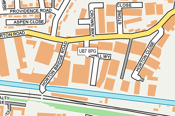
UB7 8PG is located in the Yiewsley electoral ward, within the London borough of Hillingdon and the English Parliamentary constituency of Uxbridge and South Ruislip. The Sub Integrated Care Board (ICB) Location is NHS North West London ICB - W2U3Z and the police force is Metropolitan Police. This postcode has been in use since January 1980.


GetTheData
Source: OS OpenMap – Local (Ordnance Survey)
Source: OS VectorMap District (Ordnance Survey)
Licence: Open Government Licence (requires attribution)
| Easting | 506800 |
| Northing | 180173 |
| Latitude | 51.510402 |
| Longitude | -0.462423 |
GetTheData
Source: Open Postcode Geo
Licence: Open Government Licence
| Country | England |
| Postcode District | UB7 |
➜ See where UB7 is on a map ➜ Where is Yiewsley? | |
GetTheData
Source: Land Registry Price Paid Data
Licence: Open Government Licence
Elevation or altitude of UB7 8PG as distance above sea level:
| Metres | Feet | |
|---|---|---|
| Elevation | 30m | 98ft |
Elevation is measured from the approximate centre of the postcode, to the nearest point on an OS contour line from OS Terrain 50, which has contour spacing of ten vertical metres.
➜ How high above sea level am I? Find the elevation of your current position using your device's GPS.
GetTheData
Source: Open Postcode Elevation
Licence: Open Government Licence
| Ward | Yiewsley |
| Constituency | Uxbridge And South Ruislip |
GetTheData
Source: ONS Postcode Database
Licence: Open Government Licence
| Stone Close (Horton Road) | West Drayton | 102m |
| Stone Close (Horton Road) | West Drayton | 114m |
| Whitethorn Avenue (Horton Road) | West Drayton | 197m |
| Whitethorn Avenue (Horton Road) | West Drayton | 226m |
| Roberts Close (Horton Road) | West Drayton | 407m |
| West Drayton Station | 0.7km |
| Hayes & Harlington Station | 3km |
| Iver Station | 3.1km |
GetTheData
Source: NaPTAN
Licence: Open Government Licence
Estimated total energy consumption in UB7 8PG by fuel type, 2015.
| Consumption (kWh) | 161,097 |
|---|---|
| Meter count | 8 |
| Mean (kWh/meter) | 20,137 |
| Median (kWh/meter) | 20,688 |
GetTheData
Source: Postcode level gas estimates: 2015 (experimental)
Source: Postcode level electricity estimates: 2015 (experimental)
Licence: Open Government Licence
GetTheData
Source: ONS Postcode Database
Licence: Open Government Licence


➜ Get more ratings from the Food Standards Agency
GetTheData
Source: Food Standards Agency
Licence: FSA terms & conditions
| Last Collection | |||
|---|---|---|---|
| Location | Mon-Fri | Sat | Distance |
| Mulberry Parade Post Office | 17:15 | 12:00 | 453m |
| Yiewsley Post Office | 18:30 | 12:00 | 733m |
| West Drayton Post Office | 17:10 | 12:00 | 742m |
GetTheData
Source: Dracos
Licence: Creative Commons Attribution-ShareAlike
The below table lists the International Territorial Level (ITL) codes (formerly Nomenclature of Territorial Units for Statistics (NUTS) codes) and Local Administrative Units (LAU) codes for UB7 8PG:
| ITL 1 Code | Name |
|---|---|
| TLI | London |
| ITL 2 Code | Name |
| TLI7 | Outer London - West and North West |
| ITL 3 Code | Name |
| TLI74 | Harrow and Hillingdon |
| LAU 1 Code | Name |
| E09000017 | Hillingdon |
GetTheData
Source: ONS Postcode Directory
Licence: Open Government Licence
The below table lists the Census Output Area (OA), Lower Layer Super Output Area (LSOA), and Middle Layer Super Output Area (MSOA) for UB7 8PG:
| Code | Name | |
|---|---|---|
| OA | E00012699 | |
| LSOA | E01002548 | Hillingdon 025A |
| MSOA | E02000518 | Hillingdon 025 |
GetTheData
Source: ONS Postcode Directory
Licence: Open Government Licence
| UB7 8JR | Horton Bridge Road | 76m |
| UB7 8LD | Whitethorn Avenue | 183m |
| UB7 8JU | Stone Close | 206m |
| UB7 8HT | Horton Road | 219m |
| UB7 8HL | Providence Road | 251m |
| UB7 8HR | Aspen Close | 257m |
| UB7 8FB | Triangle Mews | 276m |
| UB7 9GE | Autumn Way | 299m |
| UB7 9PE | Holly Gardens | 302m |
| UB7 8LN | Acacia Avenue | 305m |
GetTheData
Source: Open Postcode Geo; Land Registry Price Paid Data
Licence: Open Government Licence